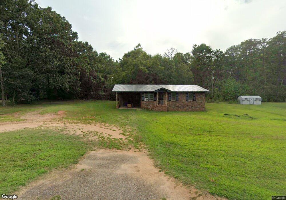
728 Anderson Rd Pendleton, SC 29670
Estimated Value: $126,110 - $312,000
Studio
--
Bath
1,021
Sq Ft
$198/Sq Ft
Est. Value
About This Home
This home is located at 728 Anderson Rd, Pendleton, SC 29670 and is currently estimated at $202,278, approximately $198 per square foot. 728 Anderson Rd is a home located in Anderson County with nearby schools including Pendleton High School and Clemson Montessori School.
Ownership History
Date
Name
Owned For
Owner Type
Purchase Details
Closed on
May 24, 2022
Sold by
Yvonne Galloway Antoinette
Bought by
Harris Alison Aretha
Current Estimated Value
Purchase Details
Closed on
May 2, 2022
Sold by
Harris E T
Bought by
Galloway Antoinette Yvonne and Harris Kenneth Craig
Purchase Details
Closed on
Oct 26, 2010
Sold by
Harris E T
Bought by
Harris Estella and Harris E
Purchase Details
Closed on
Dec 9, 2008
Sold by
Harris Estella B and Harris John H
Bought by
Harris E T
Purchase Details
Closed on
Jun 15, 2005
Sold by
Harris Estella
Bought by
Harris E T and Williams Michael
Purchase Details
Closed on
May 17, 2005
Sold by
Williams Michael D
Bought by
Harris Estella
Create a Home Valuation Report for This Property
The Home Valuation Report is an in-depth analysis detailing your home's value as well as a comparison with similar homes in the area
Home Values in the Area
Average Home Value in this Area
Purchase History
| Date | Buyer | Sale Price | Title Company |
|---|---|---|---|
| Harris Alison Aretha | -- | Law Office Of Maggi Fields Boi | |
| Galloway Antoinette Yvonne | -- | None Listed On Document | |
| Harris Estella | -- | -- | |
| Harris E T | $25,005 | -- | |
| Harris E T | -- | -- | |
| Harris Estella | -- | -- |
Source: Public Records
Tax History
| Year | Tax Paid | Tax Assessment Tax Assessment Total Assessment is a certain percentage of the fair market value that is determined by local assessors to be the total taxable value of land and additions on the property. | Land | Improvement |
|---|---|---|---|---|
| 2024 | $644 | $8,850 | $1,100 | $7,750 |
| 2023 | $1,869 | $5,310 | $660 | $4,650 |
| 2022 | $1,633 | $5,100 | $450 | $4,650 |
| 2021 | $1,501 | $4,340 | $450 | $3,890 |
| 2020 | $1,490 | $4,340 | $450 | $3,890 |
| 2019 | $1,490 | $4,340 | $450 | $3,890 |
| 2018 | $1,469 | $4,340 | $450 | $3,890 |
| 2017 | -- | $2,890 | $300 | $2,590 |
| 2016 | $158 | $2,890 | $300 | $2,590 |
| 2015 | $159 | $2,890 | $300 | $2,590 |
| 2014 | $164 | $2,890 | $300 | $2,590 |
Source: Public Records
Map
Nearby Homes
- 540 Seaborn Cir
- 538 Seaborn Cir
- 616 Anderson Rd
- 0 Cherry Street Extension
- 104 Carrie Leigh Ln
- 107 Colonial Ct
- 110 Wyndham Dr
- 102 Magnolia Ln
- 213 Bostic Ct
- 209 Bostic Ct
- 28 Vanessa Rae Ln
- 150 Queens Mill Ct
- 156 Queens Mill Ct
- 168 Queens Mill Ct
- 206 Bostic Ct
- 202 Bostic Ct
- 205 Bostic Ct
- 104 Benjamin Blvd
- 00 Danenhower Rd
- 305 Smith Ln
- 724 Anderson Rd
- 1903 Refuge Rd
- 1904 Refuge Rd
- 716 Anderson Rd
- 716 Anderson Rd
- 1900 Refuge Rd
- 711 Anderson Rd
- 702 Anderson Rd
- 2013 Refuge Rd
- 709 Anderson Rd
- 709 Anderson Rd
- 709 Anderson Rd
- 709 Anderson Rd
- 655 Anderson Rd
- 2014 Refuge Rd
- 112 Scott Cir
- 119 Scott Cir
- 710 Anderson Rd
- 2017 Refuge Rd
- 1804 Refuge Rd
Your Personal Tour Guide
Ask me questions while you tour the home.