Estimated Value: $273,094 - $299,000
3
Beds
2
Baths
1,390
Sq Ft
$204/Sq Ft
Est. Value
About This Home
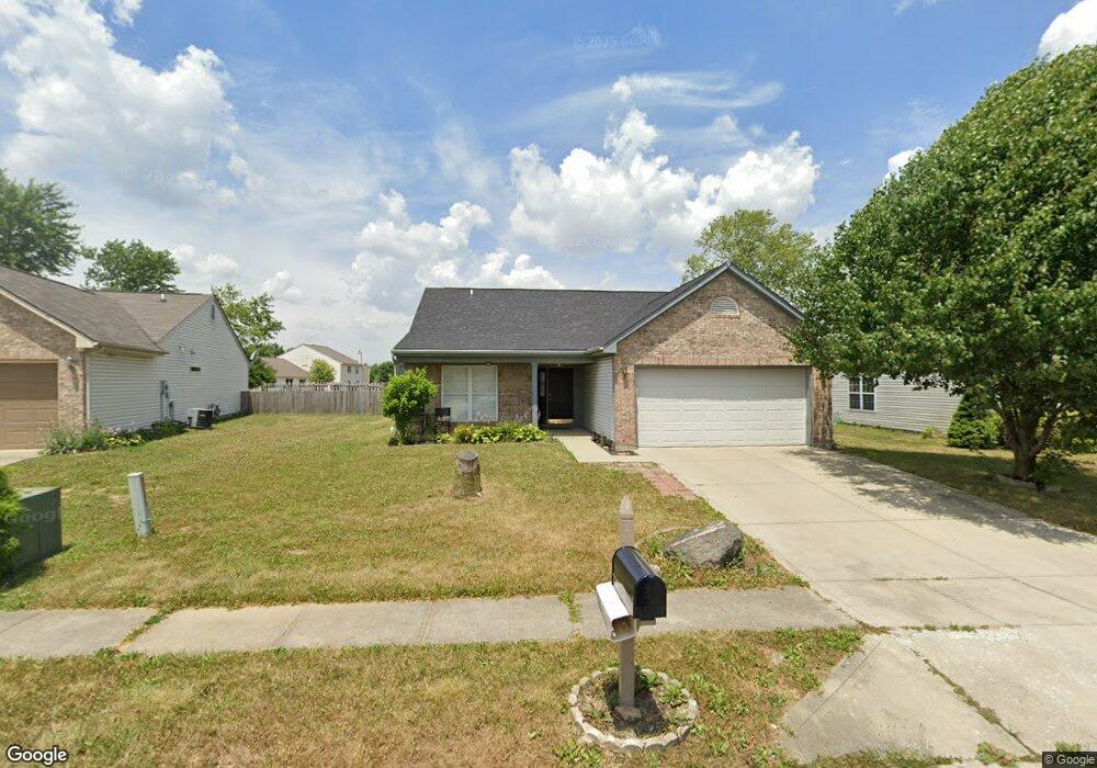
This home is located at 728 Greene Ct, Avon, IN 46123 and is currently estimated at $283,774, approximately $204 per square foot. 728 Greene Ct is a home located in Hendricks County with nearby schools including Maple Elementary School, White Oak Elementary School, and Avon Middle School North.
Ownership History
Date
Name
Owned For
Owner Type
Purchase Details
Closed on
Sep 24, 2021
Sold by
Heffley Brandi
Bought by
Fornof Jennifer M
Current Estimated Value
Home Financials for this Owner
Home Financials are based on the most recent Mortgage that was taken out on this home.
Original Mortgage
$7,787
Outstanding Balance
$7,122
Interest Rate
3.01%
Estimated Equity
$276,652
Purchase Details
Closed on
Apr 13, 2005
Sold by
Ruth Brandi L and Heffley Brandi
Bought by
Heffley Brandi
Create a Home Valuation Report for This Property
The Home Valuation Report is an in-depth analysis detailing your home's value as well as a comparison with similar homes in the area
Home Values in the Area
Average Home Value in this Area
Purchase History
| Date | Buyer | Sale Price | Title Company |
|---|---|---|---|
| Fornof Jennifer M | $222,500 | Chicago Title | |
| Heffley Brandi | -- | First American Title Insuran |
Source: Public Records
Mortgage History
| Date | Status | Borrower | Loan Amount |
|---|---|---|---|
| Open | Fornof Jennifer M | $7,787 | |
| Open | Fornof Jennifer M | $218,469 |
Source: Public Records
Tax History Compared to Growth
Tax History
| Year | Tax Paid | Tax Assessment Tax Assessment Total Assessment is a certain percentage of the fair market value that is determined by local assessors to be the total taxable value of land and additions on the property. | Land | Improvement |
|---|---|---|---|---|
| 2024 | $2,622 | $239,000 | $42,800 | $196,200 |
| 2023 | $2,262 | $207,800 | $37,200 | $170,600 |
| 2022 | $2,246 | $197,600 | $35,400 | $162,200 |
| 2021 | $1,694 | $154,400 | $33,700 | $120,700 |
| 2020 | $3,347 | $147,800 | $33,700 | $114,100 |
| 2019 | $3,241 | $141,300 | $31,800 | $109,500 |
| 2018 | $3,215 | $135,600 | $31,800 | $103,800 |
| 2017 | $2,572 | $128,600 | $30,300 | $98,300 |
| 2016 | $2,504 | $125,200 | $30,300 | $94,900 |
| 2014 | $2,336 | $116,800 | $27,500 | $89,300 |
Source: Public Records
Map
Nearby Homes
- 694 Crystal Farms Dr
- 9936 Nightsong Ln
- 10194 Buell Dr
- 9447 Jackson Way
- 9917 Countryside Ct
- 569 Dalton Way
- Riverton Plan at Brookstone - Crossings
- Fifth Avenue Plan at Brookstone - Landings
- Park Place Plan at Brookstone - Landings
- Greenfield Plan at Brookstone - Crossings
- Boardwalk Plan at Brookstone - Landings
- Hilltop Plan at Brookstone - Crossings
- Westchester Plan at Brookstone - Crossings
- 1237 Langham St
- 898 Justine Cir W
- 10586 Jacks Way
- 9652 Beckett St
- 9583 Beckett St
- 1274 Newton St
- 1280 Newton St
- 734 Greene Ct
- 722 Greene Ct
- 740 Greene Ct
- 716 Greene Ct
- 723 Greene Ct
- 731 Greene Ct
- 710 Greene Ct
- 752 Greene Ct
- 769 Hollowood Ln
- 715 Greene Ct
- 775 Hollowood Ln
- 739 Greene Ct
- 755 Greene Ct
- 759 Hollowood Ln
- 747 Greene Ct
- 781 Hollowood Ln
- 749 Hollowood Ln
- 9938 Ellsworth Ln
- 783 Hollowood Ln
- 9913 Ellsworth Ln