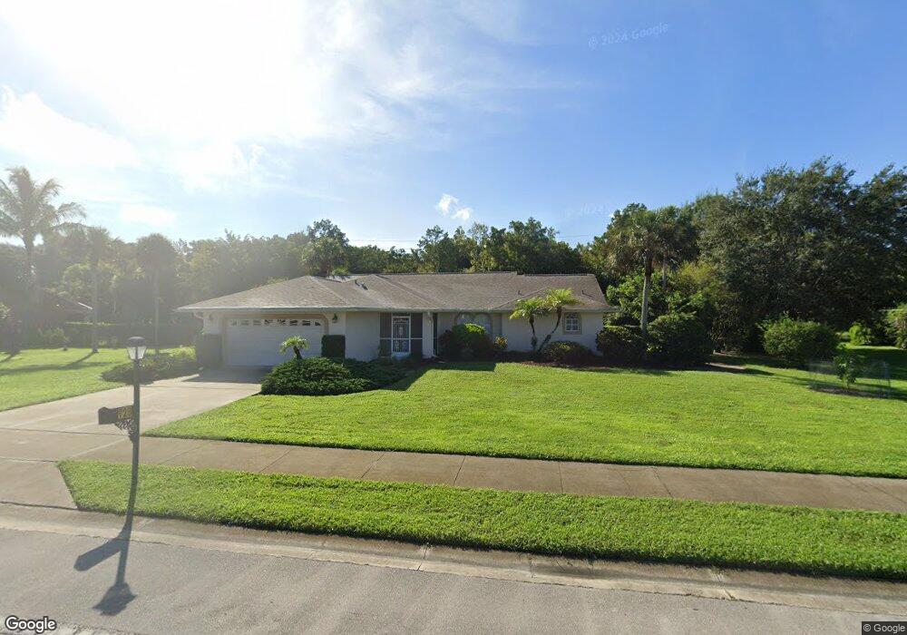
728 Saint Andrews Blvd Naples, FL 34113
Lely Country Club NeighborhoodEstimated Value: $656,000 - $763,000
--
Bed
--
Bath
1,904
Sq Ft
$371/Sq Ft
Est. Value
About This Home
This home is located at 728 Saint Andrews Blvd, Naples, FL 34113 and is currently estimated at $705,996, approximately $370 per square foot. 728 Saint Andrews Blvd is a home located in Collier County with nearby schools including Lely Elementary School, Manatee Middle School, and Lely High School.
Ownership History
Date
Name
Owned For
Owner Type
Purchase Details
Closed on
Oct 10, 2005
Sold by
Oliver Karen L
Bought by
Palm Frank Richard and Palm Marilyn E
Current Estimated Value
Purchase Details
Closed on
Sep 27, 2001
Sold by
Spangler James R
Bought by
Oliver Karen L
Home Financials for this Owner
Home Financials are based on the most recent Mortgage that was taken out on this home.
Original Mortgage
$220,500
Interest Rate
6.89%
Mortgage Type
Purchase Money Mortgage
Purchase Details
Closed on
Mar 26, 1999
Sold by
Spangerl James R and Spangler Phyllis S
Bought by
Spangler James R
Purchase Details
Closed on
Nov 30, 1994
Sold by
Bussing Jon and Bussing Frances
Bought by
Spangler James R and Spangler Phyllis S
Home Financials for this Owner
Home Financials are based on the most recent Mortgage that was taken out on this home.
Original Mortgage
$104,000
Interest Rate
9.01%
Mortgage Type
Purchase Money Mortgage
Create a Home Valuation Report for This Property
The Home Valuation Report is an in-depth analysis detailing your home's value as well as a comparison with similar homes in the area
Home Values in the Area
Average Home Value in this Area
Purchase History
| Date | Buyer | Sale Price | Title Company |
|---|---|---|---|
| Palm Frank Richard | $435,000 | -- | |
| Oliver Karen L | $245,000 | -- | |
| Spangler James R | -- | -- | |
| Spangler James R | $130,200 | -- |
Source: Public Records
Mortgage History
| Date | Status | Borrower | Loan Amount |
|---|---|---|---|
| Previous Owner | Oliver Karen L | $220,500 | |
| Previous Owner | Spangler James R | $104,000 |
Source: Public Records
Tax History Compared to Growth
Tax History
| Year | Tax Paid | Tax Assessment Tax Assessment Total Assessment is a certain percentage of the fair market value that is determined by local assessors to be the total taxable value of land and additions on the property. | Land | Improvement |
|---|---|---|---|---|
| 2025 | $5,638 | $494,567 | -- | -- |
| 2024 | $5,023 | $449,606 | -- | -- |
| 2023 | $5,023 | $408,733 | $0 | $0 |
| 2022 | $4,797 | $371,575 | $0 | $0 |
| 2021 | $4,128 | $337,795 | $107,250 | $230,545 |
| 2020 | $4,612 | $383,527 | $160,875 | $222,652 |
| 2019 | $4,847 | $377,809 | $0 | $0 |
| 2018 | $4,424 | $343,463 | $0 | $0 |
| 2017 | $4,497 | $312,239 | $0 | $0 |
| 2016 | $3,892 | $283,854 | $0 | $0 |
| 2015 | $3,517 | $258,049 | $0 | $0 |
| 2014 | $2,997 | $234,590 | $0 | $0 |
Source: Public Records
Map
Nearby Homes
- 813 Saint Andrews Blvd
- 205 Deerwood Cir Unit 103
- 208 Deerwood Cir Unit 5
- 186 Muirfield Cir
- 6445 Costa Cir
- 245 Deerwood Cir Unit 12-8
- 760 Augusta Blvd Unit 101
- 6419 Vivaldi Ct
- 6504 Costa Cir
- 6420 Costa Cir
- 6528 Costa Cir
- 6541 Roma Way
- 914 Augusta Blvd
- 914 Augusta Blvd Unit 7
- 526 Saint Andrews Blvd Unit 18
- 5841 Rattlesnake Hammock Rd Unit 203
- 740 Saint Andrews Blvd
- 716 Saint Andrews Blvd
- 723 Saint Andrews Blvd
- 717 Saint Andrews Blvd
- 729 Saint Andrews Blvd
- 704 Saint Andrews Blvd
- 711 Saint Andrews Blvd
- 735 Saint Andrews Blvd
- 705 Saint Andrews Blvd
- 741 Saint Andrews Blvd
- 692 Saint Andrews Blvd
- 764 Saint Andrews Blvd
- 753 Saint Andrews Blvd
- 106 Muirfield Cir
- 765 Saint Andrews Blvd
- 110 Muirfield Cir
- 680 Saint Andrews Blvd
- 776 Saint Andrews Blvd
- 101 Muirfield Cir Unit 102
- 114 Muirfield Cir