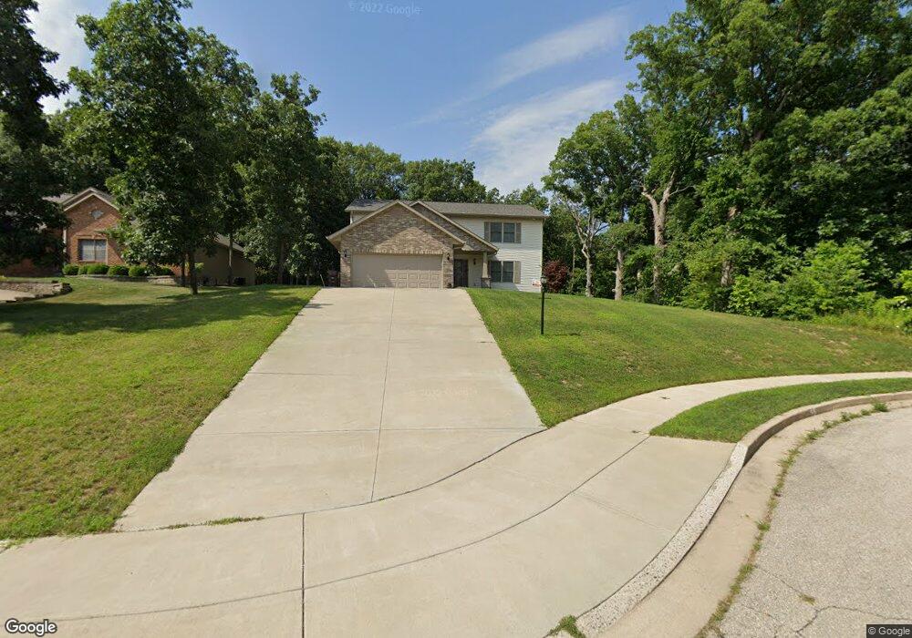
7289 N Whippoorwill Ln Peoria, IL 61614
North Peoria NeighborhoodEstimated Value: $331,000 - $368,122
5
Beds
6
Baths
2,566
Sq Ft
$135/Sq Ft
Est. Value
About This Home
This home is located at 7289 N Whippoorwill Ln, Peoria, IL 61614 and is currently estimated at $347,531, approximately $135 per square foot. 7289 N Whippoorwill Ln is a home with nearby schools including Kellar Primary School, Liberty Leadership Middle School, and Richwoods High School.
Ownership History
Date
Name
Owned For
Owner Type
Purchase Details
Closed on
Sep 27, 2016
Sold by
Autumn Ridge Land Trust
Bought by
Gillespie Deaun M and Gillespie Stephanie M
Current Estimated Value
Purchase Details
Closed on
Oct 5, 2004
Bought by
Whitehurst N E and Autumn Ridge Land Trust
Create a Home Valuation Report for This Property
The Home Valuation Report is an in-depth analysis detailing your home's value as well as a comparison with similar homes in the area
Home Values in the Area
Average Home Value in this Area
Purchase History
| Date | Buyer | Sale Price | Title Company |
|---|---|---|---|
| Gillespie Deaun M | $45,000 | Attorney Only | |
| Whitehurst N E | $1,042,500 | -- |
Source: Public Records
Mortgage History
| Date | Status | Borrower | Loan Amount |
|---|---|---|---|
| Closed | Gillespie Deaun M | $284,900 |
Source: Public Records
Tax History Compared to Growth
Tax History
| Year | Tax Paid | Tax Assessment Tax Assessment Total Assessment is a certain percentage of the fair market value that is determined by local assessors to be the total taxable value of land and additions on the property. | Land | Improvement |
|---|---|---|---|---|
| 2024 | $8,398 | $98,850 | $19,090 | $79,760 |
| 2023 | $7,967 | $90,680 | $17,510 | $73,170 |
| 2022 | $7,202 | $80,660 | $15,690 | $64,970 |
| 2021 | $7,041 | $76,820 | $14,940 | $61,880 |
| 2020 | $7,020 | $76,060 | $14,790 | $61,270 |
| 2019 | $7,134 | $77,610 | $15,090 | $62,520 |
| 2018 | $7,950 | $87,630 | $15,240 | $72,390 |
| 2017 | $2,855 | $29,610 | $15,390 | $14,220 |
| 2016 | $79 | $850 | $850 | $0 |
| 2015 | $76 | $830 | $830 | $0 |
| 2014 | $76 | $830 | $830 | $0 |
| 2013 | -- | $840 | $840 | $0 |
Source: Public Records
Map
Nearby Homes
- 1511 W Queens Court Rd
- 1320 W Cress Creek Ct
- 6909 N Patricia Ln
- 1720 W Queens Court Rd
- 7120 N Manning Dr
- 7103 N Manning Dr
- 1720 W Willow Wood Dr
- 7610 Walnut Bend Dr Unit 27
- 7615 Walnut Bend Dr Unit 30
- 7408 N Brittany Park Place Unit 8
- 7408 N Brittany Park Place
- 936 W Trailcreek Dr Unit 936
- 6217 N Knoll Aire Dr
- 7133 N Terra Vista Dr Unit 3202
- 202 W Wolf Rd
- 801 W Shermoor St
- 611 W Forest Lawn Ave
- 129 E High Point Rd
- 8414 N Dundee Rd
- 634 W Mount Hawley Terrace
- 7283 N Whippoorwill Ln
- 7277 N Whippoorwill Ln
- 7277 W Whippoorwill Ln
- 7299 N Whippoorwill Ln
- 7282 N Whippoorwill Ln
- 1400 W Queens Court Rd
- 1322 W Queens Court Rd
- 7268 N Whippoorwill Ln
- 1406 W Queens Court Rd
- 1312 W Queens Court Rd
- 1312 W Queens Court Rd Unit D
- LOT 5 W Whippoorwill Ln
- LOT 6 W Whippoorwill Ln
- LOT 7 W Whippoorwill Ln
- 1412 W Queens Court Rd
- 1408 W Tiffany Dr
- 1308 W Queens Court Rd
- 1304 W Queens Court Rd
- 1321 W Queens Court Rd
- 7257 N Whippoorwill Ln