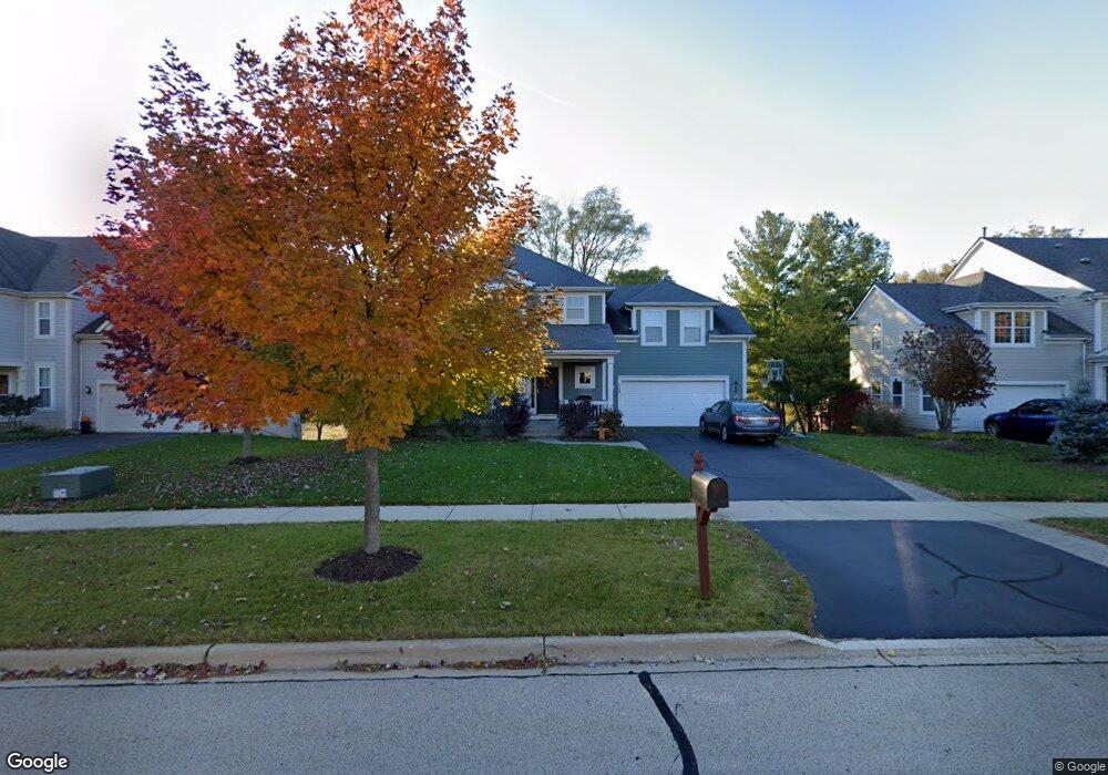
729 Cambridge Dr Batavia, IL 60510
Clover Hills NeighborhoodEstimated Value: $589,903 - $643,000
4
Beds
3
Baths
2,957
Sq Ft
$208/Sq Ft
Est. Value
About This Home
This home is located at 729 Cambridge Dr, Batavia, IL 60510 and is currently estimated at $614,726, approximately $207 per square foot. 729 Cambridge Dr is a home located in Kane County with nearby schools including Fabyan Elementary School, Geneva Community High School, and Holy Cross Catholic School.
Ownership History
Date
Name
Owned For
Owner Type
Purchase Details
Closed on
May 12, 2006
Sold by
Drh Cambridge Homes Inc
Bought by
Rooks Brian P and Rooks Noel G
Current Estimated Value
Home Financials for this Owner
Home Financials are based on the most recent Mortgage that was taken out on this home.
Original Mortgage
$335,000
Outstanding Balance
$195,567
Interest Rate
6.54%
Mortgage Type
Fannie Mae Freddie Mac
Estimated Equity
$419,159
Create a Home Valuation Report for This Property
The Home Valuation Report is an in-depth analysis detailing your home's value as well as a comparison with similar homes in the area
Home Values in the Area
Average Home Value in this Area
Purchase History
| Date | Buyer | Sale Price | Title Company |
|---|---|---|---|
| Rooks Brian P | $419,500 | Chicago Title Insurance Co |
Source: Public Records
Mortgage History
| Date | Status | Borrower | Loan Amount |
|---|---|---|---|
| Open | Rooks Brian P | $335,000 |
Source: Public Records
Tax History Compared to Growth
Tax History
| Year | Tax Paid | Tax Assessment Tax Assessment Total Assessment is a certain percentage of the fair market value that is determined by local assessors to be the total taxable value of land and additions on the property. | Land | Improvement |
|---|---|---|---|---|
| 2024 | $11,453 | $153,151 | $33,403 | $119,748 |
| 2023 | $11,046 | $139,228 | $30,366 | $108,862 |
| 2022 | $10,567 | $129,370 | $28,216 | $101,154 |
| 2021 | $10,272 | $124,562 | $27,167 | $97,395 |
| 2020 | $10,125 | $122,660 | $26,752 | $95,908 |
| 2019 | $10,056 | $120,337 | $26,245 | $94,092 |
| 2018 | $9,906 | $118,811 | $26,245 | $92,566 |
| 2017 | $9,755 | $115,642 | $25,545 | $90,097 |
| 2016 | $9,639 | $114,079 | $25,200 | $88,879 |
| 2015 | -- | $99,407 | $23,959 | $75,448 |
| 2014 | -- | $99,407 | $23,959 | $75,448 |
| 2013 | -- | $102,103 | $23,959 | $78,144 |
Source: Public Records
Map
Nearby Homes
- 869 Cambridge Dr
- 748 Hamilton Way
- 558 Schroeder Trail
- 37W775 Morningside Ln
- 668 Branson Dr
- 433 Freedlund Course
- 441 Freedlund Course
- 417 Freedlund Course
- 425 Freedlund Course
- 653 Branson Dr
- 644 Branson Dr
- 535 Branson Dr
- 2694 Berkshire Dr Unit 8
- 348 Branson Dr
- 425 Wolcott Ln Unit 10
- 274 Branson Dr
- 266 Branson Dr
- Newberry Plan at Winding Creek - Meadows
- Willwood Plan at Winding Creek - Estates
- Riverton Plan at Winding Creek - Estates
- 737 Cambridge Dr
- 721 Cambridge Dr
- 745 Cambridge Dr
- 2742 Andrews Ave
- 803 Cambridge Dr
- 801 Cambridge Dr
- 2810 Kauth Ln
- 2734 Andrews Ave
- 2802 Kauth Ln
- 2737 Andrews Ave
- 2726 Andrews Ave
- 807 Cambridge Dr
- 2729 Andrews Ave
- 809 Cambridge Dr
- 811 Cambridge Dr
- 810 Cambridge Dr
- 2718 Andrews Ave
- 2721 Andrews Ave
- 833 Cambridge Dr
- 831 Cambridge Dr