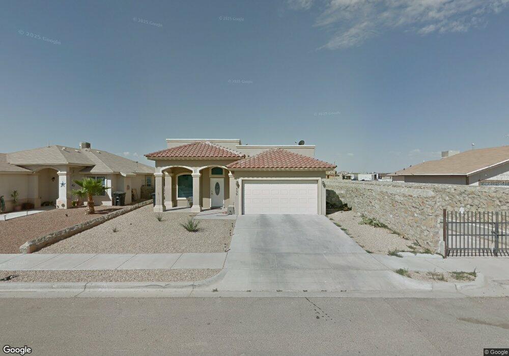
729 Danube Way El Paso, TX 79928
Mission Ridge NeighborhoodEstimated Value: $201,000 - $230,000
3
Beds
2
Baths
1,439
Sq Ft
$150/Sq Ft
Est. Value
About This Home
This home is located at 729 Danube Way, El Paso, TX 79928 and is currently estimated at $216,267, approximately $150 per square foot. 729 Danube Way is a home located in El Paso County with nearby schools including Dr Sue A Shook School, Col. John O. Ensor Middle School, and Eastlake High School.
Ownership History
Date
Name
Owned For
Owner Type
Purchase Details
Closed on
Mar 19, 2010
Sold by
Bcr I Lp
Bought by
Carrillo Vicente
Current Estimated Value
Home Financials for this Owner
Home Financials are based on the most recent Mortgage that was taken out on this home.
Original Mortgage
$119,950
Outstanding Balance
$79,580
Interest Rate
5%
Mortgage Type
New Conventional
Estimated Equity
$136,687
Purchase Details
Closed on
Jan 5, 2010
Sold by
Princess Custom Homes Llc
Bought by
Bcr I Lp
Create a Home Valuation Report for This Property
The Home Valuation Report is an in-depth analysis detailing your home's value as well as a comparison with similar homes in the area
Home Values in the Area
Average Home Value in this Area
Purchase History
| Date | Buyer | Sale Price | Title Company |
|---|---|---|---|
| Carrillo Vicente | -- | None Available | |
| Bcr I Lp | $143,061 | None Available |
Source: Public Records
Mortgage History
| Date | Status | Borrower | Loan Amount |
|---|---|---|---|
| Open | Carrillo Vicente | $119,950 |
Source: Public Records
Tax History Compared to Growth
Tax History
| Year | Tax Paid | Tax Assessment Tax Assessment Total Assessment is a certain percentage of the fair market value that is determined by local assessors to be the total taxable value of land and additions on the property. | Land | Improvement |
|---|---|---|---|---|
| 2025 | $4,250 | $185,214 | -- | -- |
| 2024 | $4,250 | $168,376 | -- | -- |
| 2023 | $3,680 | $153,069 | $0 | $0 |
| 2022 | $4,512 | $139,154 | $27,643 | $111,511 |
| 2021 | $4,866 | $139,154 | $27,643 | $111,511 |
| 2020 | $4,306 | $123,959 | $27,643 | $96,316 |
| 2018 | $4,590 | $136,767 | $27,643 | $109,124 |
| 2017 | $4,177 | $125,793 | $27,643 | $98,150 |
| 2016 | $3,983 | $119,950 | $27,643 | $92,307 |
| 2015 | $3,567 | $119,950 | $27,643 | $92,307 |
| 2014 | $3,567 | $119,950 | $27,643 | $92,307 |
Source: Public Records
Map
Nearby Homes
- 13599 Bradford St
- 792 Lincolnshire St
- 800 Lincolnshire St
- 13589 Lawkland St
- 797 Hertfordshire St
- 13618 Keighly St
- 13602 Lancashire St
- 13514 Everingham St
- 13539 Hazlewood St
- 13612 Doncaster St
- 13649 Keighly St
- 13498 Lawkland St
- 13618 Doncaster St
- 13619 Hazlewood St
- 13622 Doncaster St
- 13471 Everingham St
- 13518 Hazlewood St
- 13470 Selby St
- 13624 Doncaster St
- 13594 Gatton St
- 729 Danby Ct
- 725 Danby Ct
- 13590 Bradford St
- 13599 Bradford
- 13591 Bradford St
- 803 Danby Ct
- 13594 Bradford St
- 13595 Bradford St
- 13573 Lawkland St
- 13587 Bradford St
- 801 Danby Ct
- 13583 Bradford St
- 13575 Lawkland St
- 802 Danby Ct
- 13579 Bradford St
- 800 Danby Ct
- 13575 Bradford St
- 13598 Bradford St
- 13598 Bradford St
- 13586 Everingham St