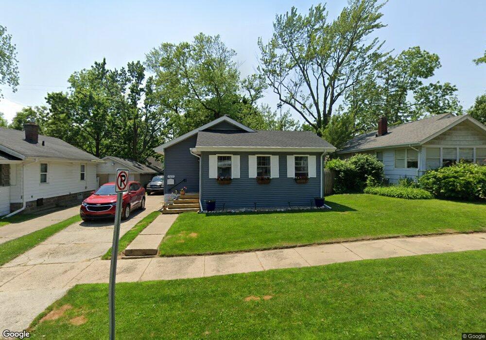
729 Dickinson St Flint, MI 48504
Mott Park NeighborhoodEstimated Value: $46,000 - $69,000
2
Beds
1
Bath
720
Sq Ft
$78/Sq Ft
Est. Value
About This Home
This home is located at 729 Dickinson St, Flint, MI 48504 and is currently estimated at $56,360, approximately $78 per square foot. 729 Dickinson St is a home located in Genesee County with nearby schools including Durant-Tuuri-Mott Elementary School, St John Vianney Catholic School, and St. Paul Lutheran School.
Ownership History
Date
Name
Owned For
Owner Type
Purchase Details
Closed on
Dec 26, 2014
Sold by
Soderlund Cummins Joan C
Bought by
Cumins Robert S and Cummins Joan C
Current Estimated Value
Purchase Details
Closed on
Oct 4, 2010
Sold by
Davis Albert T
Bought by
Soderlund Cummins Joan C
Purchase Details
Closed on
Aug 27, 2003
Sold by
Lee Arthur D and Lee Nokomis B
Bought by
Davis Albert T
Purchase Details
Closed on
Jul 21, 2003
Sold by
Pagano Lewis and Pagano Oneida D
Bought by
Lee Arthur D
Create a Home Valuation Report for This Property
The Home Valuation Report is an in-depth analysis detailing your home's value as well as a comparison with similar homes in the area
Home Values in the Area
Average Home Value in this Area
Purchase History
| Date | Buyer | Sale Price | Title Company |
|---|---|---|---|
| Cumins Robert S | -- | Sargents Title Company | |
| Soderlund Cummins Joan C | $10,000 | Greater Michigan Title Llc | |
| Davis Albert T | $35,000 | Guaranty Title Company | |
| Lee Arthur D | -- | -- |
Source: Public Records
Tax History
| Year | Tax Paid | Tax Assessment Tax Assessment Total Assessment is a certain percentage of the fair market value that is determined by local assessors to be the total taxable value of land and additions on the property. | Land | Improvement |
|---|---|---|---|---|
| 2025 | $823 | $28,600 | $0 | $0 |
| 2024 | $751 | $25,300 | $0 | $0 |
| 2023 | $742 | $21,700 | $0 | $0 |
| 2022 | $0 | $17,400 | $0 | $0 |
| 2021 | $767 | $16,400 | $0 | $0 |
| 2020 | $697 | $16,100 | $0 | $0 |
| 2019 | $683 | $9,800 | $0 | $0 |
| 2018 | $670 | $8,700 | $0 | $0 |
| 2017 | $672 | $0 | $0 | $0 |
| 2016 | $672 | $0 | $0 | $0 |
| 2015 | -- | $0 | $0 | $0 |
| 2014 | -- | $0 | $0 | $0 |
| 2012 | -- | $12,100 | $0 | $0 |
Source: Public Records
Map
Nearby Homes
- 825 Frank St
- 2026 Monteith St
- 751 Dupont St
- 913 Perry St
- 2023 Cadillac St
- 612 Bradley Ave
- 1016 Dupont St
- 3320 Pencombe Place
- 2437 Zimmerman St
- 2663 W Court St
- 3617 Sherwood Dr
- 2513 Tiffin St
- 2464 Gibson St
- 2310 Gibson St
- 1025 Frost St
- 2540 Altoona St
- 932 Bradley Ave
- 2410 Corunna Rd
- 2547 Altoona St
- 3517 Norwood Dr
- 733 Dickinson St
- 725 Dickinson St
- 801 Dickinson St
- 721 Dickinson St
- 730 Frank St
- 734 Frank St
- 726 Frank St
- 722 Frank St
- 802 Frank St
- 717 Dickinson St
- 805 Dickinson St
- 730 Dickinson St
- 734 Dickinson St
- 806 Frank St
- 726 Dickinson St
- 718 Frank St
- 802 Dickinson St
- 2029 Cartier St
- 809 Dickinson St
- 713 Dickinson St
Your Personal Tour Guide
Ask me questions while you tour the home.