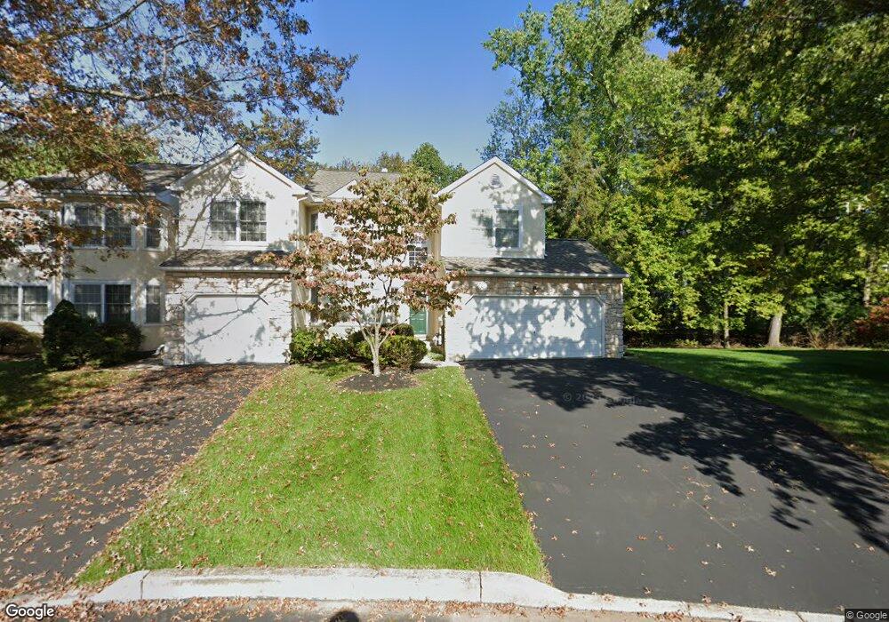
729 Locust Ln Ambler, PA 19002
Estimated Value: $509,000 - $601,000
3
Beds
3
Baths
1,984
Sq Ft
$278/Sq Ft
Est. Value
About This Home
This home is located at 729 Locust Ln, Ambler, PA 19002 and is currently estimated at $551,817, approximately $278 per square foot. 729 Locust Ln is a home located in Montgomery County with nearby schools including Lower Gwynedd El School, Wissahickon Middle School, and Wissahickon Senior High School.
Ownership History
Date
Name
Owned For
Owner Type
Purchase Details
Closed on
Jul 28, 2005
Sold by
Mallozzi Nancy and Ruzzi Nancy A
Bought by
Yamada Susan S
Current Estimated Value
Home Financials for this Owner
Home Financials are based on the most recent Mortgage that was taken out on this home.
Original Mortgage
$162,000
Outstanding Balance
$84,443
Interest Rate
5.54%
Mortgage Type
New Conventional
Estimated Equity
$467,374
Purchase Details
Closed on
Jul 17, 2000
Sold by
Kane Cynthia B
Bought by
Mallozzi Nancy
Purchase Details
Closed on
Sep 29, 1995
Sold by
Dresher Valley Builders Inc
Bought by
Kane Cynthia B
Create a Home Valuation Report for This Property
The Home Valuation Report is an in-depth analysis detailing your home's value as well as a comparison with similar homes in the area
Home Values in the Area
Average Home Value in this Area
Purchase History
| Date | Buyer | Sale Price | Title Company |
|---|---|---|---|
| Yamada Susan S | $398,000 | -- | |
| Mallozzi Nancy | $243,900 | -- | |
| Kane Cynthia B | $187,620 | -- |
Source: Public Records
Mortgage History
| Date | Status | Borrower | Loan Amount |
|---|---|---|---|
| Open | Yamada Susan S | $162,000 |
Source: Public Records
Tax History Compared to Growth
Tax History
| Year | Tax Paid | Tax Assessment Tax Assessment Total Assessment is a certain percentage of the fair market value that is determined by local assessors to be the total taxable value of land and additions on the property. | Land | Improvement |
|---|---|---|---|---|
| 2025 | $5,055 | $169,770 | $33,940 | $135,830 |
| 2024 | $5,055 | $169,770 | $33,940 | $135,830 |
| 2023 | $4,804 | $169,770 | $33,940 | $135,830 |
| 2022 | $4,627 | $169,770 | $33,940 | $135,830 |
| 2021 | $4,476 | $169,770 | $33,940 | $135,830 |
| 2020 | $4,357 | $169,770 | $33,940 | $135,830 |
| 2019 | $4,260 | $169,770 | $33,940 | $135,830 |
| 2018 | $861 | $169,770 | $33,940 | $135,830 |
| 2017 | $4,051 | $169,770 | $33,940 | $135,830 |
| 2016 | $3,985 | $169,770 | $33,940 | $135,830 |
| 2015 | $3,787 | $169,770 | $33,940 | $135,830 |
| 2014 | $3,787 | $169,770 | $33,940 | $135,830 |
Source: Public Records
Map
Nearby Homes
- 829 Foxfield Rd
- 501 N Bethlehem Pike Unit 12F
- 501 N Bethlehem Pike Unit 14P
- 6 Timber Fare
- 233 Towyn Ct
- 1 Woods Ln
- 716 Knight Rd
- 174 Albemarle Dr
- Lot 3 Johns Ln
- 0 Johns Ln Unit BROOKSIDE ELITE
- 0 Johns Ln Unit EMERSON ELITE
- 442 Old Penllyn Pike
- 137 Stafford Dr Unit L 6F
- 770 Johns Ln
- 124 Macklenburg Dr
- 790 Brushtown Rd
- Lot 1 Beech Hollow Rd
- 1214 Hunt Seat Dr
- 459 Edgewood Dr
- 2300 Navajo Path