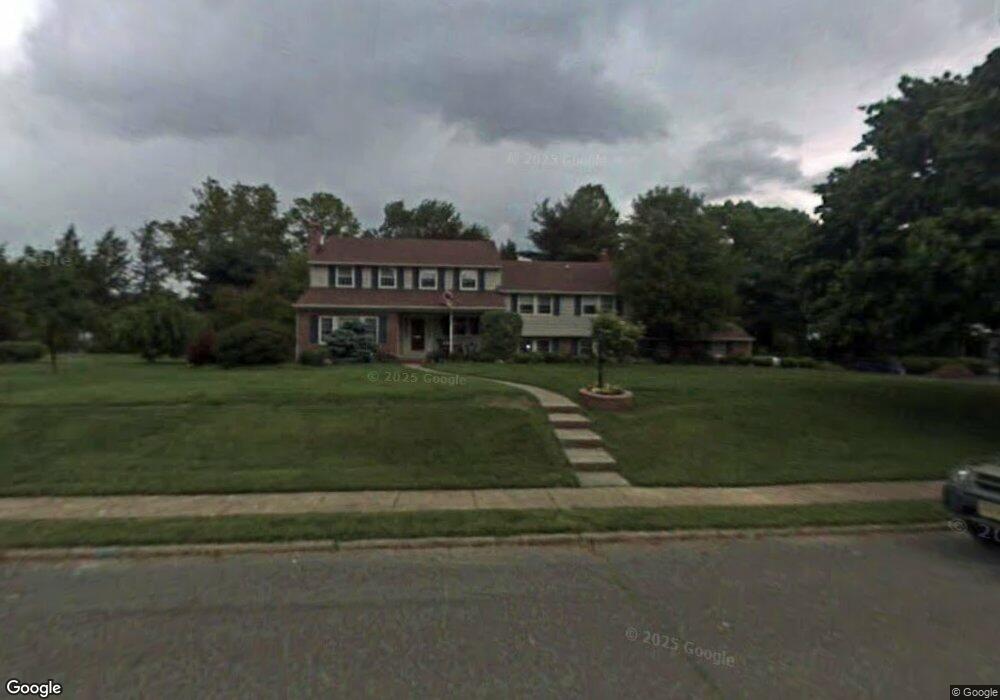
729 Signal Light Rd Moorestown, NJ 08057
Estimated Value: $1,115,121 - $1,290,000
--
Bed
--
Bath
4,045
Sq Ft
$296/Sq Ft
Est. Value
About This Home
This home is located at 729 Signal Light Rd, Moorestown, NJ 08057 and is currently estimated at $1,197,040, approximately $295 per square foot. 729 Signal Light Rd is a home located in Burlington County with nearby schools including George C. Baker Elementary School, Moorestown Upper Elementary School, and William Allen Middle School.
Ownership History
Date
Name
Owned For
Owner Type
Purchase Details
Closed on
May 29, 2003
Sold by
Gray Ralph M and Gray Catherine N
Bought by
Villani Joseph A and Villani Kimberly G
Current Estimated Value
Home Financials for this Owner
Home Financials are based on the most recent Mortgage that was taken out on this home.
Original Mortgage
$376,000
Outstanding Balance
$163,869
Interest Rate
5.71%
Mortgage Type
Purchase Money Mortgage
Estimated Equity
$1,033,171
Purchase Details
Closed on
Oct 24, 1999
Sold by
Fairbanks Russell N and Fairbanks Rachel F
Bought by
Gray Ralph M and Gray Catherine N
Home Financials for this Owner
Home Financials are based on the most recent Mortgage that was taken out on this home.
Original Mortgage
$39,000
Interest Rate
7.38%
Mortgage Type
Stand Alone Second
Create a Home Valuation Report for This Property
The Home Valuation Report is an in-depth analysis detailing your home's value as well as a comparison with similar homes in the area
Home Values in the Area
Average Home Value in this Area
Purchase History
| Date | Buyer | Sale Price | Title Company |
|---|---|---|---|
| Villani Joseph A | $474,000 | Infinity Title | |
| Gray Ralph M | $390,000 | Infinity Title Agency Inc |
Source: Public Records
Mortgage History
| Date | Status | Borrower | Loan Amount |
|---|---|---|---|
| Open | Villani Joseph A | $376,000 | |
| Previous Owner | Gray Ralph M | $39,000 | |
| Previous Owner | Gray Ralph M | $312,000 |
Source: Public Records
Tax History Compared to Growth
Tax History
| Year | Tax Paid | Tax Assessment Tax Assessment Total Assessment is a certain percentage of the fair market value that is determined by local assessors to be the total taxable value of land and additions on the property. | Land | Improvement |
|---|---|---|---|---|
| 2025 | $19,328 | $690,000 | $327,500 | $362,500 |
| 2024 | $17,848 | $681,300 | $327,500 | $353,800 |
| 2023 | $17,433 | $681,300 | $327,500 | $353,800 |
| 2021 | $17,433 | $648,800 | $0 | $0 |
| 2020 | $17,323 | $648,800 | $0 | $0 |
| 2019 | $16,845 | $681,300 | $327,500 | $353,800 |
| 2018 | $16,238 | $636,300 | $327,500 | $308,800 |
| 2017 | $16,378 | $636,300 | $327,500 | $308,800 |
| 2016 | $16,321 | $636,300 | $327,500 | $308,800 |
| 2015 | $16,124 | $636,300 | $327,500 | $308,800 |
| 2014 | $15,309 | $636,300 | $327,500 | $308,800 |
Source: Public Records
Map
Nearby Homes
- 744 Signal Light Rd
- 863 Golf View Rd
- 7 Whitetail Ct
- 628 Windsock Way
- 205 E Central Ave
- 308 Elm St
- 408 E 2nd St
- 133 Plum St Unit 6
- 514 E Main St
- 526 E Main St
- 80 E 3rd St
- 82 E 3rd St
- 633 E Main St Unit B7
- 66 E 3rd St
- 57 Brooks Rd
- 50 E 3rd St
- 693 Garwood Rd
- 415 Bridgeboro Rd
- 343 Tom Brown Rd
- 347 Tom Brown Rd
- 725 Signal Light Rd
- 733 Signal Light Rd
- 728 Stonehouse Rd
- 732 Stonehouse Rd
- 728 Signal Light Rd
- 415 Sentinel Rd
- 736 Stonehouse Rd
- 732 Signal Light Rd
- 724 Signal Light Rd
- 737 Signal Light Rd
- 740 Stonehouse Rd
- 729 Stonehouse Rd
- 408 Sentinel Rd
- 736 Signal Light Rd
- 729 N Stanwick Rd
- 733 Stonehouse Rd
- 412 Sentinel Rd
- 725 Stonehouse Rd
- 725 N Stanwick Rd
- 733 N Stanwick Rd