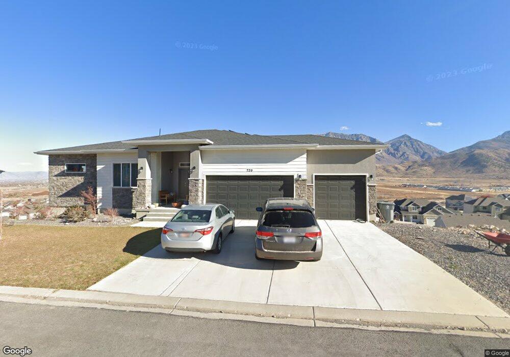
729 Summit Trail Santaquin, UT 84655
Estimated Value: $667,000 - $678,939
4
Beds
2
Baths
5,550
Sq Ft
$121/Sq Ft
Est. Value
About This Home
This home is located at 729 Summit Trail, Santaquin, UT 84655 and is currently estimated at $670,980, approximately $120 per square foot. 729 Summit Trail is a home located in Utah County with nearby schools including Santaquin Elementary School, Payson Junior High School, and Mt. Nebo Middle.
Ownership History
Date
Name
Owned For
Owner Type
Purchase Details
Closed on
Sep 11, 2019
Sold by
Mccausland Aaron Joseph
Bought by
Mccausland Aaron Joseph and Seiter Mccausland Sarah B
Current Estimated Value
Home Financials for this Owner
Home Financials are based on the most recent Mortgage that was taken out on this home.
Original Mortgage
$435,948
Outstanding Balance
$382,637
Interest Rate
3.7%
Mortgage Type
New Conventional
Estimated Equity
$288,343
Purchase Details
Closed on
May 28, 2019
Sold by
Salisbury Land Llc
Bought by
Riding Siding Construction Llc
Home Financials for this Owner
Home Financials are based on the most recent Mortgage that was taken out on this home.
Original Mortgage
$312,971
Interest Rate
4.1%
Mortgage Type
Construction
Purchase Details
Closed on
Sep 29, 2011
Sold by
Summit Ridge Communities Llc
Bought by
Central Bank
Create a Home Valuation Report for This Property
The Home Valuation Report is an in-depth analysis detailing your home's value as well as a comparison with similar homes in the area
Home Values in the Area
Average Home Value in this Area
Purchase History
| Date | Buyer | Sale Price | Title Company |
|---|---|---|---|
| Mccausland Aaron Joseph | -- | Cottonwood Ttl Ins Agcy Inc | |
| Mccausland Aaron Joseph | -- | Cottonwood Ttl Ins Agcy Ibnc | |
| Riding Siding Construction Llc | -- | Cottonwood Title Ins Agcy In | |
| Central Bank | -- | None Available |
Source: Public Records
Mortgage History
| Date | Status | Borrower | Loan Amount |
|---|---|---|---|
| Open | Mccausland Aaron Joseph | $435,948 | |
| Previous Owner | Riding Siding Construction Llc | $312,971 |
Source: Public Records
Tax History
| Year | Tax Paid | Tax Assessment Tax Assessment Total Assessment is a certain percentage of the fair market value that is determined by local assessors to be the total taxable value of land and additions on the property. | Land | Improvement |
|---|---|---|---|---|
| 2025 | $3,424 | $378,400 | -- | -- |
| 2024 | $3,424 | $340,945 | $0 | $0 |
| 2023 | $3,611 | $360,745 | $0 | $0 |
| 2022 | $3,248 | $334,675 | $0 | $0 |
| 2021 | $2,860 | $456,900 | $105,700 | $351,200 |
| 2020 | $2,833 | $438,500 | $75,500 | $363,000 |
| 2019 | $821 | $71,500 | $71,500 | $0 |
| 2018 | $794 | $65,900 | $65,900 | $0 |
| 2017 | $817 | $65,900 | $0 | $0 |
| 2016 | $643 | $50,800 | $0 | $0 |
| 2015 | $616 | $47,700 | $0 | $0 |
| 2014 | $565 | $43,700 | $0 | $0 |
Source: Public Records
Map
Nearby Homes
- 926 S Tanner Rd
- 942 S Tanner Rd
- 503 Firestone Dr
- 976 S Tanner Rd
- 1024 S Tanner Rd
- 1040 S Tanner Rd
- 412 Flagstone Dr
- 1126 Valley View Dr
- 370 Stone Hollow Dr
- 332 Stone Dr
- 1186 S Vista Ridge Dr
- 1858 W View Cove
- 1263 Crest Dale Ln
- 1859 W View Cove
- 1851 W View Cove
- 1276 W View Dr
- 1302 W View Dr
- 1334 W View Dr
- 1344 W View Dr
- 1287 Cedar Pass Dr Unit 113
- 729 Summit Trail Unit 12
- 729 Summit Trail Unit LUCAS
- 729 Summit Trail Unit MLRSE
- 729 Summit Trail Unit MORSN
- 729 Summit Trails
- 709 Summit Trail Unit 11
- 709 Summit Trail
- 744 Crest Dale Ln Unit WORTHI
- 744 Crest Dale Ln Unit MELROS
- 744 Crest Dale Ln Unit DREXEL
- 744 Crest Dale Ln Unit HILDAL
- 744 Crest Dale Ln Unit COLUMB
- 744 Crest Dale Ln Unit LUCAS
- 744 Crest Dale Ln Unit CALDWE
- 744 Crest Dale Ln Unit BALLAR
- 744 Crest Dale Ln
- 762 Crest Dale Ln Unit BALLAR
- 762 Crest Dale Ln Unit CALDWE
- 762 Crest Dale Ln Unit LUCAS
- 762 Crest Dale Ln Unit COLUMB
Your Personal Tour Guide
Ask me questions while you tour the home.