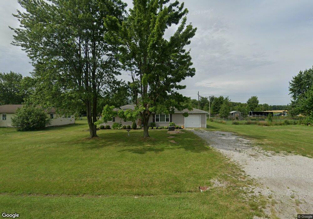
7292 State Route 15 Defiance, OH 43512
Estimated Value: $149,667 - $179,000
3
Beds
1
Bath
1,284
Sq Ft
$130/Sq Ft
Est. Value
About This Home
This home is located at 7292 State Route 15, Defiance, OH 43512 and is currently estimated at $166,667, approximately $129 per square foot. 7292 State Route 15 is a home located in Defiance County with nearby schools including Noble Elementary School, Tinora Elementary School, and Tinora Middle School.
Ownership History
Date
Name
Owned For
Owner Type
Purchase Details
Closed on
Jul 31, 2020
Sold by
Murcko Joseph P and Murcko Haley K
Bought by
Murcko Haley K
Current Estimated Value
Home Financials for this Owner
Home Financials are based on the most recent Mortgage that was taken out on this home.
Original Mortgage
$90,000
Interest Rate
2.9%
Mortgage Type
New Conventional
Purchase Details
Closed on
Sep 30, 2005
Sold by
Bauserman Richard A and Bauserman Betty J
Bought by
Murcko Joseph P
Home Financials for this Owner
Home Financials are based on the most recent Mortgage that was taken out on this home.
Original Mortgage
$84,570
Interest Rate
5.93%
Mortgage Type
New Conventional
Create a Home Valuation Report for This Property
The Home Valuation Report is an in-depth analysis detailing your home's value as well as a comparison with similar homes in the area
Purchase History
| Date | Buyer | Sale Price | Title Company |
|---|---|---|---|
| Murcko Haley K | -- | None Available | |
| Murcko Joseph P | $63,675 | None Available |
Source: Public Records
Mortgage History
| Date | Status | Borrower | Loan Amount |
|---|---|---|---|
| Previous Owner | Murcko Haley K | $90,000 | |
| Previous Owner | Murcko Joseph P | $84,570 |
Source: Public Records
Tax History
| Year | Tax Paid | Tax Assessment Tax Assessment Total Assessment is a certain percentage of the fair market value that is determined by local assessors to be the total taxable value of land and additions on the property. | Land | Improvement |
|---|---|---|---|---|
| 2025 | $1,353 | $38,390 | $3,850 | $34,540 |
| 2024 | $1,353 | $38,390 | $3,850 | $34,540 |
| 2023 | $1,372 | $38,390 | $3,850 | $34,540 |
| 2022 | $1,269 | $29,940 | $3,820 | $26,120 |
| 2021 | $1,269 | $29,940 | $3,820 | $26,120 |
| 2020 | $1,237 | $29,940 | $3,820 | $26,120 |
| 2019 | $1,240 | $28,860 | $3,820 | $25,040 |
| 2018 | $1,198 | $28,860 | $3,820 | $25,040 |
| 2017 | $1,081 | $28,851 | $3,815 | $25,036 |
| 2016 | $973 | $26,257 | $3,815 | $22,442 |
| 2015 | $494 | $25,757 | $3,815 | $21,942 |
| 2014 | $494 | $25,757 | $3,815 | $21,942 |
| 2013 | $494 | $25,757 | $3,815 | $21,942 |
| 2012 | $494 | $25,757 | $3,815 | $21,942 |
Source: Public Records
Map
Nearby Homes
- 20975 Buckskin Rd
- 8820 Ohio 15
- 22745 River Chase Ln
- 4312 W Rolling Meadows Blvd
- 4129 Misty Shores Rd
- 4313 E Rolling Meadows Blvd
- 4515 Glenburg Rd
- 4463 Glenburg Rd
- 19879 Switzer Rd
- 0 Rose St Unit Lot L 6004739
- 0 Saint Rt 66
- 6909 Ohio 66 Unit Lot 2
- 383 Maumee River Crossing
- 726 Indian Bridge Ln
- 851 Anthony Wayne Blvd
- 835 Bell St
- 823 Nicholas St
- 516 Ralston Ave
- 508 Ralston Ave
- 218 Union St
- 7292 Us St Rt 15
- 7300 Ohio 15
- 7300 State Route 15
- 7266 State Route 15
- 7314 State Route 15
- 7266 Ohio 15
- 7326 State Route 15
- 7258 State Route 15
- 7246 State Route 15
- 7348 State Route 15
- 7455 Trinity Rd
- 7370 State Route 15
- 7407 Trinity Rd
- 7382 State Route 15
- 7406 State Route 15
- 7481 Trinity Rd
- 7430 State Route 15
- 7508 Trinity Rd
- 7518 State Route 15
- 7028 State Route 15
Your Personal Tour Guide
Ask me questions while you tour the home.