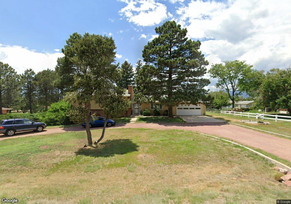
7294 Ross Dr Colorado Springs, CO 80920
Falcon Estates NeighborhoodEstimated Value: $623,084 - $710,000
4
Beds
3
Baths
1,664
Sq Ft
$400/Sq Ft
Est. Value
About This Home
This home is located at 7294 Ross Dr, Colorado Springs, CO 80920 and is currently estimated at $665,771, approximately $400 per square foot. 7294 Ross Dr is a home located in El Paso County with nearby schools including Pioneer Elementary School, Mountain Ridge Middle School, and Rampart High School.
Ownership History
Date
Name
Owned For
Owner Type
Purchase Details
Closed on
Mar 21, 2019
Sold by
Treska Mary Catherine
Bought by
Mct Ross Llc
Current Estimated Value
Purchase Details
Closed on
Jun 13, 1974
Bought by
Treska Milo
Purchase Details
Closed on
Jul 5, 1972
Bought by
Treska Milo
Purchase Details
Closed on
Mar 30, 1966
Bought by
Treska Milo
Purchase Details
Closed on
Sep 3, 1964
Bought by
Treska Milo
Create a Home Valuation Report for This Property
The Home Valuation Report is an in-depth analysis detailing your home's value as well as a comparison with similar homes in the area
Home Values in the Area
Average Home Value in this Area
Purchase History
| Date | Buyer | Sale Price | Title Company |
|---|---|---|---|
| Mct Ross Llc | -- | None Available | |
| Treska Milo | -- | -- | |
| Treska Milo | -- | -- | |
| Treska Milo | -- | -- | |
| Treska Milo | -- | -- |
Source: Public Records
Tax History Compared to Growth
Tax History
| Year | Tax Paid | Tax Assessment Tax Assessment Total Assessment is a certain percentage of the fair market value that is determined by local assessors to be the total taxable value of land and additions on the property. | Land | Improvement |
|---|---|---|---|---|
| 2025 | $2,717 | $43,590 | -- | -- |
| 2024 | $2,704 | $49,020 | $13,300 | $35,720 |
| 2023 | $2,704 | $49,020 | $13,300 | $35,720 |
| 2022 | $2,142 | $32,370 | $7,350 | $25,020 |
| 2021 | $2,380 | $33,300 | $7,560 | $25,740 |
| 2020 | $2,131 | $27,680 | $6,580 | $21,100 |
| 2019 | $2,108 | $27,680 | $6,580 | $21,100 |
| 2018 | $1,249 | $23,320 | $5,760 | $17,560 |
| 2017 | $1,245 | $23,320 | $5,760 | $17,560 |
| 2016 | $1,239 | $23,990 | $6,370 | $17,620 |
| 2015 | $1,237 | $23,990 | $6,370 | $17,620 |
| 2014 | $1,054 | $21,610 | $5,970 | $15,640 |
Source: Public Records
Map
Nearby Homes
- 7191 Ross Dr
- 1884 Fuller Rd
- 7424 Bell Dr
- 1907 Independence Dr
- 1880 Independence Dr
- 1871 Brookwood Dr
- 1510 York Rd Unit 101
- 1275 Berglind Rd
- 2110 Whitehorn Dr N
- 7137 Murdoch Dr
- 6633 Dublin Loop W Unit 4
- 6632 Dublin Loop W
- 6699 Bethesda Point Unit B
- 6598 Bethesda Point Unit B
- 1160 Berglind Rd
- 6678 Bethesda Point Unit C
- 6602 Dublin Loop W
- 6881 Los Reyes Cir
- 6872 Los Reyes Cir
- 6868 Los Reyes Cir