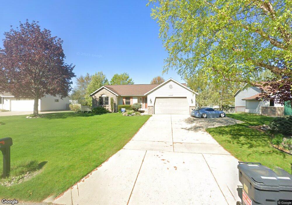
7295 21st Ave Jenison, MI 49428
Estimated Value: $369,555 - $406,000
--
Bed
3
Baths
1,272
Sq Ft
$305/Sq Ft
Est. Value
About This Home
This home is located at 7295 21st Ave, Jenison, MI 49428 and is currently estimated at $387,889, approximately $304 per square foot. 7295 21st Ave is a home located in Ottawa County with nearby schools including Rosewood Elementary School, Jenison Junior High School, and Jenison High School.
Ownership History
Date
Name
Owned For
Owner Type
Purchase Details
Closed on
May 26, 2017
Sold by
Roskam Richard A and Roskam Carol A
Bought by
Buck Joel and Buck Heather
Current Estimated Value
Home Financials for this Owner
Home Financials are based on the most recent Mortgage that was taken out on this home.
Original Mortgage
$202,500
Outstanding Balance
$168,207
Interest Rate
3.97%
Mortgage Type
VA
Estimated Equity
$219,682
Create a Home Valuation Report for This Property
The Home Valuation Report is an in-depth analysis detailing your home's value as well as a comparison with similar homes in the area
Home Values in the Area
Average Home Value in this Area
Purchase History
| Date | Buyer | Sale Price | Title Company |
|---|---|---|---|
| Buck Joel | $240,500 | Chicago Title |
Source: Public Records
Mortgage History
| Date | Status | Borrower | Loan Amount |
|---|---|---|---|
| Open | Buck Joel | $202,500 |
Source: Public Records
Tax History Compared to Growth
Tax History
| Year | Tax Paid | Tax Assessment Tax Assessment Total Assessment is a certain percentage of the fair market value that is determined by local assessors to be the total taxable value of land and additions on the property. | Land | Improvement |
|---|---|---|---|---|
| 2025 | $3,283 | $170,600 | $0 | $0 |
| 2024 | $2,848 | $164,200 | $0 | $0 |
| 2023 | $2,719 | $153,300 | $0 | $0 |
| 2022 | $2,985 | $125,700 | $0 | $0 |
| 2021 | $2,899 | $111,900 | $0 | $0 |
| 2020 | $2,867 | $104,500 | $0 | $0 |
| 2019 | $2,869 | $100,100 | $0 | $0 |
| 2018 | $2,592 | $96,500 | $0 | $0 |
| 2017 | $2,081 | $95,400 | $0 | $0 |
| 2016 | $2,068 | $86,700 | $0 | $0 |
| 2015 | $1,974 | $80,900 | $0 | $0 |
| 2014 | $1,974 | $81,500 | $0 | $0 |
Source: Public Records
Map
Nearby Homes
- 7342 Cherry Ave
- 2159 Tyler St
- 7165 Keystone Ct
- 7502 22nd Ave
- 7373 Pinegrove Dr Unit 109
- 2194 Oak Hollow Dr
- 7314 Pinegrove Dr
- 2101 Rosewood St
- 7461 Pinegrove Dr Unit 29
- 7107 Westwood Dr
- 2200 Rosewood St
- 7444 Pinegrove Dr Unit 59
- 7357 Coconut Dr
- 7445 Westwood Dr
- 3205 Deer Haven Dr
- 7425 Boulder Bluff Dr Unit 112
- 1937 Mulberry Ln
- 7523 Boulder Bluff Dr Unit 82
- 7450 Boulder Bluff Dr Unit 66
- 7450 Boulder Bluff Dr Unit 61
- 7307 21st Ave
- 7281 21st Ave
- 7296 Pine Aire Ct SW
- 7308 Pine Aire Ct SW
- 7282 Pine Aire Ct SW
- 7321 21st Ave
- 7269 21st Ave
- 7290 21st Ave
- 7304 21st Ave
- 7322 Pine Aire Ct SW
- 7268 Pine Aire Ct SW
- 7276 21st Ave
- 7316 21st Ave
- 7333 21st Ave
- 7257 21st Ave
- 7336 Pine Aire Ct SW
- 7256 Pine Aire Ct SW
- 7328 21st Ave
- 2041 Pine Bough St
- 7295 Pine Aire Ct SW