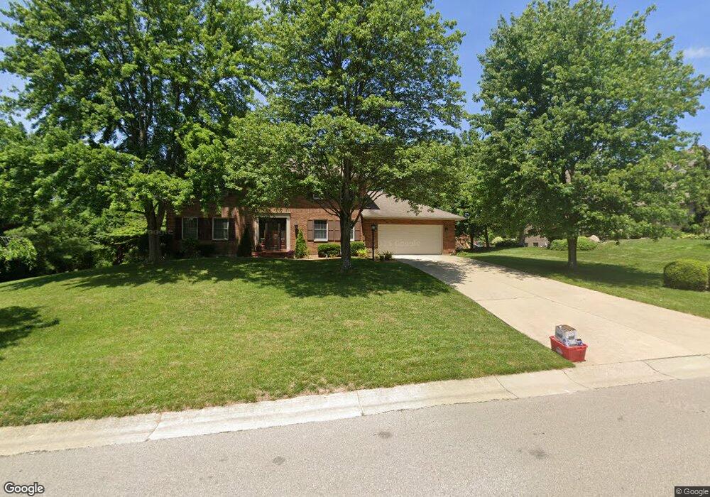
7295 Wethersfield Dr West Chester, OH 45069
West Chester Township NeighborhoodEstimated Value: $438,000 - $479,000
4
Beds
3
Baths
2,494
Sq Ft
$183/Sq Ft
Est. Value
About This Home
This home is located at 7295 Wethersfield Dr, West Chester, OH 45069 and is currently estimated at $456,457, approximately $183 per square foot. 7295 Wethersfield Dr is a home located in Butler County with nearby schools including Endeavor Elementary School, Lakota Plains Junior School, and Lakota West High School.
Ownership History
Date
Name
Owned For
Owner Type
Purchase Details
Closed on
Nov 22, 1999
Sold by
Haynes Stephen W and Haynes Jeanne L
Bought by
Lau John M and Lau Kathleen M
Current Estimated Value
Home Financials for this Owner
Home Financials are based on the most recent Mortgage that was taken out on this home.
Original Mortgage
$132,000
Interest Rate
6.99%
Mortgage Type
Purchase Money Mortgage
Purchase Details
Closed on
Feb 27, 1995
Sold by
Miskimens Scott A
Bought by
Haynes Stephen W and Haynes Jeanne
Home Financials for this Owner
Home Financials are based on the most recent Mortgage that was taken out on this home.
Original Mortgage
$129,200
Interest Rate
9.21%
Mortgage Type
New Conventional
Purchase Details
Closed on
Aug 1, 1991
Purchase Details
Closed on
Jun 1, 1988
Create a Home Valuation Report for This Property
The Home Valuation Report is an in-depth analysis detailing your home's value as well as a comparison with similar homes in the area
Home Values in the Area
Average Home Value in this Area
Purchase History
| Date | Buyer | Sale Price | Title Company |
|---|---|---|---|
| Lau John M | $194,000 | -- | |
| Haynes Stephen W | $161,500 | -- | |
| -- | $167,800 | -- | |
| -- | $32,000 | -- |
Source: Public Records
Mortgage History
| Date | Status | Borrower | Loan Amount |
|---|---|---|---|
| Previous Owner | Lau John M | $132,000 | |
| Previous Owner | Haynes Stephen W | $129,200 |
Source: Public Records
Tax History Compared to Growth
Tax History
| Year | Tax Paid | Tax Assessment Tax Assessment Total Assessment is a certain percentage of the fair market value that is determined by local assessors to be the total taxable value of land and additions on the property. | Land | Improvement |
|---|---|---|---|---|
| 2024 | $4,809 | $116,490 | $19,880 | $96,610 |
| 2023 | $4,775 | $112,130 | $19,880 | $92,250 |
| 2022 | $5,144 | $92,520 | $19,880 | $72,640 |
| 2021 | $4,697 | $89,060 | $19,880 | $69,180 |
| 2020 | $4,809 | $89,060 | $19,880 | $69,180 |
| 2019 | $6,837 | $71,340 | $19,020 | $52,320 |
| 2018 | $4,041 | $71,340 | $19,020 | $52,320 |
| 2017 | $4,113 | $71,340 | $19,020 | $52,320 |
| 2016 | $4,108 | $67,090 | $19,020 | $48,070 |
| 2015 | $4,101 | $67,090 | $19,020 | $48,070 |
| 2014 | $4,960 | $67,090 | $19,020 | $48,070 |
| 2013 | $4,960 | $78,890 | $19,020 | $59,870 |
Source: Public Records
Map
Nearby Homes
- 7229 W Hartford Ct
- 0 Walnut Creek Dr Unit 1850153
- 7392 Wheatland Meadow Ct
- 5241 Hamilton Mason Rd
- 7350 Keltner Dr
- 6993 Clawson Ridge Ct
- 7257 Clawson Ct
- 6674 Southampton Ln
- 4625 Guildford Dr
- 5146 Mountview Ct
- 8330 Park Place
- 8354 Park Place
- 7695 Fox Chase Dr
- 7213 Quail Run Dr
- 5108 Grandin Ridge Dr
- 5168 Grandin Ridge Dr
- 6940 Crown Pointe Dr
- 5577 Dove Ln
- 7077 Parliament Place
- 6875 Crown Pointe Dr
- 7285 Wethersfield Dr
- 7305 Wethersfield Dr
- 7296 W Hartford Ct
- 7280 W Hartford Ct
- 7275 Wethersfield Dr
- 7268 W Hartford Ct
- 7256 W Hartford Ct
- 7282 Wethersfield Dr
- 7246 W Hartford Ct
- 7292 Wethersfield Dr
- 7302 Wethersfield Dr
- 7265 Wethersfield Dr
- 7272 Wethersfield Dr
- 7238 W Hartford Ct
- 7316 Wethersfield Dr
- 7285 W Hartford Ct
- 7293 W Hartford Ct
- 7333 Wethersfield Dr
- 7277 W Hartford Ct
- 7262 Wethersfield Dr