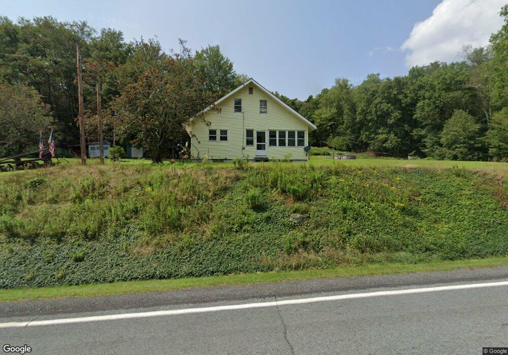
7296 State Route 52 Narrowsburg, NY 12764
Estimated Value: $199,000 - $352,000
3
Beds
1
Bath
1,196
Sq Ft
$240/Sq Ft
Est. Value
About This Home
This home is located at 7296 State Route 52, Narrowsburg, NY 12764 and is currently estimated at $287,147, approximately $240 per square foot. 7296 State Route 52 is a home with nearby schools including Sullivan West Elementary School and Sullivan West High School at Lake Huntington.
Ownership History
Date
Name
Owned For
Owner Type
Purchase Details
Closed on
Jun 29, 2018
Sold by
Heinle Katrina
Bought by
Heinle Brian
Current Estimated Value
Purchase Details
Closed on
Feb 4, 2011
Sold by
Heinle Donald H
Bought by
Heinle Brian
Home Financials for this Owner
Home Financials are based on the most recent Mortgage that was taken out on this home.
Original Mortgage
$62,377
Interest Rate
4.62%
Mortgage Type
FHA
Purchase Details
Closed on
Jul 19, 2000
Create a Home Valuation Report for This Property
The Home Valuation Report is an in-depth analysis detailing your home's value as well as a comparison with similar homes in the area
Home Values in the Area
Average Home Value in this Area
Purchase History
| Date | Buyer | Sale Price | Title Company |
|---|---|---|---|
| Heinle Brian | -- | -- | |
| Heinle Brian | $64,000 | Jeffrey P Clemente | |
| -- | -- | -- |
Source: Public Records
Mortgage History
| Date | Status | Borrower | Loan Amount |
|---|---|---|---|
| Previous Owner | Heinle Brian | $62,377 |
Source: Public Records
Tax History Compared to Growth
Tax History
| Year | Tax Paid | Tax Assessment Tax Assessment Total Assessment is a certain percentage of the fair market value that is determined by local assessors to be the total taxable value of land and additions on the property. | Land | Improvement |
|---|---|---|---|---|
| 2024 | $3,983 | $100,800 | $42,500 | $58,300 |
| 2023 | $4,031 | $100,800 | $42,500 | $58,300 |
| 2022 | $3,833 | $100,800 | $42,500 | $58,300 |
| 2021 | $4,055 | $100,800 | $42,500 | $58,300 |
| 2020 | $3,506 | $100,800 | $42,500 | $58,300 |
| 2019 | $3,503 | $100,800 | $42,500 | $58,300 |
| 2018 | $3,527 | $100,800 | $42,500 | $58,300 |
| 2017 | $3,503 | $100,800 | $42,500 | $58,300 |
| 2016 | $3,539 | $100,800 | $42,500 | $58,300 |
| 2015 | -- | $100,800 | $42,500 | $58,300 |
| 2014 | -- | $100,800 | $42,500 | $58,300 |
Source: Public Records
Map
Nearby Homes
- 200 Daub Rd
- 7552 State Route 52
- 98 Buff Rd
- 24 Buff Rd
- 273 Perry Pond Rd
- Lot 23.23 Perry Pond Rd
- 6721 State Route 52
- 16 Nelson Rd
- 1 Brook Dr
- 342 Bernas Rd
- 6658 New York 52
- 208 Shortcut Rd
- 61 Old Cochecton Rd
- 0 New York 52 Unit KEY919775
- Lot 17.9 Shortcut Rd
- 367 Cushetunk Dr
- L6.29 Cushetunk Dr
- 441 Cushetunk Dr
- 169 Mitchell Pond Rd E
- 6452 State Route 52
- 78 Tyler Rd
- 46 Tyler Rd
- 37 Town Road 45
- 27 Tyler Rd
- 14 Tyler Rd
- 19 Tyler Rd
- 7254 State Route 52
- 6 Tyler Rd
- 48 Old County Rd
- TR 42 Daub Rd
- 782 Skipperene Rd
- 680 Skipperene Rd
- 10 Old County Rd
- 71 Daub Rd
- 0 Skipperene Rd Unit 514211
- 0 Skipperene Rd Unit 557640
- 0 Skipperene Rd Unit 4426269
- 0 Skipperene Rd Unit 4426268
- 0 Skipperene Rd Unit 4426264
- 0 Skipperene Rd Unit ONEH6302674