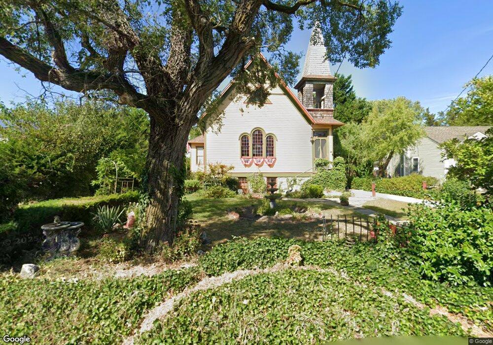
729A Jonathan Hoffman Rd Cape May, NJ 08204
Estimated Value: $651,325 - $1,269,000
Studio
--
Bath
1,844
Sq Ft
$446/Sq Ft
Est. Value
About This Home
This home is located at 729A Jonathan Hoffman Rd, Cape May, NJ 08204 and is currently estimated at $822,831, approximately $446 per square foot. 729A Jonathan Hoffman Rd is a home located in Cape May County with nearby schools including Carl T. Mitnick School, David C. Douglass Veterans Memorial School, and Maud Abrams School.
Ownership History
Date
Name
Owned For
Owner Type
Purchase Details
Closed on
Oct 25, 2002
Sold by
Smith Robert R
Bought by
Mangano Jon F and Mangano Virginia
Current Estimated Value
Home Financials for this Owner
Home Financials are based on the most recent Mortgage that was taken out on this home.
Original Mortgage
$170,000
Outstanding Balance
$70,906
Interest Rate
6.09%
Estimated Equity
$751,925
Purchase Details
Closed on
Mar 12, 1990
Sold by
Nj Church Of Latter Day Saints
Bought by
Smith Robert and Smith Joan
Create a Home Valuation Report for This Property
The Home Valuation Report is an in-depth analysis detailing your home's value as well as a comparison with similar homes in the area
Home Values in the Area
Average Home Value in this Area
Purchase History
| Date | Buyer | Sale Price | Title Company |
|---|---|---|---|
| Mangano Jon F | $212,500 | -- | |
| Smith Robert | $109,000 | -- |
Source: Public Records
Mortgage History
| Date | Status | Borrower | Loan Amount |
|---|---|---|---|
| Open | Mangano Jon F | $170,000 |
Source: Public Records
Tax History
| Year | Tax Paid | Tax Assessment Tax Assessment Total Assessment is a certain percentage of the fair market value that is determined by local assessors to be the total taxable value of land and additions on the property. | Land | Improvement |
|---|---|---|---|---|
| 2025 | $4,695 | $231,500 | $137,500 | $94,000 |
| 2024 | $4,695 | $231,500 | $137,500 | $94,000 |
Source: Public Records
Map
Nearby Homes
- 7 Bottle Creek Dr
- 3941 Bayshore Rd
- 720 Town Bank Rd
- 14 Wakefield Place
- 753 Route 9 Unit U
- 3911 Bayshore Rd
- 668 Crawford Rd
- 1 Robin Ln
- 53 Summer Cir
- 569 New England Rd
- 510 Portsmouth Rd
- 23 Taylor Ln
- 44 Heron Way
- 602 Gorham Ave
- 503 Howland Ave
- 207 Old Mill Dr
- 53 Westwood Dr
- 787 Stimpson Ln
- 118 Old Mill Dr
- 200 Willow Dr
- 730 Reeves Ave
- 724 Spring Ln
- 731 Reeves Ave
- 727 Jonathan Hoffman Rd
- 733 Reeves Ave
- 731 Jonathan Hoffman Rd
- 722 Spring Ln
- 733 Jonathan Hoffman Rd
- 926 Eldredge Ave
- 725 Spring Ln
- 723 Jonathan Hoffman Rd
- 737 Jonathan Hoffman Rd
- 723 Spring Ln
- 720 Spring Ln
- 737 Reeves Ave
- 739 Jonathan Hoffman Rd
- 726 Jonathan Hoffman Rd
- 724 Jonathan Hoffman Rd
- 925 Eldredge Ave
- 721 Spring Ln
Your Personal Tour Guide
Ask me questions while you tour the home.