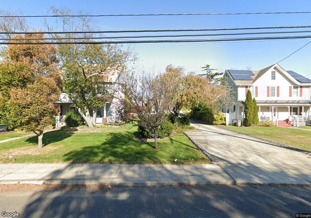
73 Atlantic Ave Long Branch, NJ 07740
Estimated Value: $719,650 - $861,000
2
Beds
3
Baths
1,848
Sq Ft
$436/Sq Ft
Est. Value
About This Home
This home is located at 73 Atlantic Ave, Long Branch, NJ 07740 and is currently estimated at $805,913, approximately $436 per square foot. 73 Atlantic Ave is a home located in Monmouth County with nearby schools including Long Branch High School and Holy Trinity School.
Ownership History
Date
Name
Owned For
Owner Type
Purchase Details
Closed on
Jan 30, 2020
Sold by
Sickler Robert F and Reichert Andrea
Bought by
Sickler Robert F and Reichert Andrea
Current Estimated Value
Purchase Details
Closed on
Nov 27, 2008
Sold by
Sickler Robert
Bought by
Sickler Robert F and Reichert Andrea
Purchase Details
Closed on
Jul 6, 2005
Sold by
Sickler Jo Anne
Bought by
Sickler Robert
Purchase Details
Closed on
Jun 28, 1999
Sold by
Stein Jeannette
Bought by
Sickler Robert
Purchase Details
Closed on
Sep 27, 1994
Sold by
Bank Of Ny
Bought by
S & L Investors
Create a Home Valuation Report for This Property
The Home Valuation Report is an in-depth analysis detailing your home's value as well as a comparison with similar homes in the area
Home Values in the Area
Average Home Value in this Area
Purchase History
| Date | Buyer | Sale Price | Title Company |
|---|---|---|---|
| Sickler Robert F | -- | None Available | |
| Sickler Robert F | -- | None Available | |
| Sickler Robert | -- | -- | |
| Sickler Robert | $175,000 | -- | |
| S & L Investors | $50,000 | -- |
Source: Public Records
Tax History Compared to Growth
Tax History
| Year | Tax Paid | Tax Assessment Tax Assessment Total Assessment is a certain percentage of the fair market value that is determined by local assessors to be the total taxable value of land and additions on the property. | Land | Improvement |
|---|---|---|---|---|
| 2025 | $9,291 | $691,000 | $287,900 | $403,100 |
| 2024 | $8,728 | $604,500 | $218,900 | $385,600 |
| 2023 | $8,728 | $562,000 | $193,900 | $368,100 |
| 2022 | $8,784 | $490,100 | $165,800 | $324,300 |
| 2021 | $8,784 | $439,000 | $135,800 | $303,200 |
| 2020 | $9,014 | $431,300 | $129,800 | $301,500 |
| 2019 | $8,561 | $407,300 | $119,800 | $287,500 |
| 2018 | $8,302 | $392,700 | $115,800 | $276,900 |
| 2017 | $7,824 | $379,600 | $108,800 | $270,800 |
| 2016 | $7,672 | $379,600 | $115,800 | $263,800 |
| 2015 | $6,852 | $307,700 | $107,500 | $200,200 |
| 2014 | $6,195 | $293,200 | $125,800 | $167,400 |
Source: Public Records
Map
Nearby Homes
- 381 Long Branch Ave
- 9 Manahassett Park Dr
- 8 Ocean Ave
- 50 Valentine St Unit 27A
- 50 Valentine St Unit 22A
- 50 Valentine St Unit 12B
- 432 Ocean Blvd N Unit 506
- 432 Ocean Blvd N Unit 315
- 43 Valentine St
- 17 Riviera Dr
- 154 Atlantic Ave
- 16 Anderson St
- 138 Rosewood Ave
- 422 Ocean Blvd N Unit 5H
- 172 Chelton Ave
- 164 Airsdale Ave
- 188 Chelton Ave
- 323 Florence Ave
- 165 Kingsley St
- 16 Shore Dr
- 71 Atlantic Ave
- 75 Atlantic Ave
- 77 Atlantic Ave
- 69 Atlantic Ave
- 69 Atlantic Ave
- 69 Atlantic Ave Unit REAR - Unit 1 (SUMME
- 69 Atlantic Ave Unit REAR - Unit 1 (ANNUA
- 69 Atlantic Ave Unit REAR
- 69 Atlantic Ave Unit LOW REAR
- 79 Atlantic Ave
- 464 Church St
- 81 Atlantic Ave
- 67 Atlantic Ave
- 80 White St
- 82 White St
- 462 Church St
- 460 Church St
- 78 White St
- 456 Church St
- 76 White St