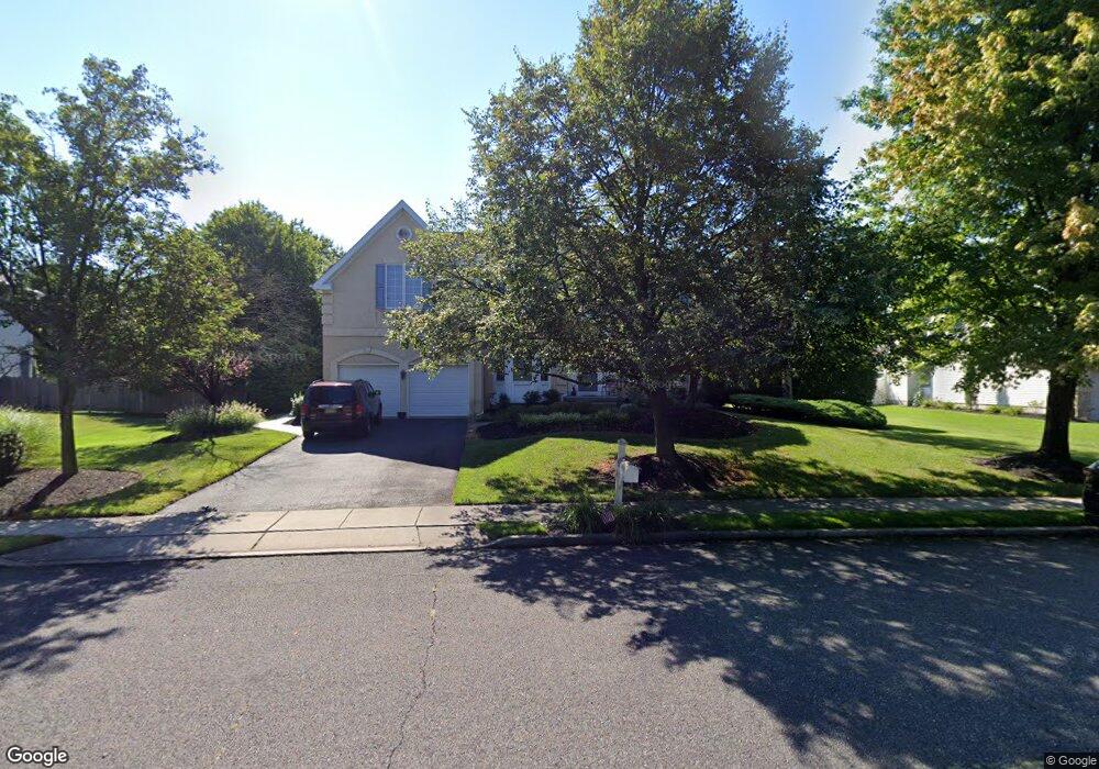
73 Broadacre Dr Mount Laurel, NJ 08054
Estimated Value: $839,000 - $954,000
--
Bed
--
Bath
3,456
Sq Ft
$261/Sq Ft
Est. Value
About This Home
This home is located at 73 Broadacre Dr, Mount Laurel, NJ 08054 and is currently estimated at $902,507, approximately $261 per square foot. 73 Broadacre Dr is a home located in Burlington County with nearby schools including Springville School, T.E. Harrington Middle School, and Mount Laurel Hartford School.
Ownership History
Date
Name
Owned For
Owner Type
Purchase Details
Closed on
Jun 25, 2003
Sold by
National Residential Nominee Svcs Inc
Bought by
Halstead Gerald D
Current Estimated Value
Home Financials for this Owner
Home Financials are based on the most recent Mortgage that was taken out on this home.
Original Mortgage
$200,000
Interest Rate
4.87%
Mortgage Type
Purchase Money Mortgage
Purchase Details
Closed on
Jun 18, 2003
Sold by
Kurylak Steven J and Kurylak Diane N
Bought by
National Residential Nominee Svcs Inc
Home Financials for this Owner
Home Financials are based on the most recent Mortgage that was taken out on this home.
Original Mortgage
$200,000
Interest Rate
4.87%
Mortgage Type
Purchase Money Mortgage
Purchase Details
Closed on
Jul 29, 1994
Sold by
Calton Homes Inc
Bought by
Conway Stephen D and Duffin Conway Andrea
Create a Home Valuation Report for This Property
The Home Valuation Report is an in-depth analysis detailing your home's value as well as a comparison with similar homes in the area
Home Values in the Area
Average Home Value in this Area
Purchase History
| Date | Buyer | Sale Price | Title Company |
|---|---|---|---|
| Halstead Gerald D | $353,000 | -- | |
| National Residential Nominee Svcs Inc | $375,000 | -- | |
| Conway Stephen D | $286,265 | Title One Abstract Inc |
Source: Public Records
Mortgage History
| Date | Status | Borrower | Loan Amount |
|---|---|---|---|
| Previous Owner | Halstead Gerald D | $200,000 |
Source: Public Records
Tax History Compared to Growth
Tax History
| Year | Tax Paid | Tax Assessment Tax Assessment Total Assessment is a certain percentage of the fair market value that is determined by local assessors to be the total taxable value of land and additions on the property. | Land | Improvement |
|---|---|---|---|---|
| 2025 | $16,480 | $522,000 | $149,500 | $372,500 |
| 2024 | $15,858 | $522,000 | $149,500 | $372,500 |
| 2023 | $15,858 | $522,000 | $149,500 | $372,500 |
| 2022 | $15,806 | $522,000 | $149,500 | $372,500 |
| 2021 | $15,509 | $522,000 | $149,500 | $372,500 |
| 2020 | $15,206 | $522,000 | $149,500 | $372,500 |
| 2019 | $15,049 | $522,000 | $149,500 | $372,500 |
| 2018 | $14,934 | $522,000 | $149,500 | $372,500 |
| 2017 | $14,548 | $522,000 | $149,500 | $372,500 |
| 2016 | $14,329 | $522,000 | $149,500 | $372,500 |
| 2015 | $14,162 | $522,000 | $149,500 | $372,500 |
| 2014 | $14,445 | $537,800 | $149,500 | $388,300 |
Source: Public Records
Map
Nearby Homes
- 3 Abington Rd
- 3 United States Cir
- 89 Peppergrass Dr S
- 15 Pecan Ct
- 132 Peppergrass Dr S
- 71 Peppergrass Dr S
- 10 Yarrow Place
- 43 Saddle Dr
- 5 Hilltop Dr
- 17 Peppergrass Dr N
- 13 Marcy Ct
- 7 Buttonbush Ct
- 8 Raven Ct
- 422 Elderberry Ct
- 420 Elderberry Ct
- 48 Keegan Ct
- 6 Keatley Dr
- 23 Emory Ln
- 208 Stallion Ct
- 13 Keatley Dr