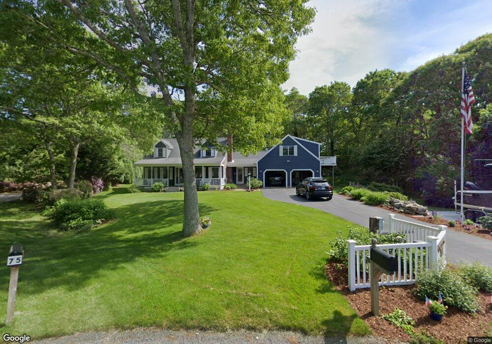
73 Desert Sands Ln Yarmouth Port, MA 02675
Yarmouth Port NeighborhoodEstimated Value: $903,917 - $1,176,000
3
Beds
3
Baths
2,172
Sq Ft
$472/Sq Ft
Est. Value
About This Home
This home is located at 73 Desert Sands Ln, Yarmouth Port, MA 02675 and is currently estimated at $1,025,479, approximately $472 per square foot. 73 Desert Sands Ln is a home located in Barnstable County with nearby schools including Dennis-Yarmouth Regional High School, Trinity Christian Academy of Cape Cod, and Southeast Alternative School.
Ownership History
Date
Name
Owned For
Owner Type
Purchase Details
Closed on
Mar 22, 2004
Sold by
Watson Patricia A and Watson Robert
Bought by
Marten Street Rt and Watson Patricia A
Current Estimated Value
Purchase Details
Closed on
Feb 9, 1993
Sold by
Mcabee Filmore W and Robertson James A
Bought by
Watson Robert and Watson Patricia A
Home Financials for this Owner
Home Financials are based on the most recent Mortgage that was taken out on this home.
Original Mortgage
$136,000
Interest Rate
8.1%
Mortgage Type
Purchase Money Mortgage
Create a Home Valuation Report for This Property
The Home Valuation Report is an in-depth analysis detailing your home's value as well as a comparison with similar homes in the area
Home Values in the Area
Average Home Value in this Area
Purchase History
| Date | Buyer | Sale Price | Title Company |
|---|---|---|---|
| Marten Street Rt | -- | -- | |
| Watson Robert | $45,000 | -- |
Source: Public Records
Mortgage History
| Date | Status | Borrower | Loan Amount |
|---|---|---|---|
| Previous Owner | Watson Robert | $210,456 | |
| Previous Owner | Watson Robert | $120,000 | |
| Previous Owner | Watson Robert | $136,000 | |
| Previous Owner | Watson Robert | $136,000 |
Source: Public Records
Tax History Compared to Growth
Tax History
| Year | Tax Paid | Tax Assessment Tax Assessment Total Assessment is a certain percentage of the fair market value that is determined by local assessors to be the total taxable value of land and additions on the property. | Land | Improvement |
|---|---|---|---|---|
| 2025 | $6,525 | $921,600 | $241,900 | $679,700 |
| 2024 | $6,052 | $820,100 | $210,400 | $609,700 |
| 2023 | $6,173 | $761,200 | $177,600 | $583,600 |
| 2022 | $5,502 | $599,300 | $158,900 | $440,400 |
| 2021 | $5,374 | $562,100 | $158,900 | $403,200 |
| 2020 | $3,363 | $510,900 | $156,400 | $354,500 |
| 2019 | $3,254 | $468,000 | $156,400 | $311,600 |
| 2018 | $4,721 | $458,800 | $147,200 | $311,600 |
| 2017 | $6,005 | $458,800 | $147,200 | $311,600 |
| 2016 | $4,579 | $458,800 | $147,200 | $311,600 |
| 2015 | $4,434 | $441,600 | $147,200 | $294,400 |
Source: Public Records
Map
Nearby Homes
- 81 Desert Sands Ln
- 100 Spyglass Hill Rd
- 83 Sisters Cir
- 83 Sisters Cir
- 67 Spy Glass Hill Rd
- 86 Doral Dr
- 99 Old Hyannis Rd
- 9 Wingfoot Dr
- 111 Old Hyannis Rd
- 105 Old Hyannis Rd
- 4390 Main St
- 4323 Main St
- 44 Iris Ln
- 116 Route 6a
- 116 Main St
- 112 Main St
- 162 Route 6a
- 186 Route 6a
- 68 Lumberjack Trail
- 56 Wharf Ln
- 61 Desert Sands Ln
- 53 Desert Sands Ln
- 74 Desert Sands Ln
- 101 Sisters Cir
- 101 Sisters Cir
- 78 Desert Sands Ln
- 100 Desert Sands Ln
- 105 Sisters Cir
- 62 Desert Sands Ln
- 49 Desert Sands Ln
- 41 Desert Sands Ln
- 50 Desert Sands Ln
- 111 Sisters Cir
- 97 Sisters Cir
- 97 Sisters Cir
- 231 Willow St
- 235 Willow St
- 38 Desert Sands Ln
- 221 Willow St
- 241 Willow St