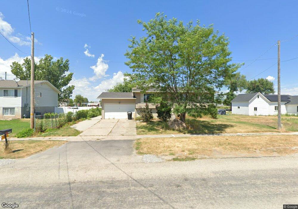
73 E 200 S Lewiston, UT 84320
Estimated Value: $326,000 - $362,000
4
Beds
2
Baths
2,088
Sq Ft
$166/Sq Ft
Est. Value
About This Home
This home is located at 73 E 200 S, Lewiston, UT 84320 and is currently estimated at $347,540, approximately $166 per square foot. 73 E 200 S is a home located in Cache County with nearby schools including Lewiston School, White Pine Middle School, and North Cache Middle School.
Ownership History
Date
Name
Owned For
Owner Type
Purchase Details
Closed on
Oct 22, 2016
Sold by
Cross Country Equity Llc
Bought by
Lunday Randall James and Lunday Yvette H
Current Estimated Value
Home Financials for this Owner
Home Financials are based on the most recent Mortgage that was taken out on this home.
Original Mortgage
$157,575
Outstanding Balance
$125,824
Interest Rate
3.42%
Mortgage Type
New Conventional
Estimated Equity
$221,716
Purchase Details
Closed on
May 5, 2016
Sold by
Ocwen Loan Servicing Llc
Bought by
Cross Country Equity Llc
Create a Home Valuation Report for This Property
The Home Valuation Report is an in-depth analysis detailing your home's value as well as a comparison with similar homes in the area
Purchase History
| Date | Buyer | Sale Price | Title Company |
|---|---|---|---|
| Lunday Randall James | -- | None Available | |
| Cross Country Equity Llc | -- | Metro National Title |
Source: Public Records
Mortgage History
| Date | Status | Borrower | Loan Amount |
|---|---|---|---|
| Open | Lunday Randall James | $157,575 |
Source: Public Records
Tax History
| Year | Tax Paid | Tax Assessment Tax Assessment Total Assessment is a certain percentage of the fair market value that is determined by local assessors to be the total taxable value of land and additions on the property. | Land | Improvement |
|---|---|---|---|---|
| 2025 | $1,450 | $187,505 | $0 | $0 |
| 2024 | $1,496 | $178,650 | $0 | $0 |
| 2023 | $1,588 | $178,095 | $0 | $0 |
| 2022 | $1,668 | $178,095 | $0 | $0 |
| 2021 | $1,579 | $260,740 | $50,500 | $210,240 |
| 2020 | $1,321 | $208,200 | $33,000 | $175,200 |
| 2019 | $1,297 | $195,424 | $33,000 | $162,424 |
| 2018 | $1,158 | $170,648 | $33,000 | $137,648 |
| 2017 | $1,097 | $85,745 | $0 | $0 |
| 2016 | $1,108 | $77,000 | $0 | $0 |
| 2015 | $986 | $76,450 | $0 | $0 |
| 2014 | $906 | $72,065 | $0 | $0 |
| 2013 | -- | $72,065 | $0 | $0 |
Source: Public Records
Map
Nearby Homes
- 50 W 300 S
- 310 S Main St
- 80 W 300 S
- 750 N Main St
- 780 N Main St
- 50 E 800 N
- 12506 N 525 E Unit 6
- 12489 N 525 E
- 12455 N 525 E Unit 1
- 12455 N 525 E
- 12506 N 525 E
- 12484 N 525 E Unit 7
- 12521 N 525 E
- 12518 N 525 E Unit 5
- 12489 N 525 E Unit 2
- 2400 W
- 12484 N 525 E
- 12518 N 525 E
- 12456 N 525 E Unit 8
- 12521 N 525 E Unit 3
Your Personal Tour Guide
Ask me questions while you tour the home.