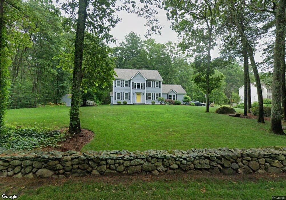
73 Forrest Rd Westford, MA 01886
Estimated Value: $917,683 - $1,037,000
4
Beds
3
Baths
2,102
Sq Ft
$471/Sq Ft
Est. Value
About This Home
This home is located at 73 Forrest Rd, Westford, MA 01886 and is currently estimated at $990,921, approximately $471 per square foot. 73 Forrest Rd is a home located in Middlesex County with nearby schools including Rita E. Miller Elementary School, Day Elementary School, and Stony Brook School.
Ownership History
Date
Name
Owned For
Owner Type
Purchase Details
Closed on
May 23, 1997
Sold by
Davanage Marilyn J
Bought by
Adomeit Hannes J and Adomeit Sharon S
Current Estimated Value
Home Financials for this Owner
Home Financials are based on the most recent Mortgage that was taken out on this home.
Original Mortgage
$212,000
Outstanding Balance
$29,237
Interest Rate
8.08%
Mortgage Type
Purchase Money Mortgage
Estimated Equity
$961,684
Purchase Details
Closed on
Sep 6, 1996
Sold by
Benchmark Homes Inc
Bought by
Crocker James G and Crocker Deborah
Home Financials for this Owner
Home Financials are based on the most recent Mortgage that was taken out on this home.
Original Mortgage
$200,000
Interest Rate
8.11%
Mortgage Type
Purchase Money Mortgage
Create a Home Valuation Report for This Property
The Home Valuation Report is an in-depth analysis detailing your home's value as well as a comparison with similar homes in the area
Home Values in the Area
Average Home Value in this Area
Purchase History
| Date | Buyer | Sale Price | Title Company |
|---|---|---|---|
| Adomeit Hannes J | $265,000 | -- | |
| Crocker James G | $252,400 | -- |
Source: Public Records
Mortgage History
| Date | Status | Borrower | Loan Amount |
|---|---|---|---|
| Open | Crocker James G | $100,000 | |
| Open | Crocker James G | $212,000 | |
| Previous Owner | Crocker James G | $200,000 |
Source: Public Records
Tax History Compared to Growth
Tax History
| Year | Tax Paid | Tax Assessment Tax Assessment Total Assessment is a certain percentage of the fair market value that is determined by local assessors to be the total taxable value of land and additions on the property. | Land | Improvement |
|---|---|---|---|---|
| 2025 | $11,061 | $803,300 | $341,400 | $461,900 |
| 2024 | $11,061 | $803,300 | $341,400 | $461,900 |
| 2023 | $10,925 | $740,200 | $325,300 | $414,900 |
| 2022 | $11,033 | $684,400 | $277,000 | $407,400 |
| 2021 | $10,423 | $626,400 | $277,000 | $349,400 |
| 2020 | $10,263 | $628,500 | $277,000 | $351,500 |
| 2019 | $9,701 | $585,800 | $260,500 | $325,300 |
| 2018 | $9,299 | $574,700 | $249,400 | $325,300 |
| 2017 | $8,929 | $544,100 | $249,400 | $294,700 |
| 2016 | $8,673 | $532,100 | $235,500 | $296,600 |
| 2015 | $8,507 | $523,800 | $225,500 | $298,300 |
| 2014 | $8,483 | $511,000 | $216,800 | $294,200 |
Source: Public Records
Map
Nearby Homes
- 427 Groton Rd
- 2 Alder Point Unit 2
- 3 Loon Way
- 55 Lawson Rd
- 8 Loon Way
- 26 N Hill Rd
- 30 Lake Shore Dr N
- 10 Gassett Rd
- 1 Appian Way
- 36 Elm Rd
- 5 Fawn Rd
- 24 Summer Village Rd Unit 24
- 2 Courtview Ln Unit 2
- 22 Highland Rd
- 20 Highland Rd
- 16 Shipley Cir
- 11 Big Rock Trail
- 18 Big Rock Trail Unit 115
- 31 Sandstone Rd
- 15 Stone Ridge Rd
- 71 Forrest Rd
- 85 Forrest Rd
- 84 Forrest Rd
- 80 Forrest Rd
- 69 Forrest Rd
- 76 Forrest Rd
- 87 Forrest Rd
- 88 Forrest Rd
- 1 Rolling Meadow Ln
- 10 Fernwood Dr
- 8 Fernwood Dr
- 70 Forrest Rd
- 90 Forrest Rd
- 67 Forrest Rd
- 72 Forrest Rd
- 3 Rolling Meadow Ln
- 6 Fernwood Dr
- 2 Rolling Meadow Ln
- 4 Rolling Meadow Ln
- 92 Forrest Rd