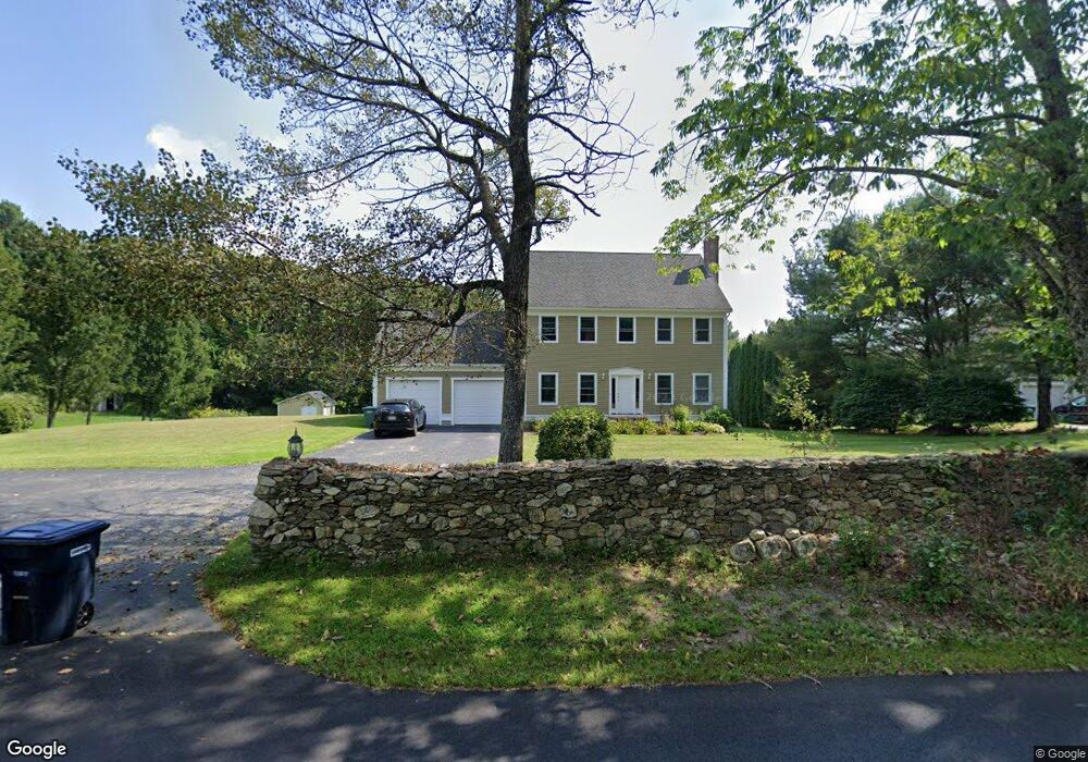
73 Freeman Rd Charlton, MA 01507
Estimated Value: $638,463 - $750,000
5
Beds
3
Baths
2,796
Sq Ft
$249/Sq Ft
Est. Value
About This Home
This home is located at 73 Freeman Rd, Charlton, MA 01507 and is currently estimated at $696,116, approximately $248 per square foot. 73 Freeman Rd is a home located in Worcester County with nearby schools including Shepherd Hill Regional High School.
Ownership History
Date
Name
Owned For
Owner Type
Purchase Details
Closed on
Aug 19, 2021
Sold by
Ugrinow Paul and Ugrinow Lourdes M
Bought by
L Miranda Ugrinow Ret and Ugrinow
Current Estimated Value
Purchase Details
Closed on
Jan 4, 2000
Sold by
Pioneer Rt and Leblanc Mark S
Bought by
Ugrinow Paul and Ugrinow Lourdes M
Create a Home Valuation Report for This Property
The Home Valuation Report is an in-depth analysis detailing your home's value as well as a comparison with similar homes in the area
Home Values in the Area
Average Home Value in this Area
Purchase History
| Date | Buyer | Sale Price | Title Company |
|---|---|---|---|
| L Miranda Ugrinow Ret | -- | None Available | |
| L Miranda Ugrinow Ret | -- | None Available | |
| Ugrinow Paul | $47,500 | -- | |
| Ugrinow Paul | $47,500 | -- |
Source: Public Records
Mortgage History
| Date | Status | Borrower | Loan Amount |
|---|---|---|---|
| Previous Owner | Ugrinow Paul | $259,000 | |
| Previous Owner | Ugrinow Paul | $224,000 | |
| Previous Owner | Ugrinow Paul | $48,000 |
Source: Public Records
Tax History
| Year | Tax Paid | Tax Assessment Tax Assessment Total Assessment is a certain percentage of the fair market value that is determined by local assessors to be the total taxable value of land and additions on the property. | Land | Improvement |
|---|---|---|---|---|
| 2025 | $6,611 | $594,000 | $111,200 | $482,800 |
| 2024 | $6,384 | $563,000 | $105,200 | $457,800 |
| 2023 | $6,269 | $515,100 | $105,100 | $410,000 |
| 2022 | $6,133 | $461,500 | $96,100 | $365,400 |
| 2021 | $6,280 | $418,400 | $84,100 | $334,300 |
| 2020 | $6,161 | $412,400 | $78,100 | $334,300 |
| 2019 | $6,091 | $412,400 | $78,100 | $334,300 |
| 2018 | $5,567 | $412,400 | $78,100 | $334,300 |
| 2017 | $5,426 | $384,800 | $78,100 | $306,700 |
| 2016 | $5,303 | $384,800 | $78,100 | $306,700 |
| 2015 | $5,164 | $384,800 | $78,100 | $306,700 |
| 2014 | $4,636 | $366,200 | $73,100 | $293,100 |
Source: Public Records
Map
Nearby Homes
- 0 Freeman Rd Unit 73369281
- 30 Bond Rd
- 91 Burlingame Rd
- 7 L Stevens Rd Unit B
- 9 L Stevens Rd Unit B
- 9 L Stevens Rd Unit A
- 8 Northside Rd
- 25 N Main St Unit A
- 34 Northside Rd
- L2 Partridge Hill Rd
- L3 Partridge Hill Rd
- 8 Wamsutta Ridge Rd
- 164 Oxford Rd
- 0 Blood Rd
- 2 Lelandville Rd
- 3 Lelandville Rd
- 6 Gillespie Rd
- 34 Worcester Rd
- 0 Worcester Rd
- 2 Potter Village Rd
Your Personal Tour Guide
Ask me questions while you tour the home.