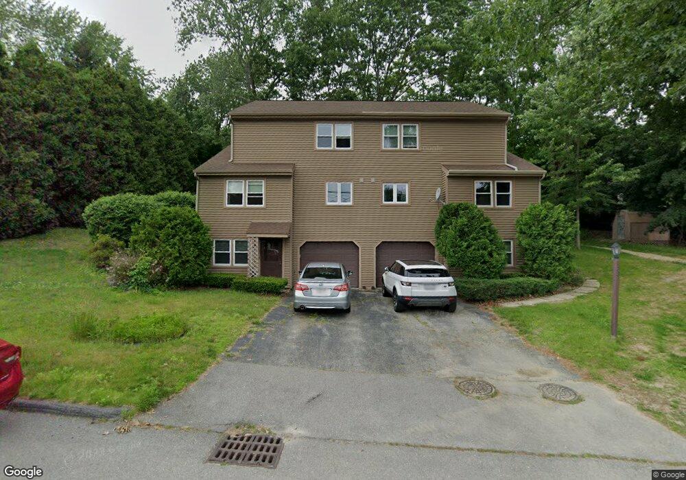
73 Gates Ln Unit A Worcester, MA 01603
Webster Square NeighborhoodEstimated Value: $307,000 - $368,095
About This Home
This home is located at 73 Gates Ln Unit A, Worcester, MA 01603 and is currently estimated at $335,524, approximately $271 per square foot. 73 Gates Ln Unit A is a home located in Worcester County with nearby schools including Gates Lane, Jacob Hiatt Magnet School, and Chandler Magnet.
Ownership History
We collect this data history from publicly available records. To have your information removed, we recommend requesting removal directly through your county’s website.
Purchase Details
Home Values in the Area
Average Home Value in this Area
Purchase History
We collect this data history from publicly available records. To have your information removed, we recommend requesting removal directly through your county’s website.
| Date | Buyer | Sale Price | Title Company |
|---|---|---|---|
| $180,000 | -- |
Mortgage History
We collect this data history from publicly available records. To have your information removed, we recommend requesting removal directly through your county’s website.
| Date | Status | Borrower | Loan Amount |
|---|---|---|---|
| Open | $141,790 | ||
| Closed | $50,000 | ||
| Closed | $175,000 | ||
| Previous Owner | $75,300 |
Tax History
We collect this data history from publicly available records. To have your information removed, we recommend requesting removal directly through your county’s website.
| Year | Tax Paid | Tax Assessment Tax Assessment Total Assessment is a certain percentage of the fair market value that is determined by local assessors to be the total taxable value of land and additions on the property. | Land | Improvement |
|---|---|---|---|---|
| 2025 | $3,789 | $287,300 | $0 | $287,300 |
| 2024 | $3,807 | $276,900 | $0 | $276,900 |
| 2023 | $3,433 | $239,400 | $0 | $239,400 |
| 2022 | $3,506 | $230,500 | $0 | $230,500 |
| 2021 | $3,373 | $207,200 | $0 | $207,200 |
| 2020 | $2,904 | $170,800 | $0 | $170,800 |
| 2019 | $3,074 | $170,800 | $0 | $170,800 |
| 2018 | $3,105 | $164,200 | $0 | $164,200 |
| 2017 | $2,368 | $123,200 | $0 | $123,200 |
| 2016 | $2,411 | $117,000 | $0 | $117,000 |
| 2015 | $2,348 | $117,000 | $0 | $117,000 |
| 2014 | $2,347 | $120,100 | $0 | $120,100 |
Map
- 17 Tallawanda Dr
- 11 Wayne St
- 153A Brookline St
- 12 Henderson Ave
- 7 Baker St
- 18 Sherer Trail
- 23 Lakewood St
- 3 Oak Leaf Cir
- 28 Lakewood St
- 106 Mill St
- 6 Buffum St
- 6 Apricot St Unit 10
- 71 Henshaw St
- 27 Lavallee Terrace
- 1 Armandale St
- 29 Cambridge St
- 5 Ferdinand St
- 1434 Main St
- 11 Hulbert Rd Unit 15
- 17 Vineyard St
Ask me questions while you tour the home.