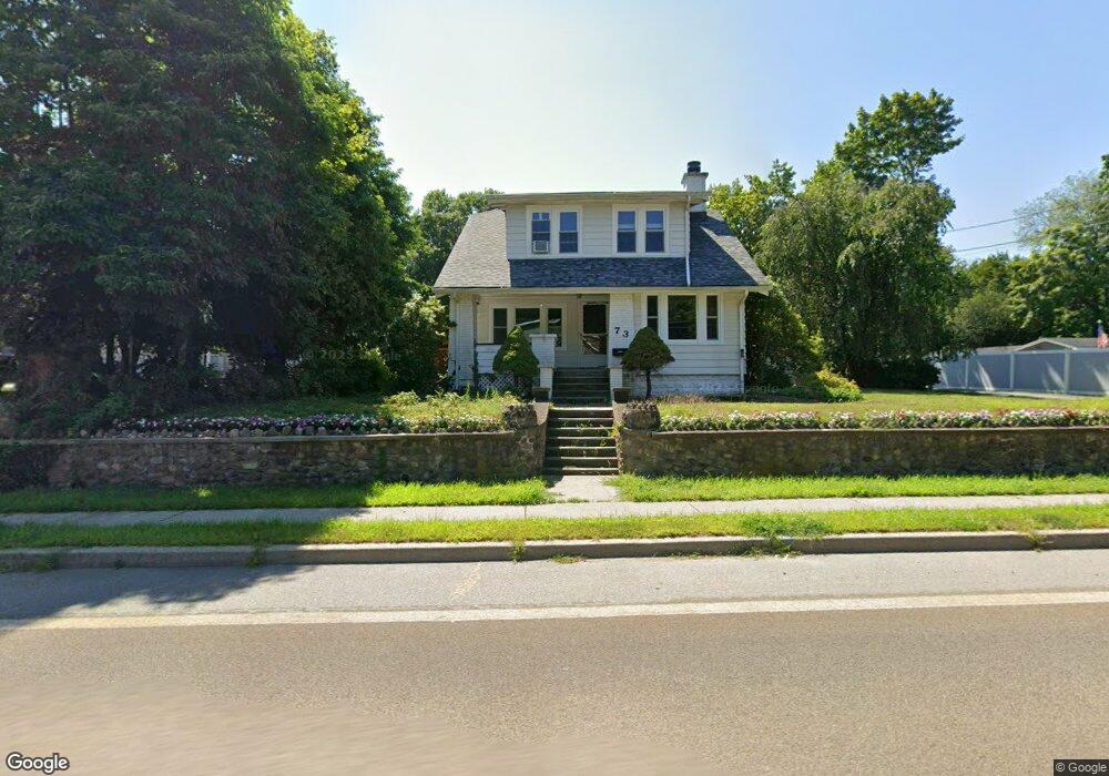
73 Glenwild Ave Bloomingdale, NJ 07403
Estimated Value: $468,000 - $530,000
--
Bed
--
Bath
1,305
Sq Ft
$378/Sq Ft
Est. Value
About This Home
This home is located at 73 Glenwild Ave, Bloomingdale, NJ 07403 and is currently estimated at $493,301, approximately $378 per square foot. 73 Glenwild Ave is a home located in Passaic County with nearby schools including Samuel R. Donald School, Martha B. Day School, and Walter T. Bergen Middle School.
Ownership History
Date
Name
Owned For
Owner Type
Purchase Details
Closed on
Dec 8, 2006
Sold by
Montayne James R
Bought by
Howard Philip B and Howard Kerri A
Current Estimated Value
Home Financials for this Owner
Home Financials are based on the most recent Mortgage that was taken out on this home.
Original Mortgage
$190,000
Outstanding Balance
$113,471
Interest Rate
6.29%
Mortgage Type
Purchase Money Mortgage
Estimated Equity
$379,830
Purchase Details
Closed on
Aug 28, 1997
Sold by
Colaci Nancy
Bought by
Montanye James and Pettignano Joseph
Home Financials for this Owner
Home Financials are based on the most recent Mortgage that was taken out on this home.
Original Mortgage
$149,900
Interest Rate
7.36%
Mortgage Type
Purchase Money Mortgage
Create a Home Valuation Report for This Property
The Home Valuation Report is an in-depth analysis detailing your home's value as well as a comparison with similar homes in the area
Home Values in the Area
Average Home Value in this Area
Purchase History
| Date | Buyer | Sale Price | Title Company |
|---|---|---|---|
| Howard Philip B | $305,000 | -- | |
| Montanye James | $169,900 | -- | |
| Montanye James R | $169,900 | -- |
Source: Public Records
Mortgage History
| Date | Status | Borrower | Loan Amount |
|---|---|---|---|
| Open | Howard Philip B | $190,000 | |
| Previous Owner | Montanye James R | $149,900 | |
| Previous Owner | Montanye James | $150,000 |
Source: Public Records
Tax History Compared to Growth
Tax History
| Year | Tax Paid | Tax Assessment Tax Assessment Total Assessment is a certain percentage of the fair market value that is determined by local assessors to be the total taxable value of land and additions on the property. | Land | Improvement |
|---|---|---|---|---|
| 2025 | $11,289 | $246,100 | $115,700 | $130,400 |
| 2024 | $11,079 | $246,100 | $115,700 | $130,400 |
| 2022 | $11,062 | $246,100 | $115,700 | $130,400 |
| 2021 | $10,823 | $246,100 | $115,700 | $130,400 |
| 2020 | $10,735 | $246,100 | $115,700 | $130,400 |
| 2019 | $10,627 | $246,100 | $115,700 | $130,400 |
| 2018 | $10,570 | $246,100 | $115,700 | $130,400 |
| 2017 | $10,371 | $246,100 | $115,700 | $130,400 |
| 2016 | $10,225 | $246,100 | $115,700 | $130,400 |
| 2015 | $9,977 | $246,100 | $115,700 | $130,400 |
| 2014 | $9,610 | $246,100 | $115,700 | $130,400 |
Source: Public Records
Map
Nearby Homes
- 65 Glenwild Ave
- 74 Glenwild Ave
- 70 Glenwild Ave
- 76 Glenwild Ave
- 63 Glenwild Ave
- 79 Glenwild Ave
- 78 Glenwild Ave
- 80 Glenwild Ave
- 1000 Avalon Way
- 81 Glenwild Ave
- 82A Glenwild Ave
- 61 Glenwild Ave
- 83 Glenwild Ave
- 24 Woodward Ave
- 86 Glenwild Ave
- 22 Woodward Ave
- 26 Woodward Ave
- 20 Woodward Ave
- 28 Woodward Ave
- 18 Woodward Ave