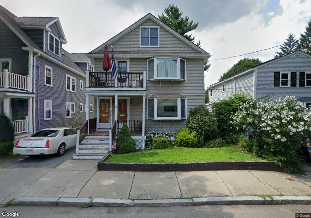
73 Griswold St Cambridge, MA 02138
Estimated Value: $1,431,000 - $3,032,000
5
Beds
3
Baths
2,531
Sq Ft
$802/Sq Ft
Est. Value
About This Home
This home is located at 73 Griswold St, Cambridge, MA 02138 and is currently estimated at $2,029,516, approximately $801 per square foot. 73 Griswold St is a home located in Middlesex County with nearby schools including Fayerweather Street School and Cambridge Montessori School.
Ownership History
Date
Name
Owned For
Owner Type
Purchase Details
Closed on
Jul 24, 1972
Bought by
Tennis John W
Current Estimated Value
Create a Home Valuation Report for This Property
The Home Valuation Report is an in-depth analysis detailing your home's value as well as a comparison with similar homes in the area
Home Values in the Area
Average Home Value in this Area
Purchase History
| Date | Buyer | Sale Price | Title Company |
|---|---|---|---|
| Tennis John W | -- | -- |
Source: Public Records
Mortgage History
| Date | Status | Borrower | Loan Amount |
|---|---|---|---|
| Open | Tennis John W | $175,000 | |
| Closed | Tennis John W | $157,000 |
Source: Public Records
Tax History Compared to Growth
Tax History
| Year | Tax Paid | Tax Assessment Tax Assessment Total Assessment is a certain percentage of the fair market value that is determined by local assessors to be the total taxable value of land and additions on the property. | Land | Improvement |
|---|---|---|---|---|
| 2025 | $10,536 | $1,659,200 | $539,800 | $1,119,400 |
| 2024 | $9,706 | $1,639,600 | $562,300 | $1,077,300 |
| 2023 | $8,895 | $1,517,900 | $573,600 | $944,300 |
| 2022 | $7,839 | $1,388,200 | $555,000 | $833,200 |
| 2021 | $7,839 | $1,340,000 | $556,800 | $783,200 |
| 2020 | $7,525 | $1,308,700 | $540,500 | $768,200 |
| 2019 | $7,107 | $1,196,500 | $482,400 | $714,100 |
| 2018 | $4,698 | $1,067,100 | $406,200 | $660,900 |
| 2017 | $6,482 | $998,800 | $380,900 | $617,900 |
| 2016 | $6,318 | $903,900 | $330,100 | $573,800 |
| 2015 | $6,240 | $797,900 | $290,200 | $507,700 |
| 2014 | $5,923 | $706,800 | $253,900 | $452,900 |
Source: Public Records
Map
Nearby Homes
- 95 Griswold St Unit 95
- 93 Griswold St Unit 93
- 15 Sunset Rd
- 55 S Normandy Ave
- 23 Loomis St Unit 23
- 4 Merrill Ave
- 48 Hamilton Rd
- 46 Hamilton Rd
- 63 Loomis St Unit 63
- 48 Concord Ave
- 73 Trowbridge St Unit 73A
- 73 Trowbridge St Unit 73B
- 118 Blanchard Rd
- 105 Watson Rd
- 29 Wheeler St Unit 108
- 36 Madison St
- 38 Myrtle St
- 31 Mott St Unit 31A
- 1 Spinney Terrace
- 137-139 Thorndike St Unit 2
- 71 Griswold St Unit 1
- 73 Griswold St Unit 1
- 67 Griswold St
- 67 Griswold St Unit 2,67
- 67 Griswold St Unit 1,67
- 69 Griswold St
- 69 Griswold St Unit 69
- 69 Griswold St Unit 1
- 75 Griswold St
- 63 Griswold St
- 65 Griswold St
- 81 Griswold St
- 40 Sunset Rd
- 34 Sunset Rd
- 74 Griswold St
- 59 Griswold St Unit 2
- 59 Griswold St Unit 1
- 59 Griswold St
- 61 Griswold St
- 61 Griswold St Unit 61