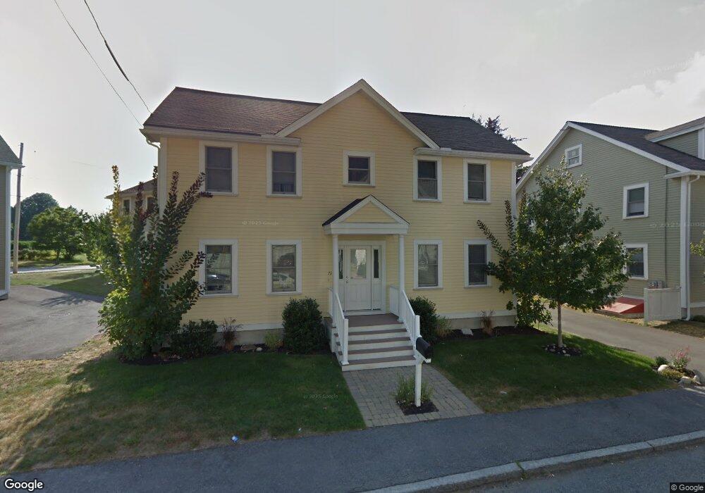
73 Hanks St Unit 8A Lowell, MA 01852
Belvidere NeighborhoodEstimated Value: $524,000 - $618,000
3
Beds
3
Baths
1,765
Sq Ft
$331/Sq Ft
Est. Value
About This Home
This home is located at 73 Hanks St Unit 8A, Lowell, MA 01852 and is currently estimated at $584,212, approximately $330 per square foot. 73 Hanks St Unit 8A is a home located in Middlesex County with nearby schools including Moody Elementary School, Abraham Lincoln Elementary School, and Greenhalge Elementary School.
Ownership History
Date
Name
Owned For
Owner Type
Purchase Details
Closed on
Jul 17, 2008
Sold by
Rogers Dev Assoc Llc
Bought by
Lopez Basilio and Mangels Matthew L
Current Estimated Value
Home Financials for this Owner
Home Financials are based on the most recent Mortgage that was taken out on this home.
Original Mortgage
$297,695
Outstanding Balance
$193,023
Interest Rate
6.17%
Mortgage Type
Purchase Money Mortgage
Estimated Equity
$391,189
Create a Home Valuation Report for This Property
The Home Valuation Report is an in-depth analysis detailing your home's value as well as a comparison with similar homes in the area
Home Values in the Area
Average Home Value in this Area
Purchase History
| Date | Buyer | Sale Price | Title Company |
|---|---|---|---|
| Lopez Basilio | $330,773 | -- |
Source: Public Records
Mortgage History
| Date | Status | Borrower | Loan Amount |
|---|---|---|---|
| Open | Lopez Basilio | $297,695 |
Source: Public Records
Tax History
| Year | Tax Paid | Tax Assessment Tax Assessment Total Assessment is a certain percentage of the fair market value that is determined by local assessors to be the total taxable value of land and additions on the property. | Land | Improvement |
|---|---|---|---|---|
| 2025 | $6,495 | $565,800 | $0 | $565,800 |
| 2024 | $6,119 | $513,800 | $0 | $513,800 |
| 2023 | $5,764 | $464,100 | $0 | $464,100 |
| 2022 | $5,474 | $431,400 | $0 | $431,400 |
| 2021 | $5,284 | $392,600 | $0 | $392,600 |
| 2020 | $5,305 | $397,100 | $0 | $397,100 |
| 2019 | $5,236 | $372,900 | $0 | $372,900 |
| 2018 | $4,978 | $345,900 | $0 | $345,900 |
| 2017 | $4,916 | $329,500 | $0 | $329,500 |
| 2016 | $4,327 | $285,400 | $0 | $285,400 |
| 2015 | $4,464 | $288,400 | $0 | $288,400 |
| 2013 | $4,581 | $305,200 | $0 | $305,200 |
Source: Public Records
Map
Nearby Homes
- 44 Hanks St
- 200 Rogers St Unit 6
- 250 Nesmith St Unit 11
- 234 Nesmith St Unit 8
- 313 Nesmith St
- 254 Pleasant St
- 80 Rogers St Unit 204
- 88 Perry St
- 31 Merrill St
- 8 Clarks Ct
- 42 Pentucket Ave
- 810 Lawrence St Unit C
- 39 Groves Ave
- 11 Cottage St
- 128 Warren St Unit 12
- 5 Lenox St Unit 2
- 111 Draper St
- 7 Butler Ave Unit 5
- 8 Cedar Ct
- 29 Pine Hill St Unit 29
- 220 Rogers St Unit 8B
- 220 Rogers St Unit 8A
- 212 Rogers St Unit 9B
- 214 Rogers St Unit 9A
- 212 Rogers St
- 214 Rogers St Unit 214
- 65 Hanks St
- 65 Hanks St Unit 7A
- 67 Hanks St
- 67 Hanks St
- 67 Hanks St Unit 7B
- 82 Hanks St
- 72 Hanks St
- 86 Hanks St
- 66 Hanks St Unit 1 Bedroom
- 66 Hanks St Unit 2 Bedroom
- 236 Rogers St
- 206 Rogers St Unit 2
- 206 Rogers St Unit 3
- 206 Rogers St Unit 1
Your Personal Tour Guide
Ask me questions while you tour the home.