Estimated Value: $1,155,000 - $1,344,000
2
Beds
1
Bath
868
Sq Ft
$1,443/Sq Ft
Est. Value
About This Home
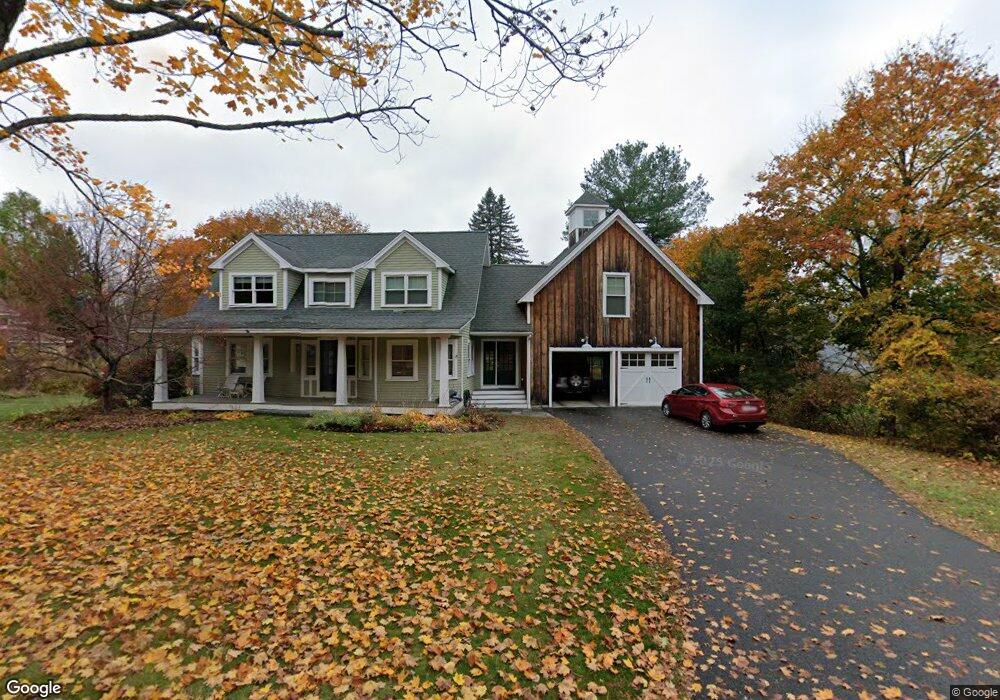
This home is located at 73 Liberty St Unit 34A, A, Acton, MA 01720 and is currently estimated at $1,252,447, approximately $1,442 per square foot. 73 Liberty St Unit 34A, A is a home located in Middlesex County with nearby schools including Acton-Boxborough Regional High School and Maynard Knowledge Beginnings.
Ownership History
Date
Name
Owned For
Owner Type
Purchase Details
Closed on
May 26, 2017
Sold by
Perry Anne B
Bought by
Arber Brandon L and Arber Jessica
Current Estimated Value
Home Financials for this Owner
Home Financials are based on the most recent Mortgage that was taken out on this home.
Original Mortgage
$500,000
Interest Rate
4.08%
Mortgage Type
New Conventional
Purchase Details
Closed on
Jun 10, 2010
Sold by
Eigen Anthony J and Eigan Anthony J
Bought by
Perry Anne B
Purchase Details
Closed on
May 20, 2002
Sold by
Omalley Hilary E
Bought by
Eigan Anthony J and Eigan Lori A
Home Financials for this Owner
Home Financials are based on the most recent Mortgage that was taken out on this home.
Original Mortgage
$300,000
Interest Rate
7.15%
Mortgage Type
Purchase Money Mortgage
Purchase Details
Closed on
May 15, 2001
Sold by
Smokelin John-Scott and Stephan Jennifer M
Bought by
Omalley Hilary
Purchase Details
Closed on
Dec 18, 1995
Sold by
Goddard Jonathan M and Goddard Susan Gf
Bought by
Stephan Jennifer M and Smokelin John-Scott
Purchase Details
Closed on
May 2, 1994
Sold by
Beram James P and Beram Kathleen W
Bought by
Goddard Jonathan M and Goddard Susan G F
Purchase Details
Closed on
Jan 25, 1989
Sold by
Carr Howard L
Bought by
Beram James P
Create a Home Valuation Report for This Property
The Home Valuation Report is an in-depth analysis detailing your home's value as well as a comparison with similar homes in the area
Home Values in the Area
Average Home Value in this Area
Purchase History
| Date | Buyer | Sale Price | Title Company |
|---|---|---|---|
| Arber Brandon L | $826,000 | -- | |
| Perry Anne B | $445,000 | -- | |
| Eigan Anthony J | $430,000 | -- | |
| Omalley Hilary | $390,000 | -- | |
| Stephan Jennifer M | $227,100 | -- | |
| Goddard Jonathan M | $235,000 | -- | |
| Beram James P | $218,000 | -- |
Source: Public Records
Mortgage History
| Date | Status | Borrower | Loan Amount |
|---|---|---|---|
| Open | Arber Brandon L | $500,000 | |
| Previous Owner | Eigan Anthony J | $300,000 | |
| Previous Owner | Beram James P | $87,000 | |
| Previous Owner | Beram James P | $35,000 |
Source: Public Records
Tax History Compared to Growth
Tax History
| Year | Tax Paid | Tax Assessment Tax Assessment Total Assessment is a certain percentage of the fair market value that is determined by local assessors to be the total taxable value of land and additions on the property. | Land | Improvement |
|---|---|---|---|---|
| 2025 | $19,237 | $1,121,700 | $346,300 | $775,400 |
| 2024 | $18,042 | $1,082,300 | $346,300 | $736,000 |
| 2023 | $18,454 | $1,050,900 | $314,900 | $736,000 |
| 2022 | $16,422 | $844,300 | $273,800 | $570,500 |
| 2021 | $15,872 | $784,600 | $253,500 | $531,100 |
| 2020 | $14,565 | $757,000 | $253,500 | $503,500 |
| 2019 | $14,057 | $725,700 | $253,500 | $472,200 |
| 2018 | $13,750 | $709,500 | $253,500 | $456,000 |
| 2017 | $13,523 | $709,500 | $253,500 | $456,000 |
| 2016 | $10,596 | $551,000 | $253,500 | $297,500 |
| 2015 | $10,497 | $551,000 | $253,500 | $297,500 |
| 2014 | $10,200 | $524,400 | $253,500 | $270,900 |
Source: Public Records
Map
Nearby Homes
- 79 Robbins St
- 25 Main St
- 19 Railroad St Unit B1
- 19 Railroad St Unit B2
- 19 Railroad St Unit E2
- 35 Faulkner Hill Rd
- 5 Main St
- 84 Central St
- 131 Main St
- 129 Main St
- 129 Main St Unit 129
- 19 Marble Farm Rd Unit 19
- 4 Loring Ave
- 40 High St
- 4,7,8 Crestwood Ln
- 128 Audubon Dr
- 32 Brewster Ln
- 8 Macleod Ln
- 154 Summer St
- 90 Willow St Unit 1