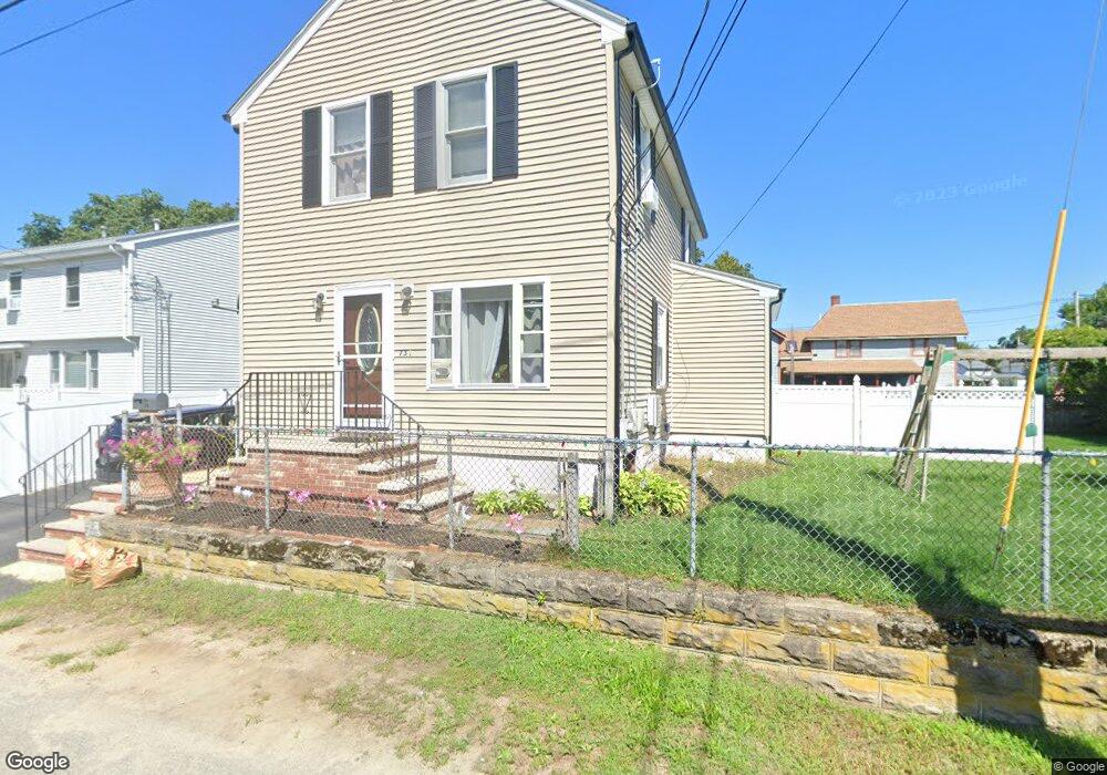
73 Maple Ave Riverside, RI 02915
Riverside NeighborhoodEstimated Value: $406,372 - $511,000
3
Beds
1
Bath
1,760
Sq Ft
$254/Sq Ft
Est. Value
About This Home
This home is located at 73 Maple Ave, Riverside, RI 02915 and is currently estimated at $447,093, approximately $254 per square foot. 73 Maple Ave is a home located in Providence County with nearby schools including East Providence High School, St Mary Academy-Bay View, and The Gordon School.
Ownership History
Date
Name
Owned For
Owner Type
Purchase Details
Closed on
Apr 3, 2012
Sold by
Louis Edith J and Louis Legouaze J
Bought by
Louis Edith J
Current Estimated Value
Purchase Details
Closed on
Dec 3, 2003
Sold by
Brightman Bruce and Brightman Joan
Bought by
Louis Edith and Louis Legouaze
Create a Home Valuation Report for This Property
The Home Valuation Report is an in-depth analysis detailing your home's value as well as a comparison with similar homes in the area
Home Values in the Area
Average Home Value in this Area
Purchase History
| Date | Buyer | Sale Price | Title Company |
|---|---|---|---|
| Louis Edith J | -- | -- | |
| Louis Edith | $207,000 | -- | |
| Louis Edith J | -- | -- | |
| Louis Edith | $207,000 | -- |
Source: Public Records
Mortgage History
| Date | Status | Borrower | Loan Amount |
|---|---|---|---|
| Previous Owner | Louis Edith | $271,400 | |
| Previous Owner | Louis Edith | $234,000 | |
| Previous Owner | Louis Edith | $8,350 |
Source: Public Records
Tax History
| Year | Tax Paid | Tax Assessment Tax Assessment Total Assessment is a certain percentage of the fair market value that is determined by local assessors to be the total taxable value of land and additions on the property. | Land | Improvement |
|---|---|---|---|---|
| 2025 | $4,788 | $366,300 | $99,000 | $267,300 |
| 2024 | $4,772 | $311,300 | $82,500 | $228,800 |
| 2023 | $4,595 | $311,300 | $82,500 | $228,800 |
| 2022 | $4,381 | $200,400 | $55,400 | $145,000 |
| 2021 | $4,309 | $200,400 | $54,200 | $146,200 |
| 2020 | $4,126 | $200,400 | $54,200 | $146,200 |
| 2019 | $4,012 | $200,400 | $54,200 | $146,200 |
| 2018 | $3,871 | $169,200 | $54,500 | $114,700 |
| 2017 | $3,785 | $169,200 | $54,500 | $114,700 |
| 2016 | $3,766 | $169,200 | $54,500 | $114,700 |
| 2015 | $3,860 | $168,200 | $55,500 | $112,700 |
| 2014 | $3,860 | $168,200 | $55,500 | $112,700 |
Source: Public Records
Map
Nearby Homes
- 28 Jefferson Ave
- 33 Pine St Unit 35
- 56 Knowlton St
- 103 Burnside Ave
- 25 Arnold St
- 151 Willett Ave Unit 2
- 43 Bullocks Point Ave Unit 4A
- 33 Bullocks Point Ave Unit 5C
- 25 Bullocks Point Ave Unit 5C
- 6 Fuller Ave
- 41 White Ave
- 14 Winthrop St
- 14 Benedict St
- 15 Claire St
- 0 Carousel Dr
- 85 Hilton Ave
- 916 Bullocks Pt Ave
- 9 Mystic Ave
- 23 Albert Ave
- 400 Narragansett Pkwy Unit WA11
- 75 Maple Ave Unit 77
- 74 Lincoln Ave Unit 76
- 93 Maple Ave
- 90 Lincoln Ave Unit 92
- 66 Lincoln Ave
- 82 Maple Ave Unit 84
- 10 Willow St
- 96 Lincoln Ave
- 99 Maple Ave
- 1 Willow St
- 17 Linden St
- 75 Lincoln Ave
- 72 Maple Ave
- 5-7 Coxe St
- 5 Coxe St
- 57 Coxe St
- 71 Lincoln Ave
- 77 Lincoln Ave Unit 79
- 63 Maple Ave
- 22 Linden St
Your Personal Tour Guide
Ask me questions while you tour the home.