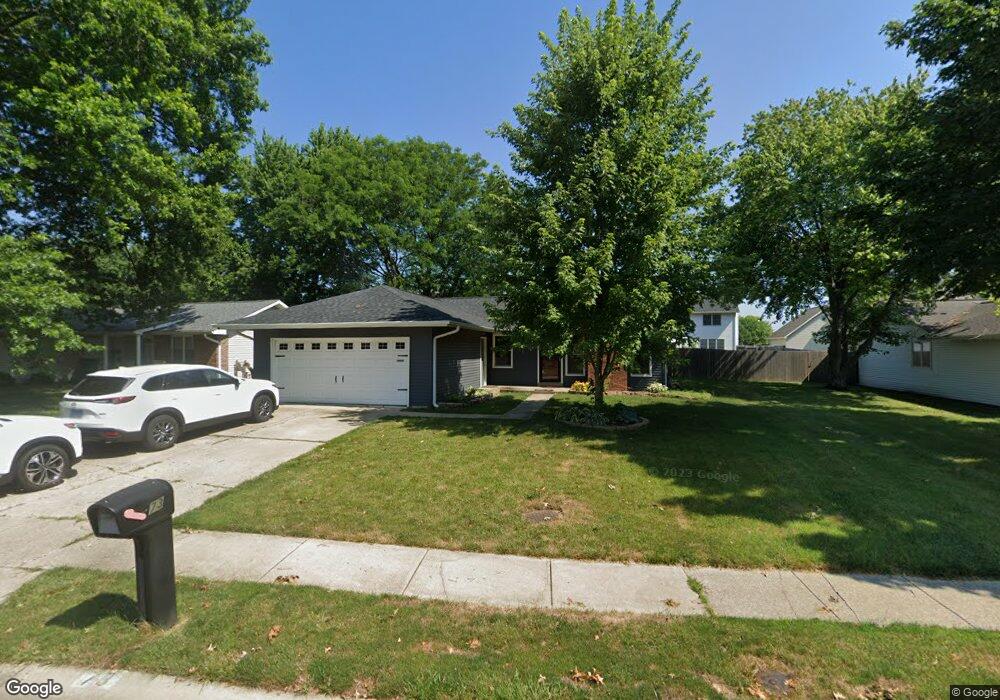
73 Mccarthy Dr Springfield, IL 62702
Estimated Value: $211,356 - $247,000
About This Home
This home is located at 73 Mccarthy Dr, Springfield, IL 62702 and is currently estimated at $223,339, approximately $155 per square foot. 73 Mccarthy Dr is a home located in Sangamon County with nearby schools including Dubois Elementary School, U.S. Grant Middle School, and Springfield High School.
Ownership History
We collect this data history from publicly available records. To have your information removed, we recommend requesting removal directly through your county’s website.
Purchase Details
Home Financials for this Owner
Home Financials are based on the most recent Mortgage that was taken out on this home.Purchase Details
Purchase Details
Purchase History
We collect this data history from publicly available records. To have your information removed, we recommend requesting removal directly through your county’s website.
| Date | Buyer | Sale Price | Title Company |
|---|---|---|---|
| -- | -- | ||
| -- | None Listed On Document | ||
| $125,000 | -- |
Mortgage History
We collect this data history from publicly available records. To have your information removed, we recommend requesting removal directly through your county’s website.
| Date | Status | Borrower | Loan Amount |
|---|---|---|---|
| Open | $348,000 |
Tax History
We collect this data history from publicly available records. To have your information removed, we recommend requesting removal directly through your county’s website.
| Year | Tax Paid | Tax Assessment Tax Assessment Total Assessment is a certain percentage of the fair market value that is determined by local assessors to be the total taxable value of land and additions on the property. | Land | Improvement |
|---|---|---|---|---|
| 2025 | $4,878 | $60,254 | $10,182 | $50,072 |
| 2024 | $4,720 | $56,196 | $9,496 | $46,700 |
| 2023 | $4,538 | $51,330 | $8,674 | $42,656 |
| 2022 | $3,347 | $48,348 | $8,229 | $40,119 |
| 2021 | $3,199 | $46,538 | $7,921 | $38,617 |
| 2020 | $3,137 | $46,608 | $7,933 | $38,675 |
| 2019 | $3,075 | $46,445 | $7,905 | $38,540 |
| 2018 | $2,739 | $43,420 | $7,865 | $35,555 |
| 2017 | $2,671 | $42,858 | $7,763 | $35,095 |
| 2016 | $2,605 | $42,233 | $7,650 | $34,583 |
| 2015 | $2,569 | $41,729 | $7,559 | $34,170 |
| 2014 | $2,805 | $41,459 | $7,510 | $33,949 |
| 2013 | $2,742 | $39,843 | $7,511 | $32,332 |
Map
- 62 N Oxford Rd
- 60 N Oxford Rd
- 2620 Cedar Pond Dr
- 12 N Oxford Rd
- 2716 Meadow Pointe Dr
- 29 Hollybrook Dr
- 160 S Durkin Dr Unit 3
- 24 Redwood Ln Unit 98
- 2650 Cooper Ave
- 2605 Cardifs Ave
- 890 Roanoke Dr
- 16 Whisperglen Ln
- 108 Collier Dr
- 343 S Durkin Dr
- 2629 Lemont Dr
- 1038 N Koke Mill Rd
- 2510 & 2518 W Jefferson St
- 3229 W Point Dr
- 200 S Koke Mill Rd
- 2606 Gaylord Ave
- 2620 Hazelnut Dr
- 2624 Hazelnut Dr
- 2616 Hazelnut Dr
- 77 Mccarthy Dr
- 81 Mccarthy Dr
- 85 Mccarthy Dr
- 401 Colbrook Dr
- 2621 Hazelnut Dr
- 2612 Hazelnut Dr
- 69 Mccarthy Dr
- 2700 Hazelnut Dr
- 2608 Hazelnut Dr
- 65 Mccarthy Dr
- 405 Colbrook Dr
- 404 N Durkin Dr
- 400 Colbrook Dr
- 401 N Durkin Dr
- 89 Mccarthy Dr
- 241 Glasgow Dr
- 68 Mccarthy Dr
Ask me questions while you tour the home.