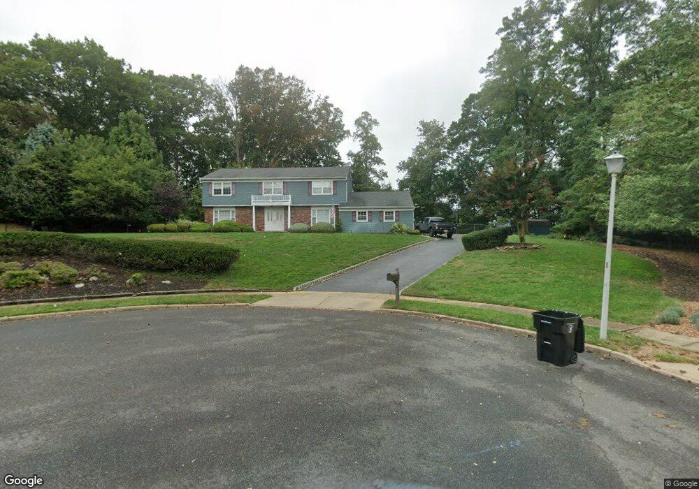
73 Mccutcheon Ct Middletown, NJ 07748
New Monmouth NeighborhoodEstimated Value: $1,085,000 - $1,287,000
4
Beds
2
Baths
2,888
Sq Ft
$405/Sq Ft
Est. Value
About This Home
This home is located at 73 Mccutcheon Ct, Middletown, NJ 07748 and is currently estimated at $1,170,048, approximately $405 per square foot. 73 Mccutcheon Ct is a home located in Monmouth County with nearby schools including Nut Swamp Elementary School, Thompson Middle School, and Middletown - South High School.
Ownership History
Date
Name
Owned For
Owner Type
Purchase Details
Closed on
Nov 12, 2009
Sold by
Shaw Gary A and Shaw Kathleen S
Current Estimated Value
Home Financials for this Owner
Home Financials are based on the most recent Mortgage that was taken out on this home.
Original Mortgage
$350,000
Outstanding Balance
$226,895
Interest Rate
4.86%
Mortgage Type
New Conventional
Estimated Equity
$943,153
Create a Home Valuation Report for This Property
The Home Valuation Report is an in-depth analysis detailing your home's value as well as a comparison with similar homes in the area
Home Values in the Area
Average Home Value in this Area
Purchase History
| Date | Buyer | Sale Price | Title Company |
|---|---|---|---|
| -- | $650,000 | None Available |
Source: Public Records
Mortgage History
| Date | Status | Borrower | Loan Amount |
|---|---|---|---|
| Open | -- | $350,000 |
Source: Public Records
Tax History Compared to Growth
Tax History
| Year | Tax Paid | Tax Assessment Tax Assessment Total Assessment is a certain percentage of the fair market value that is determined by local assessors to be the total taxable value of land and additions on the property. | Land | Improvement |
|---|---|---|---|---|
| 2025 | $14,657 | $953,200 | $463,800 | $489,400 |
| 2024 | $13,708 | $891,000 | $410,600 | $480,400 |
| 2023 | $13,708 | $788,700 | $312,600 | $476,100 |
| 2022 | $13,708 | $716,900 | $286,200 | $430,700 |
| 2021 | $13,921 | $669,300 | $286,200 | $383,100 |
| 2020 | $13,705 | $641,000 | $286,200 | $354,800 |
| 2019 | $13,603 | $644,100 | $286,200 | $357,900 |
| 2018 | $13,656 | $630,200 | $286,200 | $344,000 |
| 2017 | $13,264 | $624,500 | $286,200 | $338,300 |
| 2016 | $12,341 | $579,100 | $286,200 | $292,900 |
| 2015 | $12,299 | $575,800 | $286,200 | $289,600 |
| 2014 | $12,635 | $577,200 | $286,200 | $291,000 |
Source: Public Records
Map
Nearby Homes
- 164 Heights Terrace
- 11 Mayflower Dr
- 20 Devon Rd
- 0 Hamiltonian Dr Unit 22514980
- 93 Twin Brooks Ave
- 74 Fish Hawk Dr
- 35 Woodland Dr
- 93 Wallace Rd
- 8 Allston St
- 304 April Way Unit 304
- 211 April Way Unit 211
- 24 Princeton St
- 7 Meehan Ct
- 6 Waller Dr
- 8 Church St
- 10 Waller Dr
- 16 Waller Dr
- Hartshorne Plan at Middletown Walk
- 22 Waller Dr
- 58 Edmund Way
