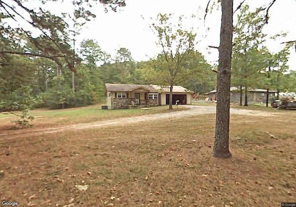
73 Meadowview Dr Rossville, GA 30741
Estimated Value: $158,000 - $210,025
2
Beds
1
Bath
900
Sq Ft
$204/Sq Ft
Est. Value
About This Home
This home is located at 73 Meadowview Dr, Rossville, GA 30741 and is currently estimated at $184,006, approximately $204 per square foot. 73 Meadowview Dr is a home located in Walker County with nearby schools including Stone Creek Elementary School, Rossville Middle School, and Ridgeland High School.
Ownership History
Date
Name
Owned For
Owner Type
Purchase Details
Closed on
Oct 8, 2021
Sold by
Executor Hulsey Harrell Bart
Bought by
Hulsey Harrell Bart
Current Estimated Value
Purchase Details
Closed on
Jan 23, 2013
Sold by
Bolton Myrtle Elizabeth
Bought by
Bolton Daniel George
Purchase Details
Closed on
Sep 26, 1999
Sold by
Bolton William E and Bolton Elizabeth
Bought by
Bolton Elizabeth H
Purchase Details
Closed on
Oct 12, 1972
Sold by
Denton John H
Bought by
Bolton William E and Bolton Elizabeth
Purchase Details
Closed on
Jan 1, 1963
Bought by
Denton John H
Create a Home Valuation Report for This Property
The Home Valuation Report is an in-depth analysis detailing your home's value as well as a comparison with similar homes in the area
Home Values in the Area
Average Home Value in this Area
Purchase History
| Date | Buyer | Sale Price | Title Company |
|---|---|---|---|
| Hulsey Harrell Bart | -- | -- | |
| Bolton Myrtle Elizabeth | -- | -- | |
| Bolton Daniel George | -- | -- | |
| Bolton Elizabeth H | -- | -- | |
| Bolton William E | -- | -- | |
| Denton John H | -- | -- |
Source: Public Records
Tax History Compared to Growth
Tax History
| Year | Tax Paid | Tax Assessment Tax Assessment Total Assessment is a certain percentage of the fair market value that is determined by local assessors to be the total taxable value of land and additions on the property. | Land | Improvement |
|---|---|---|---|---|
| 2024 | $1,166 | $48,802 | $7,818 | $40,984 |
| 2023 | $1,161 | $45,659 | $6,981 | $38,678 |
| 2022 | $1,244 | $49,652 | $3,729 | $45,923 |
| 2021 | $90 | $33,451 | $3,729 | $29,722 |
| 2020 | $90 | $28,330 | $3,729 | $24,601 |
| 2019 | $90 | $28,330 | $3,729 | $24,601 |
| 2018 | $750 | $28,330 | $3,729 | $24,601 |
| 2017 | $886 | $28,330 | $3,729 | $24,601 |
| 2016 | $774 | $28,330 | $3,729 | $24,601 |
| 2015 | $619 | $20,762 | $2,216 | $18,546 |
| 2014 | $538 | $20,762 | $2,216 | $18,546 |
| 2013 | -- | $20,762 | $2,216 | $18,546 |
Source: Public Records
Map
Nearby Homes
- 21 Saddle St
- 55 Saddlebred Way
- Davidson Plan at The Stables
- Primrose Plan at The Stables
- Whitman Plan at The Stables
- Aspen Plan at The Stables
- 124 Overbrook Dr
- 2937 Happy Valley Rd
- 213 Overbrook Dr
- 132 Saddlebred Way
- 163 Saddlebred Way
- 115 Saddlebred Way
- 114 Saddlebred Way
- 100 Saddlebred Way
- 278 Dry Valley Rd
- 306 Dry Valley Rd
- 252 Overbrook Dr
- 50 Buck Creek Ln
- 18 Buck Creek Ln
- 99 Meadowview Dr
- 35 Meadowview Dr
- 147 Meadowview Dr
- 147 Meadowview Dr
- 98 Turner Ln
- 0 Cora Ann Dr Unit Tract B 1319965
- 0 Cora Ann Dr Unit RTC2340944
- Lot 3 the Stables Unit 3
- Lot 3 the Stables
- 21 Saddle St Unit 36040341
- 21 Saddle St Unit 36040339
- 21 Saddle St Unit 36040342
- Lot 14 the Stables
- Lot 32 the Stables Unit 32
- Lot 32 the Stables
- Lot 3 the Stables
- Lot 28 the Stables
- 231 Turner Ln
- Lot 16 the Stables
- Lot 12 the Stables