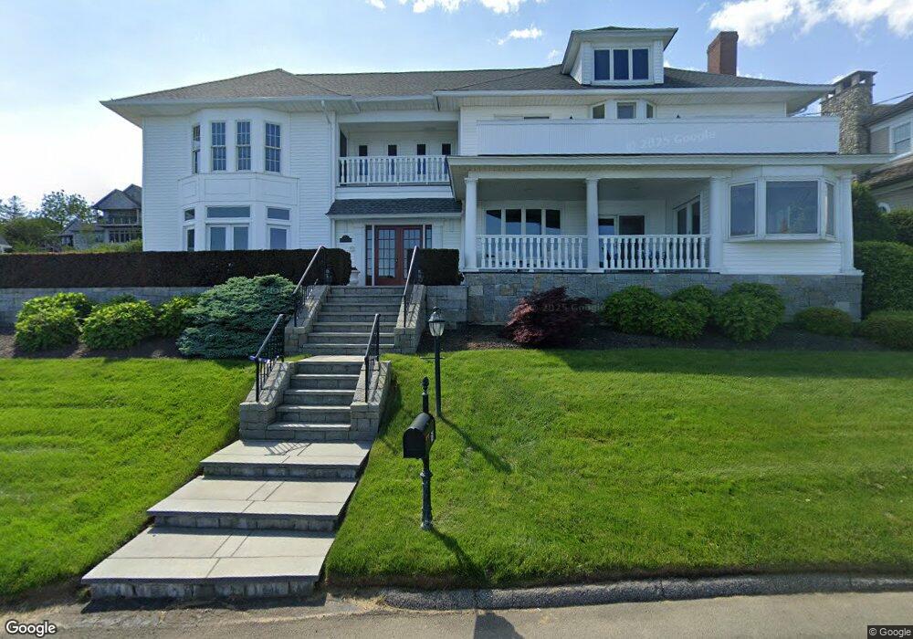
73 Morningside Dr Milford, CT 06460
Woodmont NeighborhoodEstimated Value: $1,575,512 - $1,921,000
5
Beds
5
Baths
4,243
Sq Ft
$414/Sq Ft
Est. Value
About This Home
This home is located at 73 Morningside Dr, Milford, CT 06460 and is currently estimated at $1,756,171, approximately $413 per square foot. 73 Morningside Dr is a home with nearby schools including Orchard Hills School, East Shore Middle School, and Joseph A. Foran High School.
Ownership History
Date
Name
Owned For
Owner Type
Purchase Details
Closed on
Oct 12, 2021
Sold by
Sarwar Carol
Bought by
Carol A Sarwar Ret
Current Estimated Value
Purchase Details
Closed on
Dec 23, 1993
Sold by
Papa Ethyl R
Bought by
Sarwar Hasan and Sarwar Carol
Home Financials for this Owner
Home Financials are based on the most recent Mortgage that was taken out on this home.
Original Mortgage
$292,000
Interest Rate
7%
Mortgage Type
Unknown
Create a Home Valuation Report for This Property
The Home Valuation Report is an in-depth analysis detailing your home's value as well as a comparison with similar homes in the area
Home Values in the Area
Average Home Value in this Area
Purchase History
| Date | Buyer | Sale Price | Title Company |
|---|---|---|---|
| Carol A Sarwar Ret | -- | None Available | |
| Carol A Sarwar Ret | -- | None Available | |
| Sarwar Hasan | $365,000 | -- | |
| Sarwar Hasan | $365,000 | -- |
Source: Public Records
Mortgage History
| Date | Status | Borrower | Loan Amount |
|---|---|---|---|
| Previous Owner | Sarwar Hasan | $292,000 |
Source: Public Records
Tax History Compared to Growth
Tax History
| Year | Tax Paid | Tax Assessment Tax Assessment Total Assessment is a certain percentage of the fair market value that is determined by local assessors to be the total taxable value of land and additions on the property. | Land | Improvement |
|---|---|---|---|---|
| 2025 | $25,795 | $872,940 | $417,880 | $455,060 |
| 2024 | $25,437 | $872,940 | $417,880 | $455,060 |
| 2023 | $23,718 | $872,940 | $417,880 | $455,060 |
| 2022 | $23,264 | $872,940 | $417,880 | $455,060 |
| 2021 | $24,065 | $870,340 | $432,250 | $438,090 |
| 2020 | $24,091 | $870,340 | $432,250 | $438,090 |
| 2019 | $24,117 | $870,340 | $432,250 | $438,090 |
| 2018 | $24,143 | $870,340 | $432,250 | $438,090 |
| 2017 | $24,187 | $870,340 | $432,250 | $438,090 |
| 2016 | $23,837 | $856,230 | $432,250 | $423,980 |
| 2015 | $23,872 | $856,230 | $432,250 | $423,980 |
| 2014 | $23,307 | $856,230 | $432,250 | $423,980 |
Source: Public Records
Map
Nearby Homes
- 34 Orchard Rd
- 141 Ridgewood Dr
- 12 Nolan Terrace
- 83 Yale Ave
- 40 Devine Place
- 32 Burwell Ave
- 571 Pond Point Ave
- 565 Pond Point Ave
- 470 Pond Point Ave
- 62 Soundview Ave
- 38 Elaine Rd
- 32 Morehouse Ave
- 13 Richard St
- 97 Carriage Path S Unit 97
- 25 Carmen Rd
- 16 Point Beach Dr
- 185 Melba St Unit 104
- 10 Point Beach Dr
- 10 Sperry St
- 5 Vine St
- 7 Thompson Hill Rd
- 1 Thompson Hill Rd
- 81 Morningside Dr
- 2 Orchard Rd
- 89 Morningside Dr
- 21 Thompson Hill Rd
- 20 Thompson Hill Rd
- 10 Orchard Rd
- 61 Morningside Dr
- 95 Morningside Dr
- 29 Thompson Hill Rd
- 19 Orchard Rd
- 5 Orchard Rd
- 105 Morningside Dr
- 30 Thompson Hill Rd
- 53 Morningside Dr
- 28 Center St
- 22 Orchard Rd
- 11 Soundview Place
- 33 Thompson Hill Rd