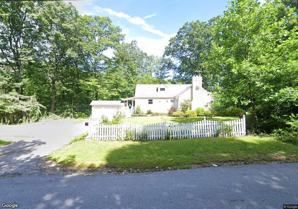
73 Pierce St West Boylston, MA 01583
Estimated Value: $458,000 - $499,000
3
Beds
2
Baths
1,469
Sq Ft
$323/Sq Ft
Est. Value
About This Home
This home is located at 73 Pierce St, West Boylston, MA 01583 and is currently estimated at $474,692, approximately $323 per square foot. 73 Pierce St is a home located in Worcester County with nearby schools including Major Edwards Elementary School, West Boylston Junior/Senior High School, and Abby Kelley Foster Charter Public School.
Ownership History
Date
Name
Owned For
Owner Type
Purchase Details
Closed on
Jul 9, 2012
Sold by
Donaldson Caroline J and Donaldson Edward L
Bought by
Donaldson Caroline J
Current Estimated Value
Purchase Details
Closed on
Aug 27, 1993
Sold by
Koza Michael F and Koza Karen
Bought by
Donaldson Edward L and Donaldson Caroline
Home Financials for this Owner
Home Financials are based on the most recent Mortgage that was taken out on this home.
Original Mortgage
$99,750
Interest Rate
7.06%
Mortgage Type
Purchase Money Mortgage
Create a Home Valuation Report for This Property
The Home Valuation Report is an in-depth analysis detailing your home's value as well as a comparison with similar homes in the area
Home Values in the Area
Average Home Value in this Area
Purchase History
| Date | Buyer | Sale Price | Title Company |
|---|---|---|---|
| Donaldson Caroline J | -- | -- | |
| Donaldson Edward L | $105,000 | -- |
Source: Public Records
Mortgage History
| Date | Status | Borrower | Loan Amount |
|---|---|---|---|
| Previous Owner | Donaldson Edward L | $112,000 | |
| Previous Owner | Donaldson Edward L | $125,000 | |
| Previous Owner | Donaldson Edward L | $99,750 |
Source: Public Records
Tax History Compared to Growth
Tax History
| Year | Tax Paid | Tax Assessment Tax Assessment Total Assessment is a certain percentage of the fair market value that is determined by local assessors to be the total taxable value of land and additions on the property. | Land | Improvement |
|---|---|---|---|---|
| 2025 | $58 | $419,300 | $112,200 | $307,100 |
| 2024 | $5,510 | $372,800 | $112,200 | $260,600 |
| 2023 | $5,526 | $354,700 | $110,900 | $243,800 |
| 2022 | $5,108 | $288,900 | $110,900 | $178,000 |
| 2021 | $5,078 | $275,100 | $104,900 | $170,200 |
| 2020 | $5,009 | $269,600 | $104,900 | $164,700 |
| 2019 | $4,831 | $256,300 | $104,900 | $151,400 |
| 2018 | $4,699 | $251,000 | $104,900 | $146,100 |
| 2017 | $4,469 | $237,700 | $104,900 | $132,800 |
| 2016 | $4,242 | $229,900 | $97,600 | $132,300 |
| 2015 | $4,149 | $226,200 | $96,700 | $129,500 |
Source: Public Records
Map
Nearby Homes
- 9 Kings Mountain Dr
- 1 Highland Ave
- 16 Jasmine Dr Unit 16
- 152 Worcester St Unit 8
- 14 Maple St
- 39 Bowen St
- 32 Whispering Pine Cir Unit 32
- 12 Birchbrush Ln
- 41 Whispering Pine Cir Unit 41
- 20 Hawthorne Dr
- 363 Prospect St
- 156 Prospect St
- 20 Jersey Dr
- 39 Meola Ave
- 55 Meola Ave
- 64 Worcester St
- 1110 W Boylston St Unit A
- 1097 W Boylston St
- 55 Angell Brook Dr
- 83 Hillside Village Dr
- 78 Pierce St
- 81 Pierce St
- 80 Pierce St
- 72 Pierce St
- 34 Bunkerhill Pkwy
- 87 Pierce St
- 88 Pierce St
- 30 Bunkerhill Pkwy
- 321 Worcester St
- 38 Bunkerhill Pkwy
- 26 Bunkerhill Pkwy
- 93 Pierce St
- 92 Pierce St
- 31 Bunkerhill Pkwy
- 83 Pierce St
- 323 Worcester St
- 57 Pierce St
- 22 Bunkerhill Pkwy
- 42 Bunkerhill Pkwy
- 96 Pierce St