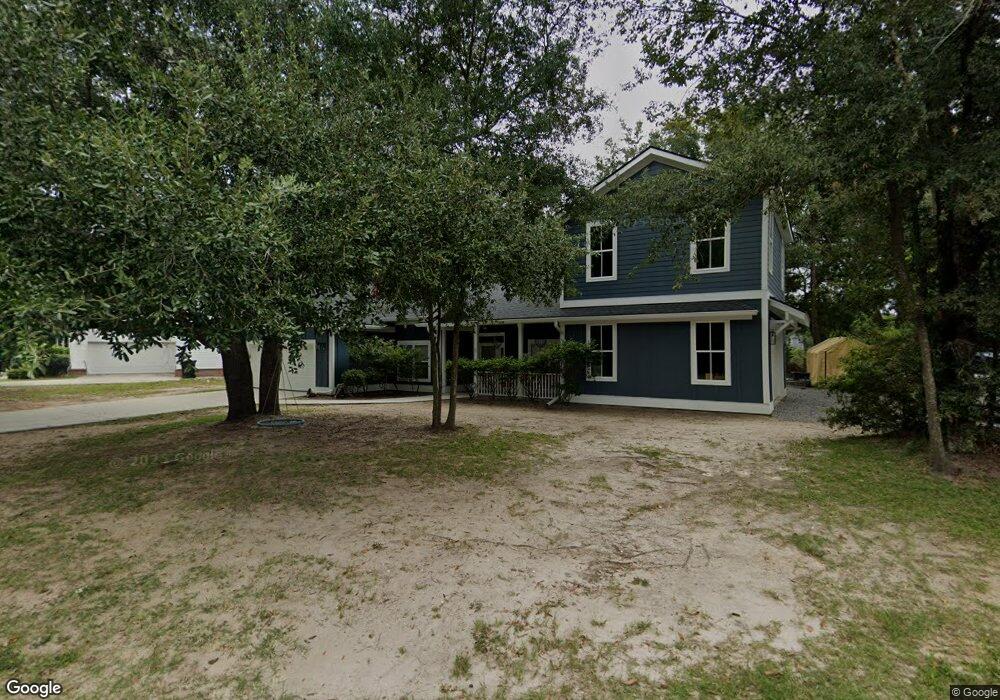
73 Rivers Point Row Charleston, SC 29412
James Island NeighborhoodEstimated Value: $612,000 - $701,000
3
Beds
2
Baths
1,711
Sq Ft
$386/Sq Ft
Est. Value
About This Home
This home is located at 73 Rivers Point Row, Charleston, SC 29412 and is currently estimated at $660,651, approximately $386 per square foot. 73 Rivers Point Row is a home located in Charleston County with nearby schools including Harbor View Elementary School, Camp Road Middle, and James Island Charter High School.
Ownership History
Date
Name
Owned For
Owner Type
Purchase Details
Closed on
Apr 14, 2017
Current Estimated Value
Home Financials for this Owner
Home Financials are based on the most recent Mortgage that was taken out on this home.
Original Mortgage
$240,000
Outstanding Balance
$199,716
Interest Rate
4.21%
Mortgage Type
Future Advance Clause Open End Mortgage
Estimated Equity
$460,935
Purchase Details
Closed on
Nov 13, 2009
Sold by
Danielson William E and Danielson Carla K
Bought by
Terrien Amanda M and Terrien Sandra M
Purchase Details
Closed on
Jul 9, 2003
Sold by
Joe Ford Construction
Bought by
Danielson William E and Danielson Carla K
Purchase Details
Closed on
Dec 6, 2002
Sold by
Ford Thomas Glenn
Bought by
Joe Ford Construction
Create a Home Valuation Report for This Property
The Home Valuation Report is an in-depth analysis detailing your home's value as well as a comparison with similar homes in the area
Home Values in the Area
Average Home Value in this Area
Purchase History
| Date | Buyer | Sale Price | Title Company |
|---|---|---|---|
| -- | -- | None Available | |
| Terrien Amanda M | $225,000 | -- | |
| Danielson William E | $211,900 | -- | |
| Joe Ford Construction | $75,000 | -- |
Source: Public Records
Mortgage History
| Date | Status | Borrower | Loan Amount |
|---|---|---|---|
| Open | -- | $240,000 |
Source: Public Records
Tax History Compared to Growth
Tax History
| Year | Tax Paid | Tax Assessment Tax Assessment Total Assessment is a certain percentage of the fair market value that is determined by local assessors to be the total taxable value of land and additions on the property. | Land | Improvement |
|---|---|---|---|---|
| 2024 | $1,787 | $13,270 | $0 | $0 |
| 2023 | $1,787 | $11,170 | $0 | $0 |
| 2022 | $1,407 | $11,170 | $0 | $0 |
| 2021 | $1,474 | $11,170 | $0 | $0 |
| 2020 | $1,527 | $11,170 | $0 | $0 |
| 2019 | $1,364 | $9,720 | $0 | $0 |
| 2017 | $1,318 | $9,720 | $0 | $0 |
| 2016 | $1,264 | $9,720 | $0 | $0 |
| 2015 | $1,306 | $9,720 | $0 | $0 |
| 2014 | $1,180 | $0 | $0 | $0 |
| 2011 | -- | $0 | $0 | $0 |
Source: Public Records
Map
Nearby Homes
- 35 Rivers Point Row Unit A
- 36 Forde Row
- 10 Bass Ln Unit D
- 50 Held Cir Unit C
- 9 Maplecrest Dr
- 14 Clam Shell Row
- 1 Maplecrest Dr
- 14 Maplecrest Dr
- 21 Rivers Point Row Unit 11 C
- 21 Rivers Point Row Unit 3C
- 17 S Anderson Ave Unit A,B,C, D
- 1 S Anderson Ave
- 1453 Camp Rd
- 1734 Combahee St
- 1514 Patterson Ave
- 1531 Inland Ave
- 27 Brockman Dr Unit 27B
- 27 Brockman Dr Unit 27C
- 1741 Combahee St
- 1764 Lady Ashley St
- 37 Rivers Point Row Unit D
- 37 Rivers Point Row Unit C
- 37 Rivers Point Row Unit B
- 37 Rivers Point Row Unit A
- 3 Forde Row
- 77 Rivers Point Row
- 1 Commercial Row Unit 11C
- 1 Commercial Row Unit 11B
- 1 Commercial Row Unit 11A
- 1 Commercial Row Unit 12D
- 1 Commercial Row Unit 12C
- 1 Commercial Row Unit 12B
- 1 Commercial Row Unit 12A
- 1 Commercial Row Unit C
- 1 Commercial Row Unit A
- 1 Commercial Row Unit B
- 35 Rivers Point Row Unit D
- 35 Rivers Point Row Unit C
- 35 Rivers Point Row Unit B
- 35 Rivers Point Row