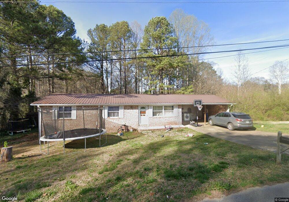
73 Shady Lane Dr Unit 1 & 2 Tallapoosa, GA 30176
Estimated Value: $123,000 - $189,564
3
Beds
2
Baths
1,056
Sq Ft
$157/Sq Ft
Est. Value
About This Home
This home is located at 73 Shady Lane Dr Unit 1 & 2, Tallapoosa, GA 30176 and is currently estimated at $165,891, approximately $157 per square foot. 73 Shady Lane Dr Unit 1 & 2 is a home located in Haralson County with nearby schools including Haralson County High School.
Ownership History
Date
Name
Owned For
Owner Type
Purchase Details
Closed on
Apr 5, 2013
Sold by
Schreiber Robert Steven
Bought by
Godwin Kimberly D
Current Estimated Value
Home Financials for this Owner
Home Financials are based on the most recent Mortgage that was taken out on this home.
Original Mortgage
$37,163
Outstanding Balance
$26,327
Interest Rate
3.55%
Mortgage Type
New Conventional
Estimated Equity
$139,564
Purchase Details
Closed on
Nov 30, 2004
Sold by
Hatchett Jeffrey Alan
Bought by
Schreiber Robert Steven
Purchase Details
Closed on
Jul 11, 2002
Sold by
Mabry Reagan Andrew and Stephanie Erin
Bought by
Hatchett Jeffrey Alan
Purchase Details
Closed on
Jun 2, 2000
Sold by
Mcguire Tommy
Bought by
Mabry Reagan Andrew and Stephanie Eri
Purchase Details
Closed on
Jun 28, 1972
Sold by
Nunnelly Gary
Bought by
Mcguire Tommy
Purchase Details
Closed on
Feb 9, 1972
Sold by
Superior Brokerage
Bought by
Nunnelly Gary
Create a Home Valuation Report for This Property
The Home Valuation Report is an in-depth analysis detailing your home's value as well as a comparison with similar homes in the area
Home Values in the Area
Average Home Value in this Area
Purchase History
| Date | Buyer | Sale Price | Title Company |
|---|---|---|---|
| Godwin Kimberly D | $33,920 | -- | |
| Schreiber Robert Steven | $92,000 | -- | |
| Schreiber Robert Steven | $92,000 | -- | |
| Hatchett Jeffrey Alan | $75,500 | -- | |
| Mabry Reagan Andrew | $55,000 | -- | |
| Mcguire Tommy | $19,800 | -- | |
| Nunnelly Gary | $2,000 | -- |
Source: Public Records
Mortgage History
| Date | Status | Borrower | Loan Amount |
|---|---|---|---|
| Open | Godwin Kimberly D | $37,163 |
Source: Public Records
Tax History Compared to Growth
Tax History
| Year | Tax Paid | Tax Assessment Tax Assessment Total Assessment is a certain percentage of the fair market value that is determined by local assessors to be the total taxable value of land and additions on the property. | Land | Improvement |
|---|---|---|---|---|
| 2024 | $1,071 | $35,573 | $5,088 | $30,485 |
| 2023 | $1,274 | $40,512 | $4,800 | $35,712 |
| 2022 | $805 | $33,177 | $4,800 | $28,377 |
| 2021 | $802 | $31,757 | $4,800 | $26,957 |
| 2020 | $830 | $32,671 | $4,800 | $27,871 |
| 2019 | $840 | $31,927 | $4,800 | $27,127 |
| 2018 | $806 | $30,381 | $4,800 | $25,581 |
| 2017 | $777 | $26,976 | $4,800 | $22,176 |
| 2016 | $654 | $24,442 | $4,800 | $19,642 |
| 2015 | $703 | $23,984 | $4,800 | $19,184 |
| 2014 | $410 | $27,168 | $7,676 | $19,492 |
Source: Public Records
Map
Nearby Homes
- 110 Dunson Rd
- 28 McDonald Ridge
- 77 McDonald Rd
- 194 Faye St
- 135 Oakland Ct
- 174 Faye St
- 711 Kay St
- 622 Cedartown Ave
- 0 Providence Lake Rd Unit 10576961
- 0 Creek Dr Unit 148038
- 438 Bowdon St
- 0 Cherokee Dr Unit 148037
- 871 Cherokee Dr
- 244 Monroe St
- 0 Georgia 120 Unit 7646686
- 0 Georgia 120 Unit 10600882
- 250 Kiker St
- --- Steadman #32 Rd
- 0 Steadman Rd Unit 10608314
- 0 Broad St Unit 10614514
- 73 Shady Ln Unit 1 & 2
- 73 Shady Ln
- 0 Shady Lane Dr Unit 7512256
- 0 Shady Lane Dr Unit 8654399
- 0 Shady Lane Dr Unit 8592787
- 0 Shady Lane Dr Unit 3204492
- 85 Shady Ln
- 72 Shady Ln
- 69 Dunson Rd
- 19 Bluebird Ln
- 27 Bluebird Ln
- 35 Shady Ln
- 85 Dunson Rd
- 100 Shady Ln
- 36 Main Dr
- 31 Shady Ln
- 33 Bluebird Ln
- 116 Shady Ln
- 116 Shady Lane Dr
- 22 Main Dr