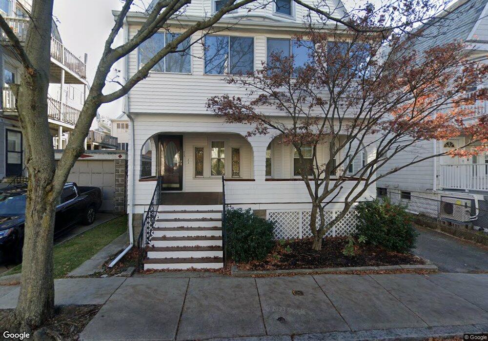
73 Simpson Ave Somerville, MA 02144
Davis Square NeighborhoodEstimated Value: $1,059,000 - $1,738,368
3
Beds
1
Bath
--
Sq Ft
3,180
Sq Ft
About This Home
This home is located at 73 Simpson Ave, Somerville, MA 02144 and is currently estimated at $1,524,842. 73 Simpson Ave is a home located in Middlesex County with nearby schools including Somerville High School, Benjamin Banneker Charter Public School, and St. Clement Elementary School.
Ownership History
Date
Name
Owned For
Owner Type
Purchase Details
Closed on
Dec 18, 2018
Sold by
Annese Jean B
Bought by
Jean B Annese Irt
Current Estimated Value
Purchase Details
Closed on
Apr 25, 2018
Sold by
Silva Linda A
Bought by
Annese Jean B
Purchase Details
Closed on
Jun 7, 2013
Sold by
Annese Jean B
Bought by
Jean B Annese Irt and Silva Linda A
Create a Home Valuation Report for This Property
The Home Valuation Report is an in-depth analysis detailing your home's value as well as a comparison with similar homes in the area
Home Values in the Area
Average Home Value in this Area
Purchase History
| Date | Buyer | Sale Price | Title Company |
|---|---|---|---|
| Jean B Annese Irt | -- | -- | |
| Annese Jean B | -- | -- | |
| Silva Linda A | -- | -- | |
| Jean B Annese Irt | -- | -- |
Source: Public Records
Tax History
| Year | Tax Paid | Tax Assessment Tax Assessment Total Assessment is a certain percentage of the fair market value that is determined by local assessors to be the total taxable value of land and additions on the property. | Land | Improvement |
|---|---|---|---|---|
| 2025 | $15,974 | $1,464,200 | $810,100 | $654,100 |
| 2024 | $15,280 | $1,452,500 | $810,100 | $642,400 |
| 2023 | $14,559 | $1,408,000 | $810,100 | $597,900 |
| 2022 | $13,704 | $1,346,200 | $771,600 | $574,600 |
| 2021 | $13,333 | $1,308,400 | $765,900 | $542,500 |
| 2020 | $12,367 | $1,225,700 | $715,300 | $510,400 |
| 2019 | $12,215 | $1,135,200 | $697,700 | $437,500 |
| 2018 | $11,274 | $996,800 | $634,300 | $362,500 |
| 2017 | $11,049 | $946,800 | $598,400 | $348,400 |
| 2016 | $10,671 | $851,600 | $534,400 | $317,200 |
| 2015 | $10,188 | $807,900 | $493,500 | $314,400 |
Source: Public Records
Map
Nearby Homes
- 1004 Broadway Unit 3
- 55 Packard Ave Unit 1
- 69 Electric Ave Unit 3
- 69 Electric Ave Unit 1
- 34 Elmwood St Unit 2
- 17 Holland St Unit 301
- 30 Clarendon Ave
- 5 Glendale Ave Unit 5
- 26 Warner St
- 68 Winslow Ave
- 69 Clarendon Ave Unit A
- 202 Powder House Blvd Unit 1
- 202 Powder House Blvd Unit 2
- 371 Highland Ave
- 622 Boston Ave Unit 7A
- 97 Elmwood St Unit 313
- 97 Elmwood St Unit 110
- 97 Elmwood St Unit 310
- 355 Highland Ave Unit 3
- 353 Summer St Unit 310
- 71 Simpson Ave
- 986 Broadway
- 986 Broadway Unit 3
- 986 Broadway Unit 2
- 67 Simpson Ave
- 67 Simpson Ave Unit 1
- 67 Simpson Ave Unit 2
- 84 Irving St
- 86 Irving St
- 982 Broadway
- 982 Broadway Unit 3
- 80 Irving St
- 80 Irving St Unit 2
- 1000 Broadway
- 74 Simpson Ave
- 72 Simpson Ave
- 998 Broadway
- 998 Broadway Unit 1
- 998 Broadway Unit 3
- 63 Simpson Ave
Your Personal Tour Guide
Ask me questions while you tour the home.