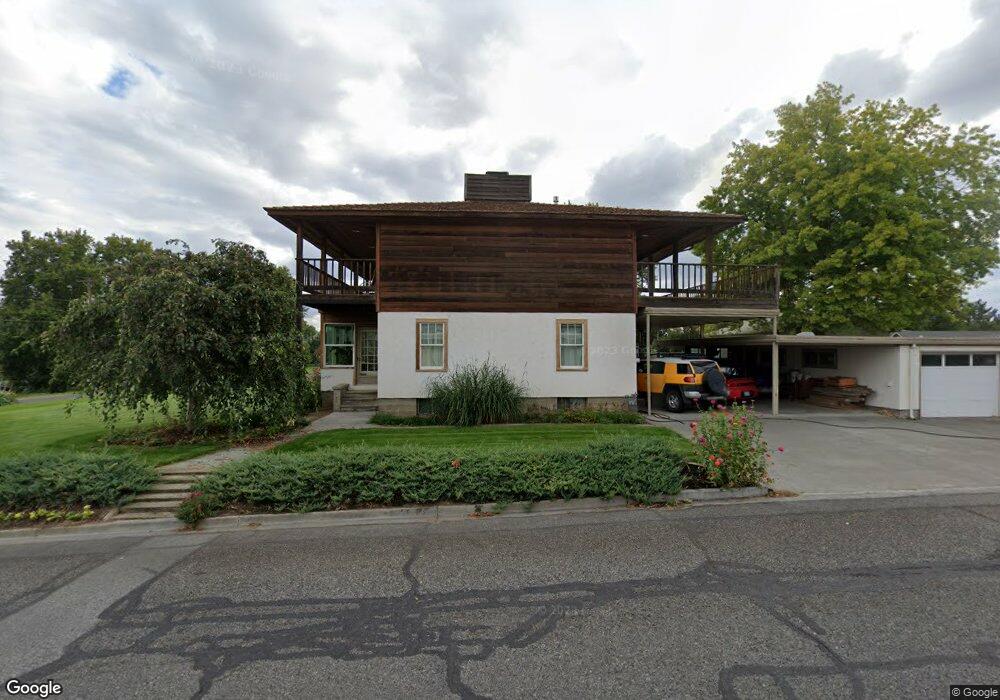
73 Snyder St Richland, WA 99354
Estimated Value: $477,114 - $565,000
3
Beds
2
Baths
1,874
Sq Ft
$283/Sq Ft
Est. Value
About This Home
This home is located at 73 Snyder St, Richland, WA 99354 and is currently estimated at $530,279, approximately $282 per square foot. 73 Snyder St is a home located in Benton County with nearby schools including Jefferson Elementary School, Chief Joseph Middle School, and Hanford High School.
Ownership History
Date
Name
Owned For
Owner Type
Purchase Details
Closed on
Feb 10, 2022
Sold by
Mcfadden Janet G
Bought by
Mcfadden Norman R
Current Estimated Value
Home Financials for this Owner
Home Financials are based on the most recent Mortgage that was taken out on this home.
Original Mortgage
$297,500
Outstanding Balance
$277,462
Interest Rate
3.92%
Mortgage Type
New Conventional
Estimated Equity
$252,817
Create a Home Valuation Report for This Property
The Home Valuation Report is an in-depth analysis detailing your home's value as well as a comparison with similar homes in the area
Home Values in the Area
Average Home Value in this Area
Purchase History
| Date | Buyer | Sale Price | Title Company |
|---|---|---|---|
| Mcfadden Norman R | $313 | Layman Brewe | |
| Mcfadden Norman R | $313 | Layman Brewe |
Source: Public Records
Mortgage History
| Date | Status | Borrower | Loan Amount |
|---|---|---|---|
| Open | Mcfadden Norman R | $297,500 |
Source: Public Records
Tax History Compared to Growth
Tax History
| Year | Tax Paid | Tax Assessment Tax Assessment Total Assessment is a certain percentage of the fair market value that is determined by local assessors to be the total taxable value of land and additions on the property. | Land | Improvement |
|---|---|---|---|---|
| 2024 | $4,174 | $455,850 | $52,500 | $403,350 |
| 2023 | $4,174 | $445,490 | $52,500 | $392,990 |
| 2022 | $3,783 | $383,450 | $52,500 | $330,950 |
| 2021 | $3,582 | $342,070 | $52,500 | $289,570 |
| 2020 | $5,342 | $311,060 | $52,500 | $258,560 |
| 2019 | $4,667 | $439,890 | $207,850 | $232,040 |
| 2018 | $5,115 | $414,110 | $207,850 | $206,260 |
| 2017 | $4,519 | $379,730 | $207,850 | $171,880 |
| 2016 | -- | $379,730 | $207,850 | $171,880 |
| 2015 | $4,539 | $379,730 | $207,850 | $171,880 |
| 2014 | -- | $379,730 | $207,850 | $171,880 |
| 2013 | -- | $379,730 | $207,850 | $171,880 |
Source: Public Records
Map
Nearby Homes
- 2342 Davison Ave
- 324 Saint St
- 2110 Davison Ave
- 2462 Mullet Ct
- 2460 Westmoreland Dr
- 2445 Westmoreland Dr
- 42 Mercury Dr
- 560 Spengler St
- 63 Galaxy Ln
- 49 Galaxy Ln
- 1947 Hetrick St
- 562 Fuller St
- 325 McDonald Dr
- Lot 3 Nka John Mullen Trail
- Lot 2 Nka John Mullen Trail
- Lot 1 Trail
- 21 Nuclear Ln
- 164 Charolais Trail
- 11702 Cordon Crest Ct
- 721 Hanford St
- 2241 Harris Ave
- 2234 Enterprise Dr
- 2303 Harris Ave
- 2228 Enterprise Dr
- 2235 Harris Ave
- 2304 Enterprise Dr
- 2222 Enterprise Dr
- 2237 Enterprise Dr
- 2229 Harris Ave
- 2309 Harris Ave
- 2310 Enterprise Dr
- 2231 Enterprise Dr
- 2301 Enterprise Dr
- 2216 Enterprise Dr
- 2225 Enterprise Dr
- 2223 Harris Ave
- 2307 Enterprise Dr
- 2315 Harris Ave
- 2316 Enterprise Dr
- 2219 Enterprise Dr