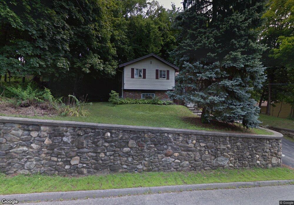
73 Stow Rd Marlborough, MA 01752
Estimated Value: $545,000 - $585,000
3
Beds
2
Baths
1,500
Sq Ft
$377/Sq Ft
Est. Value
About This Home
This home is located at 73 Stow Rd, Marlborough, MA 01752 and is currently estimated at $566,175, approximately $377 per square foot. 73 Stow Rd is a home located in Middlesex County with nearby schools including Marlborough High School, New Covenant Christian School, and Glenhaven Academy - JRI School.
Create a Home Valuation Report for This Property
The Home Valuation Report is an in-depth analysis detailing your home's value as well as a comparison with similar homes in the area
Home Values in the Area
Average Home Value in this Area
Tax History Compared to Growth
Tax History
| Year | Tax Paid | Tax Assessment Tax Assessment Total Assessment is a certain percentage of the fair market value that is determined by local assessors to be the total taxable value of land and additions on the property. | Land | Improvement |
|---|---|---|---|---|
| 2025 | $4,473 | $453,700 | $210,800 | $242,900 |
| 2024 | $4,311 | $421,000 | $191,600 | $229,400 |
| 2023 | $4,667 | $404,400 | $153,900 | $250,500 |
| 2022 | $4,585 | $349,500 | $146,600 | $202,900 |
| 2021 | $9,485 | $322,300 | $119,400 | $202,900 |
| 2020 | $4,367 | $308,000 | $116,300 | $191,700 |
| 2019 | $4,242 | $301,500 | $114,000 | $187,500 |
| 2018 | $4,429 | $302,700 | $102,600 | $200,100 |
| 2017 | $3,790 | $247,400 | $101,300 | $146,100 |
| 2016 | $3,521 | $229,500 | $101,300 | $128,200 |
| 2015 | $3,612 | $229,200 | $103,800 | $125,400 |
Source: Public Records
Map
Nearby Homes
- 323 Robert Rd
- 37 Hosmer St Unit 10
- 37 Hosmer St Unit 20
- 38 Airport Blvd
- 256 Robert Rd
- 116 Boston Post Rd E Unit 105
- 110 Boston Post Rd E Unit 104
- 45 Raffaele Rd
- 181 Boston Post Rd E Unit 26
- 96 Cook Ln
- 97 Cook Ln
- 41 Kane Dr
- 261 Boston Post Rd E Unit 1
- 271 Boston Post Rd E Unit 4
- 23 Victoria Ln
- 24 Clinton St
- 99 Kings Grant Rd
- 16 Clinton St
- 70 Phelps St
- 100 Phelps St Unit 7