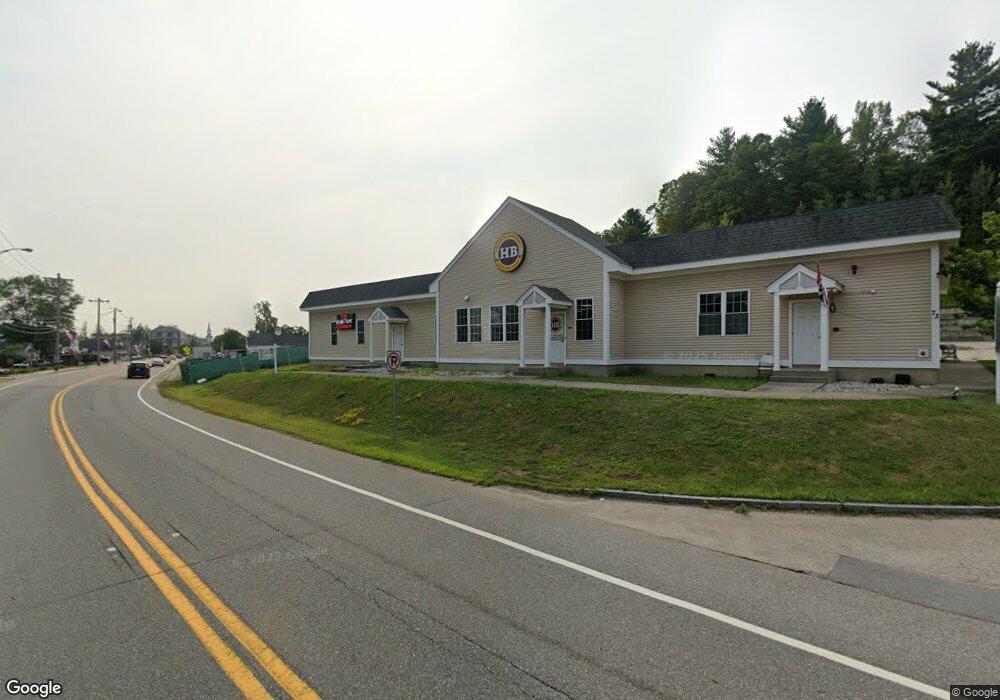
73 W Main St Northborough, MA 01532
--
Bed
--
Bath
6,000
Sq Ft
2.36
Acres
About This Home
This home is located at 73 W Main St, Northborough, MA 01532. 73 W Main St is a home located in Worcester County with nearby schools including Lincoln Street Elementary School, Robert E. Melican Middle School, and Algonquin Regional High School.
Ownership History
Date
Name
Owned For
Owner Type
Purchase Details
Closed on
Dec 6, 2020
Sold by
Voyiatzis Dimitrios and Voyiatzis Joanna C
Bought by
Voyiatzis Joanna C and Voyiatzis Nicholas D
Purchase Details
Closed on
Jan 8, 2008
Sold by
Parkin Voyiatzis 15242
Bought by
Voyiatzis Dimitrios and Voyiatzis Joanna C
Purchase Details
Closed on
Jul 24, 2007
Sold by
Morgan Rt
Bought by
Voyiatzis Parking T and Exchange Auth Llp
Purchase Details
Closed on
Feb 3, 1989
Sold by
Brown Stephen J
Bought by
Morgan Rlty Tr
Home Financials for this Owner
Home Financials are based on the most recent Mortgage that was taken out on this home.
Original Mortgage
$172,000
Interest Rate
10.62%
Mortgage Type
Commercial
Create a Home Valuation Report for This Property
The Home Valuation Report is an in-depth analysis detailing your home's value as well as a comparison with similar homes in the area
Home Values in the Area
Average Home Value in this Area
Purchase History
| Date | Buyer | Sale Price | Title Company |
|---|---|---|---|
| Voyiatzis Joanna C | -- | None Available | |
| Voyiatzis Dimitrios | -- | -- | |
| Voyiatzis Parking T | $250,000 | -- | |
| Morgan Rlty Tr | $215,000 | -- |
Source: Public Records
Mortgage History
| Date | Status | Borrower | Loan Amount |
|---|---|---|---|
| Previous Owner | Morgan Rlty Tr | $1,350,000 | |
| Previous Owner | Morgan Rlty Tr | $172,000 |
Source: Public Records
Tax History Compared to Growth
Tax History
| Year | Tax Paid | Tax Assessment Tax Assessment Total Assessment is a certain percentage of the fair market value that is determined by local assessors to be the total taxable value of land and additions on the property. | Land | Improvement |
|---|---|---|---|---|
| 2025 | $30,629 | $2,149,400 | $469,100 | $1,680,300 |
| 2024 | $36,438 | $2,551,700 | $414,500 | $2,137,200 |
| 2023 | $31,266 | $2,114,000 | $392,100 | $1,721,900 |
| 2022 | $35,346 | $2,143,500 | $374,200 | $1,769,300 |
| 2021 | $36,899 | $2,155,300 | $374,200 | $1,781,100 |
| 2020 | $38,462 | $2,229,700 | $374,200 | $1,855,500 |
| 2019 | $36,029 | $2,100,800 | $333,100 | $1,767,700 |
| 2018 | $36,533 | $2,100,800 | $411,900 | $1,688,900 |
| 2017 | $36,604 | $2,104,900 | $411,900 | $1,693,000 |
| 2016 | $36,072 | $2,100,900 | $411,900 | $1,689,000 |
| 2015 | $37,325 | $2,231,000 | $531,900 | $1,699,100 |
| 2014 | $37,012 | $2,231,000 | $531,900 | $1,699,100 |
Source: Public Records
Map
Nearby Homes
- 89 W Main St
- 90 W Main St
- 39 Pleasant St Unit B19
- 39 Pleasant St Unit C5
- 132 W Main St
- 5 Swan View Common Dr
- 19 Crestwood Dr Unit 19
- 71 Summer St
- 86 Whitney St
- 105 Lincoln St
- 85 Hudson St Unit 85
- 59 School St Unit A-14
- 6 Silas Dr
- 185-187 South St
- 198 South St
- 6 Vanessa Dr
- 14 Vanessa Dr
- 26 Maple St
- 223 South St
- 107 Washburn St
- 65 W Main St
- 85 W Main St
- 15 Liberty Dr
- 82 W Main St Unit 3
- 19 Liberty Dr
- 11 Liberty Dr
- 62 W Main St
- 89 W Main St
- 89 W Main St Unit 207
- 89 W Main St Unit 206
- 89 W Main St Unit 204
- 89 W Main St Unit 203
- 89 W Main St Unit 202
- 89 W Main St Unit 201
- 89 W Main St Unit 101
- 10 Monroe St
- 7 Liberty Dr
- 14 Liberty Dr
- 10 Liberty Dr
- 14 Monroe St