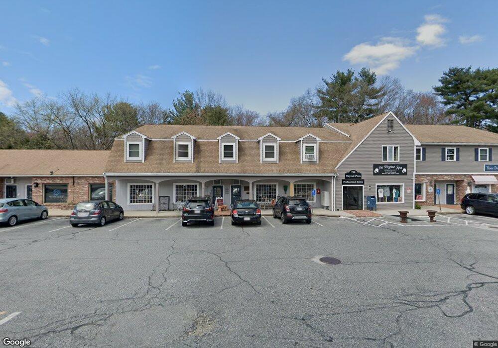
730 Boston Post Rd Sudbury, MA 01776
--
Bed
1
Bath
18,500
Sq Ft
2.85
Acres
About This Home
This home is located at 730 Boston Post Rd, Sudbury, MA 01776. 730 Boston Post Rd is a home located in Middlesex County with nearby schools including Israel Loring Elementary School, Ephraim Curtis Middle School, and Lincoln-Sudbury Regional High School.
Ownership History
Date
Name
Owned For
Owner Type
Purchase Details
Closed on
Sep 20, 1988
Sold by
730 Bost Post Rd Tr
Bought by
Wayside Plaza Trust
Home Financials for this Owner
Home Financials are based on the most recent Mortgage that was taken out on this home.
Original Mortgage
$2,025,000
Interest Rate
10.43%
Mortgage Type
Commercial
Create a Home Valuation Report for This Property
The Home Valuation Report is an in-depth analysis detailing your home's value as well as a comparison with similar homes in the area
Home Values in the Area
Average Home Value in this Area
Purchase History
| Date | Buyer | Sale Price | Title Company |
|---|---|---|---|
| Wayside Plaza Trust | $1,865,000 | -- |
Source: Public Records
Mortgage History
| Date | Status | Borrower | Loan Amount |
|---|---|---|---|
| Closed | Wayside Plaza Trust | $800,000 | |
| Closed | Wayside Plaza Trust | $2,025,000 |
Source: Public Records
Tax History Compared to Growth
Tax History
| Year | Tax Paid | Tax Assessment Tax Assessment Total Assessment is a certain percentage of the fair market value that is determined by local assessors to be the total taxable value of land and additions on the property. | Land | Improvement |
|---|---|---|---|---|
| 2025 | $63,234 | $3,005,400 | $1,205,100 | $1,800,300 |
| 2024 | $61,260 | $2,895,100 | $1,119,800 | $1,775,300 |
| 2023 | $56,563 | $2,796,000 | $1,076,200 | $1,719,800 |
| 2022 | $57,457 | $2,338,500 | $1,076,200 | $1,262,300 |
| 2021 | $58,029 | $2,271,200 | $1,076,200 | $1,195,000 |
| 2020 | $53,606 | $2,146,800 | $1,076,200 | $1,070,600 |
| 2019 | $52,167 | $2,146,800 | $1,076,200 | $1,070,600 |
| 2018 | $49,572 | $2,040,000 | $1,008,900 | $1,031,100 |
| 2017 | $50,540 | $2,020,800 | $966,900 | $1,053,900 |
| 2016 | $48,593 | $1,935,200 | $924,900 | $1,010,300 |
| 2015 | $48,038 | $1,930,800 | $882,800 | $1,048,000 |
| 2014 | $48,154 | $1,930,800 | $882,800 | $1,048,000 |
Source: Public Records
Map
Nearby Homes
- 0 Boston Post Rd
- 54 Stone Rd
- 0 Robbins Rd
- 12 Hickory Rd
- 143 Peakham Rd
- 30 Rolling Ln
- 7 Adams Rd
- 24 Woodland Rd
- 89 Bridle Path
- 7 Saddle Ridge Rd
- 30 Nobscot Rd Unit 14
- 123 Dutton Rd
- 6 Mountain View Dr
- 1011 Boston Post Rd
- 32 Eaton Rd W
- 21 Summer St
- 19 Nob Hill Dr
- 91 Eaton Rd W
- 50 Juniper Ln
- 270 Old Lancaster Rd
- 730 Boston Post Rd Unit rear office
- 730 Boston Post Rd Unit Knit Purl
- 730 Boston Post Rd Unit Front
- 730 Boston Post Rd Unit Rear
- 730 Boston Post Rd Unit 26
- 730 Boston Post Rd Unit 29
- 730 Boston Post Rd Unit 26-1
- 730 Boston Post Rd Unit 28
- 730 Boston Post Rd Unit 26
- 730 Boston Post Rd Unit 25
- 730 Boston Post Rd Unit 102
- 730 Boston Post Rd Unit 27
- 725 Boston Post Rd Unit 16
- 725 Boston Post Rd Unit 15
- 725 Boston Post Rd Unit 14
- 725 Boston Post Rd Unit 13
- 725 Boston Post Rd Unit 12
- 725 Boston Post Rd Unit 11
- 725 Boston Post Rd Unit 9
- 725 Boston Post Rd Unit 8