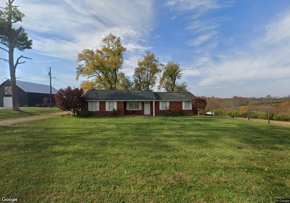
730 Duvall Station Rd Georgetown, KY 40324
Estimated Value: $436,000 - $508,000
3
Beds
1
Bath
1,732
Sq Ft
$267/Sq Ft
Est. Value
About This Home
This home is located at 730 Duvall Station Rd, Georgetown, KY 40324 and is currently estimated at $461,761, approximately $266 per square foot. 730 Duvall Station Rd is a home located in Scott County with nearby schools including Stamping Ground Elementary School, Creekside Elementary School, and Royal Spring Middle School.
Ownership History
Date
Name
Owned For
Owner Type
Purchase Details
Closed on
Sep 9, 2022
Sold by
Hardin Yvonne Deann
Bought by
Hall Marilyn Jane and Hall Everett Thomas
Current Estimated Value
Home Financials for this Owner
Home Financials are based on the most recent Mortgage that was taken out on this home.
Original Mortgage
$351,131
Interest Rate
5.13%
Mortgage Type
Construction
Create a Home Valuation Report for This Property
The Home Valuation Report is an in-depth analysis detailing your home's value as well as a comparison with similar homes in the area
Home Values in the Area
Average Home Value in this Area
Purchase History
| Date | Buyer | Sale Price | Title Company |
|---|---|---|---|
| Hall Marilyn Jane | $350,000 | -- |
Source: Public Records
Mortgage History
| Date | Status | Borrower | Loan Amount |
|---|---|---|---|
| Closed | Hall Marilyn Jane | $351,131 |
Source: Public Records
Tax History Compared to Growth
Tax History
| Year | Tax Paid | Tax Assessment Tax Assessment Total Assessment is a certain percentage of the fair market value that is determined by local assessors to be the total taxable value of land and additions on the property. | Land | Improvement |
|---|---|---|---|---|
| 2024 | $2,029 | $350,000 | $0 | $0 |
| 2023 | $2,046 | $225,619 | $6,989 | $218,630 |
| 2022 | $1,477 | $173,742 | $5,942 | $167,800 |
| 2021 | $1,524 | $173,742 | $153,142 | $20,600 |
| 2020 | $1,191 | $138,590 | $5,390 | $133,200 |
| 2019 | $1,123 | $128,690 | $0 | $0 |
| 2018 | $790 | $128,690 | $0 | $0 |
| 2017 | $732 | $121,490 | $0 | $0 |
| 2016 | $673 | $120,468 | $0 | $0 |
| 2015 | $669 | $83,568 | $0 | $0 |
| 2014 | $645 | $84,468 | $0 | $0 |
| 2011 | $625 | $85,936 | $0 | $0 |
Source: Public Records
Map
Nearby Homes
- 537 Sebree Rd
- 795 Sebree Rd
- 874 Sebree Rd
- 635A Lot A White Oak Rd
- 154 Elk Dr
- 106 Elk Dr
- 2588 Long Lick Pike
- 322 Locust Fork Rd
- 130 Locust Fork Rd
- 1676 Graves Rd
- 107 Winding View Trail
- 1105 Locust Fork Rd
- 1099 Lloyd Rd
- 1542 Long Lick Pike
- 224 Snavely Rd
- 117 Windsong Way
- 112 Lost Tree Dr
- 200 Victoria Way
- 1267 Stamping Ground Rd
- 1 Frankfort Pike
- 729 Duvall Station Rd
- 706 Duvall Station Rd
- 705 Duvall Station Rd
- 780 Duvall Station Rd
- 826 Duvall Station Rd
- 847 Duvall Station Rd
- 826 Duvall Station Rd
- 0 Duvall Station Rd
- 0 Duvall Station Rd
- 566 Duvall Station Rd
- 564 Duvall Station Rd
- 556 Duvall Station Rd
- 880 Duvall Station Rd
- 943 Duvall Station Rd
- 555 Duvall Station Rd
- 538 Duvall Station Rd
- 940 Duvall Station Rd
- 106 Parker Place
- 102 Parker Place
- 100 Parker Place