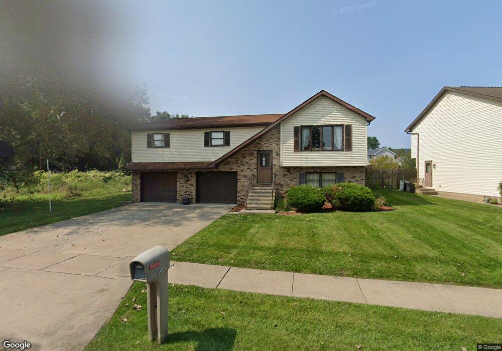
730 Parrott Ave Scranton, PA 18504
Hyde Park NeighborhoodEstimated Value: $99,084 - $262,000
--
Bed
--
Bath
--
Sq Ft
0.28
Acres
About This Home
This home is located at 730 Parrott Ave, Scranton, PA 18504 and is currently estimated at $176,271. 730 Parrott Ave is a home located in Lackawanna County with nearby schools including Longan Elementary School, Adams Elementary School, and Frances Willard School.
Ownership History
Date
Name
Owned For
Owner Type
Purchase Details
Closed on
Dec 13, 2024
Sold by
Cerra Antoinette M and Bartlett Darryl
Bought by
Bartlett Darryl
Current Estimated Value
Home Financials for this Owner
Home Financials are based on the most recent Mortgage that was taken out on this home.
Original Mortgage
$77,360
Outstanding Balance
$76,653
Interest Rate
6%
Mortgage Type
Credit Line Revolving
Estimated Equity
$99,618
Purchase Details
Closed on
Jan 13, 1998
Bought by
Cerra Antoinette M
Create a Home Valuation Report for This Property
The Home Valuation Report is an in-depth analysis detailing your home's value as well as a comparison with similar homes in the area
Home Values in the Area
Average Home Value in this Area
Purchase History
| Date | Buyer | Sale Price | Title Company |
|---|---|---|---|
| Bartlett Darryl | $96,700 | None Listed On Document | |
| Cerra Antoinette M | -- | -- |
Source: Public Records
Mortgage History
| Date | Status | Borrower | Loan Amount |
|---|---|---|---|
| Open | Bartlett Darryl | $77,360 |
Source: Public Records
Tax History Compared to Growth
Tax History
| Year | Tax Paid | Tax Assessment Tax Assessment Total Assessment is a certain percentage of the fair market value that is determined by local assessors to be the total taxable value of land and additions on the property. | Land | Improvement |
|---|---|---|---|---|
| 2025 | $6,014 | $18,000 | $4,000 | $14,000 |
| 2024 | $5,511 | $18,000 | $4,000 | $14,000 |
| 2023 | $5,511 | $18,000 | $4,000 | $14,000 |
| 2022 | $5,390 | $18,000 | $4,000 | $14,000 |
| 2021 | $5,390 | $18,000 | $4,000 | $14,000 |
| 2020 | $5,294 | $18,000 | $4,000 | $14,000 |
| 2019 | $4,984 | $18,000 | $4,000 | $14,000 |
| 2018 | $4,984 | $18,000 | $4,000 | $14,000 |
| 2017 | $4,899 | $18,000 | $4,000 | $14,000 |
| 2016 | $1,638 | $18,000 | $4,000 | $14,000 |
| 2015 | $3,389 | $18,000 | $4,000 | $14,000 |
| 2014 | -- | $18,000 | $4,000 | $14,000 |
Source: Public Records
Map
Nearby Homes
- 706 Parrott Ave
- 1223 Eynon St
- 1215 Eynon St
- 1227-1229 Hampton St
- 816 12th Ave
- 405 17th Ave
- 1157-59 Hampton St
- 415 18th Ave
- 1234 Bryn Mawr St Unit 11
- 332 14th Ave
- 1819 Luzerne St
- 318 15th Ave
- 1134/1136 Luzerne St
- 305 S Garfield Ave
- 1335 Sloan St
- 1021 Fellows St
- 1301 Sloan St
- 414 S 416 S Edwards Ct
- 1411 Watson St
- 401 S Main Ave
- 728 Parrott Ave
- 726 Parrott Ave
- 807 Dale Dr
- 809 Dale Dr
- 805 Dale Dr
- 1510 W Locust St
- 1512 W Locust St
- 1514 W Locust St
- 724 Parrott Ave
- 803 Dale Dr
- 1516 W Locust St Unit 1518
- 1516 1518 W Locust St
- 1506 W Locust St
- 1452 W Locust St Unit 1454
- 813 Dale Dr
- 722 Parrott Ave
- 1442 W Locust St
- 801 Dale Dr
- 1501 W 1503 Locust St
- 1440 W Locust St