730 Summit Dr Dallastown, PA 17313
Estimated Value: $270,000 - $354,000
3
Beds
1
Bath
1,794
Sq Ft
$172/Sq Ft
Est. Value
About This Home
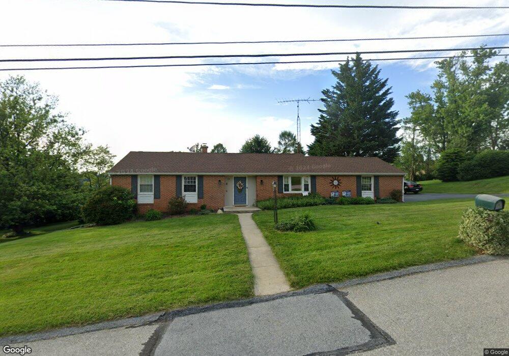
This home is located at 730 Summit Dr, Dallastown, PA 17313 and is currently estimated at $308,239, approximately $171 per square foot. 730 Summit Dr is a home located in York County with nearby schools including Dallastown Elementary School, Dallastown Area Middle School, and Dallastown Area High School.
Ownership History
Date
Name
Owned For
Owner Type
Purchase Details
Closed on
Feb 28, 2001
Sold by
Dill Charles Jay and Dill Lori S
Bought by
Mcnealy Brick and Mcnealy Melissa L
Current Estimated Value
Home Financials for this Owner
Home Financials are based on the most recent Mortgage that was taken out on this home.
Original Mortgage
$103,120
Outstanding Balance
$43,151
Interest Rate
9.03%
Estimated Equity
$265,088
Purchase Details
Closed on
Jun 6, 1989
Bought by
Dill Charles J and Dill Lori S
Create a Home Valuation Report for This Property
The Home Valuation Report is an in-depth analysis detailing your home's value as well as a comparison with similar homes in the area
Home Values in the Area
Average Home Value in this Area
Purchase History
| Date | Buyer | Sale Price | Title Company |
|---|---|---|---|
| Mcnealy Brick | $128,900 | -- | |
| Dill Charles J | $89,900 | -- |
Source: Public Records
Mortgage History
| Date | Status | Borrower | Loan Amount |
|---|---|---|---|
| Open | Mcnealy Brick | $103,120 | |
| Closed | Mcnealy Brick | $25,780 |
Source: Public Records
Tax History Compared to Growth
Tax History
| Year | Tax Paid | Tax Assessment Tax Assessment Total Assessment is a certain percentage of the fair market value that is determined by local assessors to be the total taxable value of land and additions on the property. | Land | Improvement |
|---|---|---|---|---|
| 2025 | $4,945 | $144,050 | $43,740 | $100,310 |
| 2024 | $4,873 | $144,050 | $43,740 | $100,310 |
| 2023 | $4,873 | $144,050 | $43,740 | $100,310 |
| 2022 | $4,713 | $144,050 | $43,740 | $100,310 |
| 2021 | $4,490 | $144,050 | $43,740 | $100,310 |
| 2020 | $4,490 | $144,050 | $43,740 | $100,310 |
| 2019 | $4,476 | $144,050 | $43,740 | $100,310 |
| 2018 | $4,445 | $144,050 | $43,740 | $100,310 |
| 2017 | $4,268 | $144,050 | $43,740 | $100,310 |
| 2016 | $0 | $144,050 | $43,740 | $100,310 |
| 2015 | -- | $144,050 | $43,740 | $100,310 |
| 2014 | -- | $144,050 | $43,740 | $100,310 |
Source: Public Records
Map
Nearby Homes
- 56 E Frederick St
- 64 S Pleasant Ave
- 260 Country Ridge Dr
- 211 Country Ridge Dr
- 156 Country Ridge Dr
- 126 Country Ridge Dr
- 131 Country Ridge Dr
- 136 Teila Dr
- 435 Frederick Dr
- 106 Teila Dr
- 840 Country Club Rd
- 424 Dartha Dr
- 0 S Franklin St
- 600 S Duke St
- 253 W Chestnut St Unit 11
- 355 W Main St
- 786 Arbor Dr
- 2855 Springwood Rd
- 661 S Duke St
- 0 Gary Dr