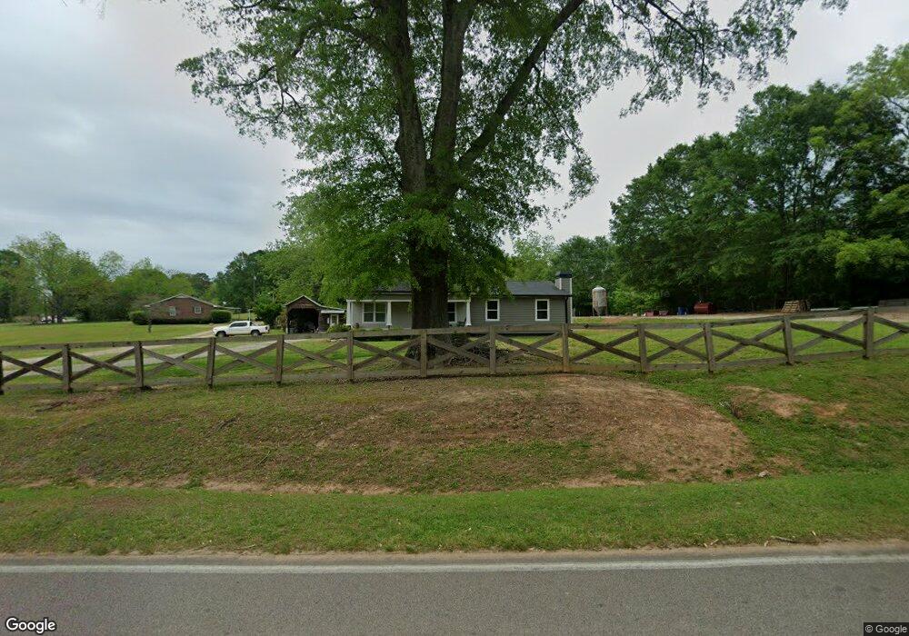
7300 Forrest Rd Hogansville, GA 30230
Estimated Value: $197,471 - $419,000
3
Beds
2
Baths
2,014
Sq Ft
$158/Sq Ft
Est. Value
About This Home
This home is located at 7300 Forrest Rd, Hogansville, GA 30230 and is currently estimated at $317,618, approximately $157 per square foot. 7300 Forrest Rd is a home located in Meriwether County with nearby schools including Unity Elementary School.
Ownership History
Date
Name
Owned For
Owner Type
Purchase Details
Closed on
Jul 19, 2024
Sold by
Betty B Daniel Trust
Bought by
Banks Susan Parker
Current Estimated Value
Purchase Details
Closed on
May 22, 2017
Sold by
Parker Peggy
Bought by
Banks Susan Parker
Purchase Details
Closed on
Jun 12, 2013
Sold by
Daniel Betty Brown
Bought by
Parker Peggy D and Parker Daniel Betty
Purchase Details
Closed on
Apr 15, 2013
Sold by
Daniel Alfred O
Bought by
Daniel Betty Brown
Purchase Details
Closed on
Mar 8, 2002
Sold by
Freeman Shirley Ann
Bought by
Daniel Alfred and Daniel Bett
Purchase Details
Closed on
Feb 1, 2002
Sold by
Massey Patra
Bought by
Freeman Shirley Ann
Purchase Details
Closed on
Jan 1, 1961
Bought by
Massey Patra
Purchase Details
Closed on
Jan 1, 1942
Sold by
Lee Mrs Annie Ruth
Create a Home Valuation Report for This Property
The Home Valuation Report is an in-depth analysis detailing your home's value as well as a comparison with similar homes in the area
Home Values in the Area
Average Home Value in this Area
Purchase History
| Date | Buyer | Sale Price | Title Company |
|---|---|---|---|
| Banks Susan Parker | -- | -- | |
| Banks Susan Parker | -- | -- | |
| Parker Peggy D | -- | -- | |
| Daniel Betty Brown | -- | -- | |
| Daniel Alfred | $22,500 | -- | |
| Freeman Shirley Ann | -- | -- | |
| Massey Patra | -- | -- | |
| -- | -- | -- |
Source: Public Records
Tax History Compared to Growth
Tax History
| Year | Tax Paid | Tax Assessment Tax Assessment Total Assessment is a certain percentage of the fair market value that is determined by local assessors to be the total taxable value of land and additions on the property. | Land | Improvement |
|---|---|---|---|---|
| 2024 | $1,935 | $55,280 | $2,600 | $52,680 |
| 2023 | $1,738 | $47,880 | $2,600 | $45,280 |
| 2022 | $1,346 | $37,080 | $2,600 | $34,480 |
| 2021 | $1,366 | $37,080 | $2,600 | $34,480 |
| 2020 | $1,377 | $37,080 | $2,600 | $34,480 |
| 2019 | $1,123 | $30,160 | $2,600 | $27,560 |
| 2018 | $881 | $30,160 | $2,600 | $27,560 |
| 2017 | $618 | $16,280 | $2,600 | $13,680 |
| 2016 | $565 | $16,280 | $2,600 | $13,680 |
| 2015 | $565 | $16,280 | $2,600 | $13,680 |
| 2014 | $566 | $16,280 | $2,600 | $13,680 |
| 2013 | -- | $16,280 | $2,600 | $13,680 |
Source: Public Records
Map
Nearby Homes
- 7133 Forrest Rd
- 8444 Forrest Rd
- 2860 Sewell Rd
- 5151 Primrose Rd
- 1314 Tenny Nelson Rd
- 95 Esther Dr
- 104 Park View Dr
- 1530 Goldmine Rd
- 659 Park Pine Cir
- 516 Tenney Nelson Rd
- The Northern Hills Plan at Shallow Valley
- The Millie Plan at Shallow Valley
- The Bradford Plan at Shallow Valley
- The Forsythe Plan at Shallow Valley
- The Coleman Plan at Shallow Valley
- 98.81 Ellis Rd
- 156 Charlie Fuller Rd Unit LOT 7
- 130 Charlie Fuller Rd Unit LOT 6
- 38 Charlie Fuller Rd Unit LOT 2
- 54 Charlie Fuller Rd Unit LOT 3
- 7267 Forrest Rd
- 5115 Lone Oak Rd
- 7306 Forrest Rd
- 7251 Forrest Rd
- 4866 Lone Oak Rd
- 7246 Forrest Rd
- 5141 Lone Oak Rd
- 4993 Lone Oak Rd
- 7359 Forrest Rd
- 7182 Forrest Rd
- 4979 Lone Oak Rd
- 7389 Forrest Rd
- 7386 Forrest Rd
- 5180 Lone Oak Rd
- 4957 Lone Oak Rd
- 0 Highway 54 Unit 7042820
- 0 Highway 54 Unit 7178000
- 0 Highway 54 Unit 9013055
- 0 Highway 54 Unit 8114039
- 0 Highway 54 Unit 8115243