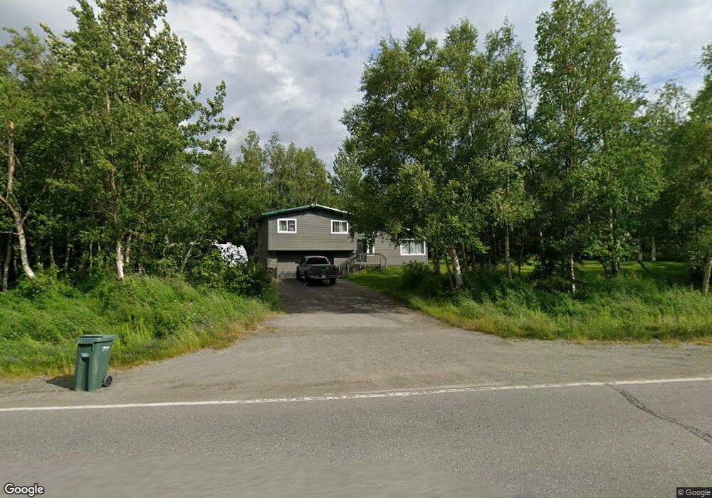
7301 de Armoun Rd Anchorage, AK 99516
Mid-Hillside NeighborhoodEstimated Value: $230,000 - $588,000
3
Beds
2
Baths
1,248
Sq Ft
$343/Sq Ft
Est. Value
About This Home
This home is located at 7301 de Armoun Rd, Anchorage, AK 99516 and is currently estimated at $427,539, approximately $342 per square foot. 7301 de Armoun Rd is a home located in Anchorage Municipality with nearby schools including Bear Valley Elementary School, Goldenview Middle School, and South Anchorage High School.
Ownership History
Date
Name
Owned For
Owner Type
Purchase Details
Closed on
Mar 19, 2019
Sold by
Dunford Richard C and Short Janice
Bought by
Mahoney Matthew Alan
Current Estimated Value
Home Financials for this Owner
Home Financials are based on the most recent Mortgage that was taken out on this home.
Original Mortgage
$136,000
Outstanding Balance
$119,324
Interest Rate
4.3%
Mortgage Type
New Conventional
Estimated Equity
$308,215
Purchase Details
Closed on
Jun 22, 1996
Sold by
Dunford Jeanne
Bought by
Dunford Richard C
Create a Home Valuation Report for This Property
The Home Valuation Report is an in-depth analysis detailing your home's value as well as a comparison with similar homes in the area
Home Values in the Area
Average Home Value in this Area
Purchase History
| Date | Buyer | Sale Price | Title Company |
|---|---|---|---|
| Mahoney Matthew Alan | -- | None Available | |
| Dunford Richard C | -- | None Available |
Source: Public Records
Mortgage History
| Date | Status | Borrower | Loan Amount |
|---|---|---|---|
| Open | Mahoney Matthew Alan | $136,000 |
Source: Public Records
Tax History Compared to Growth
Tax History
| Year | Tax Paid | Tax Assessment Tax Assessment Total Assessment is a certain percentage of the fair market value that is determined by local assessors to be the total taxable value of land and additions on the property. | Land | Improvement |
|---|---|---|---|---|
| 2025 | $2,081 | $397,100 | $121,700 | $275,400 |
| 2024 | $2,081 | $367,700 | $115,800 | $251,900 |
| 2023 | $4,993 | $329,600 | $109,700 | $219,900 |
| 2022 | $1,831 | $319,700 | $109,600 | $210,100 |
| 2021 | $4,969 | $301,700 | $109,600 | $192,100 |
| 2020 | $4,590 | $306,000 | $109,600 | $196,400 |
| 2019 | $1,354 | $291,800 | $109,600 | $182,200 |
| 2018 | $1,493 | $301,300 | $124,600 | $176,700 |
| 2017 | $1,850 | $298,100 | $119,600 | $178,500 |
| 2016 | $3,417 | $296,900 | $119,600 | $177,300 |
| 2015 | $3,417 | $298,100 | $115,500 | $182,600 |
| 2014 | $3,417 | $292,100 | $105,000 | $187,100 |
Source: Public Records
Map
Nearby Homes
- 000 de Palatis Cir
- 12920 Hillside Dr
- 12801 Midori Dr
- 6931 Sequoia Cir
- 7801 E 130th Ave
- 6820 Gunnison Dr
- L3 Patrick Rd
- 6801 Teresa Cir
- 12531 Freitag Cir
- 8521 Spendlove Dr
- 12855 Ginami St
- 11800 Nebesna Dr
- 11840 Coughlan Way
- 13100 Ridgeview Dr
- 11831 Moose Rd
- L1 Downey Finch Dr
- 14310 Pickett St
- 6550 Rockridge Dr
- 5800 E 142nd Ave
- 14170 Golden View Dr
- 13120 Hillside Dr
- 13140 Saunders Rd
- 13145 Hillside Dr
- 7300 de Armoun Rd
- 13040 Hillside Dr
- 13100 Saunders Rd
- 13101 Hillside Dr Unit 1
- 7400 Upper de Armoun Rd
- 13141 Foster Rd
- 7435 Upper de Armoun Rd
- 13121 Foster Rd
- 13045 Hillside Dr
- 7200 de Armoun Rd
- 13101 Foster Rd
- 8120 Rabbit Creek Rd
- 13020 Saunders Rd
- 13000 Hillside Dr
- 13041 Foster Rd
- 13368 de Palatis Cir
- 000 Upper Dearmoun