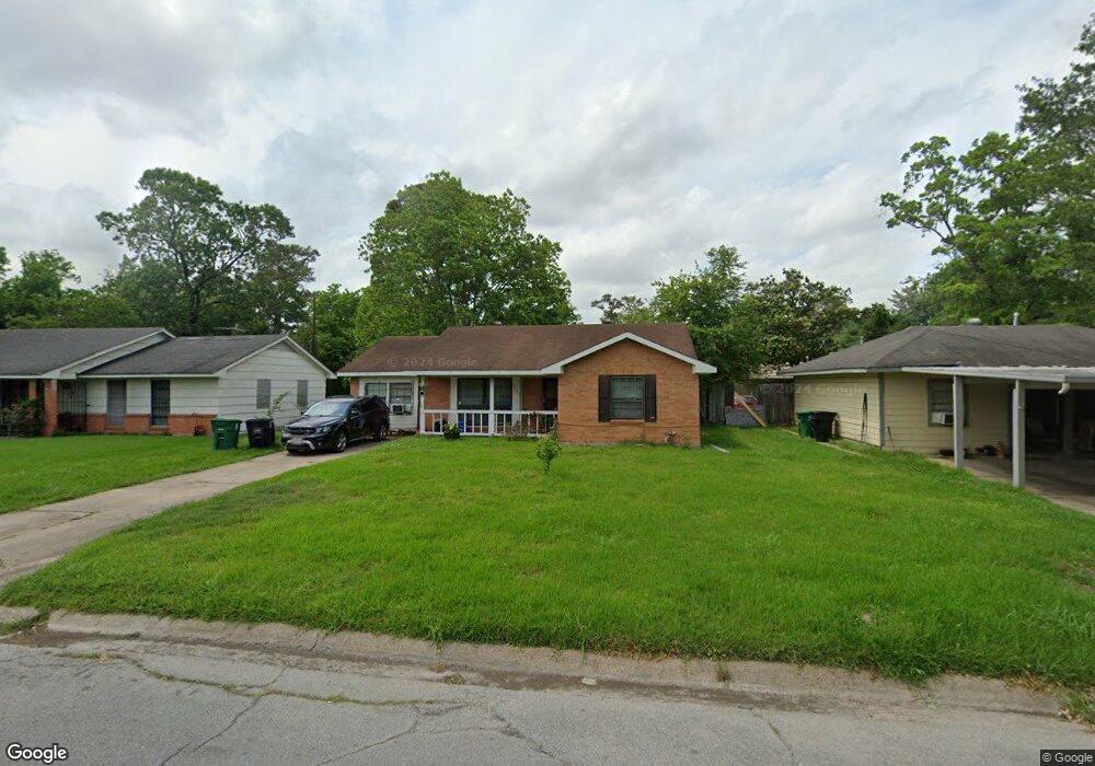
7301 Lakewood Dr Houston, TX 77016
East Little York NeighborhoodEstimated Value: $180,000 - $231,000
3
Beds
1
Bath
2,535
Sq Ft
$82/Sq Ft
Est. Value
About This Home
This home is located at 7301 Lakewood Dr, Houston, TX 77016 and is currently estimated at $207,943, approximately $82 per square foot. 7301 Lakewood Dr is a home located in Harris County with nearby schools including Shadydale Elementary School, Forest Brook Middle, and North Forest High School.
Ownership History
Date
Name
Owned For
Owner Type
Purchase Details
Closed on
Aug 11, 2023
Sold by
Tukur Deborah
Bought by
Henao Miguel A and Rios Eunice V
Current Estimated Value
Purchase Details
Closed on
Nov 16, 1998
Sold by
Covington Melvin and Covington Billie Jo
Bought by
Tukur Deborah M
Home Financials for this Owner
Home Financials are based on the most recent Mortgage that was taken out on this home.
Original Mortgage
$41,225
Interest Rate
6.46%
Create a Home Valuation Report for This Property
The Home Valuation Report is an in-depth analysis detailing your home's value as well as a comparison with similar homes in the area
Home Values in the Area
Average Home Value in this Area
Purchase History
| Date | Buyer | Sale Price | Title Company |
|---|---|---|---|
| Henao Miguel A | -- | None Listed On Document | |
| Tukur Deborah M | -- | Texas American Title Company |
Source: Public Records
Mortgage History
| Date | Status | Borrower | Loan Amount |
|---|---|---|---|
| Previous Owner | Tukur Deborah M | $41,225 |
Source: Public Records
Tax History Compared to Growth
Tax History
| Year | Tax Paid | Tax Assessment Tax Assessment Total Assessment is a certain percentage of the fair market value that is determined by local assessors to be the total taxable value of land and additions on the property. | Land | Improvement |
|---|---|---|---|---|
| 2025 | $4,497 | $226,492 | $52,287 | $174,205 |
| 2024 | $4,497 | $214,913 | $52,287 | $162,626 |
| 2023 | $4,497 | $266,039 | $43,272 | $222,767 |
| 2022 | $2,285 | $216,945 | $36,060 | $180,885 |
| 2021 | $2,199 | $191,475 | $27,045 | $164,430 |
| 2020 | $2,077 | $113,587 | $18,751 | $94,836 |
| 2019 | $1,973 | $104,817 | $12,333 | $92,484 |
| 2018 | $1,141 | $83,576 | $12,333 | $71,243 |
| 2017 | $1,630 | $83,576 | $12,333 | $71,243 |
| 2016 | $1,481 | $83,576 | $12,333 | $71,243 |
| 2015 | $821 | $63,053 | $12,333 | $50,720 |
| 2014 | $821 | $51,284 | $12,333 | $38,951 |
Source: Public Records
Map
Nearby Homes
- 7226 Gore Dr
- 10313 Blades St
- 7210 Colton St
- 7818 Laurel Gem Dr
- 7827 Laurel Gem Dr
- 7823 Laurel Gem Dr
- 7821 Laurel Gem Dr
- 7812 Laurel Gem Dr
- 7830 Laurel Gem Dr
- 7824 Laurel Gem Dr
- 7819 Laurel Gem Dr
- 7815 Laurel Gem Dr
- 7234 Boggess Rd
- 10317 Kelburn Dr
- 7306 Parker Rd
- 7449 Gleason Rd
- 7252 Parker Rd
- 7305 Yoe St
- 10128 Homestead Rd
- 10124 Homestead Rd
- 7305 Lakewood Dr
- 7255 Lakewood Dr
- 7302 Colton St
- 7309 Lakewood Dr
- 7251 Lakewood Dr
- 7250 Colton St
- 7306 Colton St
- 7246 Colton St
- 7302 Lakewood Dr
- 7310 Colton St
- 7313 Lakewood Dr
- 7247 Lakewood Dr
- 7252 Lakewood Dr
- 7242 Colton St
- 7310 Lakewood Dr
- 7314 Colton St
- 7317 Lakewood Dr
- 7248 Lakewood Dr
- 7243 Lakewood Dr
- 7238 Colton St