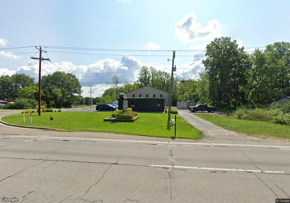
7301 Red Arrow Hwy Stevensville, MI 49127
Estimated Value: $179,645
--
Bed
1
Bath
2,160
Sq Ft
$83/Sq Ft
Est. Value
About This Home
This home is located at 7301 Red Arrow Hwy, Stevensville, MI 49127 and is currently priced at $179,645, approximately $83 per square foot. 7301 Red Arrow Hwy is a home located in Berrien County with nearby schools including Bridgman Elementary School, F.C. Reed Middle School, and Bridgman High School.
Ownership History
Date
Name
Owned For
Owner Type
Purchase Details
Closed on
Jan 8, 2019
Sold by
Berrien County Cancer Services Inc
Bought by
Mcghee Scott
Current Estimated Value
Home Financials for this Owner
Home Financials are based on the most recent Mortgage that was taken out on this home.
Original Mortgage
$82,500
Outstanding Balance
$72,826
Interest Rate
4.8%
Mortgage Type
Commercial
Purchase Details
Closed on
May 1, 1985
Purchase Details
Closed on
Jun 1, 1975
Create a Home Valuation Report for This Property
The Home Valuation Report is an in-depth analysis detailing your home's value as well as a comparison with similar homes in the area
Home Values in the Area
Average Home Value in this Area
Purchase History
| Date | Buyer | Sale Price | Title Company |
|---|---|---|---|
| Mcghee Scott | $109,250 | None Available | |
| -- | $43,000 | -- | |
| -- | $13,000 | -- |
Source: Public Records
Mortgage History
| Date | Status | Borrower | Loan Amount |
|---|---|---|---|
| Open | Mcghee Scott | $82,500 |
Source: Public Records
Tax History Compared to Growth
Tax History
| Year | Tax Paid | Tax Assessment Tax Assessment Total Assessment is a certain percentage of the fair market value that is determined by local assessors to be the total taxable value of land and additions on the property. | Land | Improvement |
|---|---|---|---|---|
| 2025 | $5,097 | $220,800 | $0 | $0 |
| 2024 | $3,956 | $223,400 | $0 | $0 |
| 2023 | $3,812 | $174,700 | $0 | $0 |
| 2022 | $3,630 | $153,300 | $0 | $0 |
| 2021 | $1,949 | $64,200 | $32,300 | $31,900 |
| 2020 | $1,960 | $64,700 | $0 | $0 |
| 2019 | $1,663 | $54,700 | $0 | $0 |
| 2018 | $29 | $0 | $0 | $0 |
| 2017 | $0 | $0 | $0 | $0 |
| 2016 | $0 | $0 | $0 | $0 |
| 2015 | -- | $0 | $0 | $0 |
| 2014 | -- | $0 | $0 | $0 |
Source: Public Records
Map
Nearby Homes
- 8115 Date Rd
- 8351 Jericho Rd
- 2626 Heritage Way
- 2516 Heritage Way
- 2600 Bell Cir
- 2191 W Linco Rd
- 3856 Jericho Rd
- 2394 Ulrich Ln
- 2430 Ulrich Ln
- 5853 Ridge Rd
- 5845 Ridge Rd
- 5363 Red Arrow Hwy
- 0 Red Arrow Hwy Unit 25003360
- 6257 Lara Ln
- 5797 Wildwood Dr
- 8635 Poplar Ln
- 6175 Lara Ln
- 4893 Wildwood Dr
- 5758 St Joseph Ave
- 9200 Jericho Rd
- 7333 Red Arrow Hwy
- 7291 Red Arrow Hwy
- 7292 Red Arrow Hwy
- 7349 Red Arrow Hwy
- 7281 Red Arrow Hwy
- 7272 Red Arrow Hwy
- 7377 Red Arrow Hwy
- 7270 Red Arrow Hwy Unit 1-2
- 7270 Red Arrow Hwy
- 7393 Red Arrow Hwy
- 3410 W Linco Rd
- 7407 Red Arrow Hwy
- 7352 W Linco Rd
- 7201 Red Arrow Hwy
- 7425 Red Arrow Hwy
- 7222 Red Arrow Hwy
- 7210 Red Arrow Hwy
- 7194 Red Arrow Hwy
- 7174 Red Arrow Hwy
- 7296 Red Arrow Hwy
