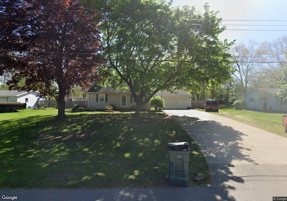
7302 Astronaut Ave Jenison, MI 49428
Estimated Value: $317,927 - $353,000
4
Beds
2
Baths
1,342
Sq Ft
$251/Sq Ft
Est. Value
About This Home
This home is located at 7302 Astronaut Ave, Jenison, MI 49428 and is currently estimated at $336,232, approximately $250 per square foot. 7302 Astronaut Ave is a home located in Ottawa County with nearby schools including Sandy Hill Elementary School, Jenison Junior High School, and Jenison High School.
Ownership History
Date
Name
Owned For
Owner Type
Purchase Details
Closed on
Oct 26, 2007
Sold by
Chudy Matthew M and Chudy Valerie J
Bought by
Verbrugge Tom and Verbrugge Rachel E
Current Estimated Value
Home Financials for this Owner
Home Financials are based on the most recent Mortgage that was taken out on this home.
Original Mortgage
$101,600
Outstanding Balance
$64,283
Interest Rate
6.38%
Mortgage Type
Purchase Money Mortgage
Estimated Equity
$271,949
Create a Home Valuation Report for This Property
The Home Valuation Report is an in-depth analysis detailing your home's value as well as a comparison with similar homes in the area
Home Values in the Area
Average Home Value in this Area
Purchase History
| Date | Buyer | Sale Price | Title Company |
|---|---|---|---|
| Verbrugge Tom | $127,000 | None Available |
Source: Public Records
Mortgage History
| Date | Status | Borrower | Loan Amount |
|---|---|---|---|
| Open | Verbrugge Tom | $101,600 |
Source: Public Records
Tax History Compared to Growth
Tax History
| Year | Tax Paid | Tax Assessment Tax Assessment Total Assessment is a certain percentage of the fair market value that is determined by local assessors to be the total taxable value of land and additions on the property. | Land | Improvement |
|---|---|---|---|---|
| 2025 | $1,952 | $125,200 | $0 | $0 |
| 2024 | $19 | $124,500 | $0 | $0 |
| 2023 | $1,791 | $120,900 | $0 | $0 |
| 2022 | $1,966 | $106,000 | $0 | $0 |
| 2021 | $1,909 | $97,700 | $0 | $0 |
| 2020 | $1,888 | $87,500 | $0 | $0 |
| 2019 | $1,890 | $83,200 | $0 | $0 |
| 2018 | $1,763 | $77,200 | $0 | $0 |
| 2017 | $1,732 | $73,700 | $0 | $0 |
| 2016 | $1,721 | $67,300 | $0 | $0 |
| 2015 | $1,643 | $64,100 | $0 | $0 |
| 2014 | $1,643 | $64,000 | $0 | $0 |
Source: Public Records
Map
Nearby Homes
- 7425 Boulder Bluff Dr Unit 112
- 7373 Pinegrove Dr Unit 109
- 7405 Pinegrove Dr
- 7700 Ridgewood Dr
- 3270 Hollace Dr
- 7368 21st Ave
- 6835 Kay Boer Dr
- 1198 Blair St
- 7951 Engelhurst Ct
- 1241 S Marymark Dr
- 8110 Greenridge Dr
- 1468 Maplewood Dr Unit 9
- 1002 Village Ln Unit 190
- 1520 Winifred St
- 932 Village Ln Unit 52
- 674 Waterview Ct SW Unit 26
- 7692 Cardinal Dr
- 1109 Fairfield Dr
- 6374 Clover Ln
- 1157 Corvette Dr
- 7318 Astronaut Ave
- 7286 Astronaut Ave
- 7317 Sunset Ave
- 7331 Sunset Ave
- 7303 Sunset Ave
- 7305 Astronaut Ave
- 7334 Astronaut Ave
- 7270 Astronaut Ave
- 7289 Astronaut Ave
- 7289 Sunset Ave
- 7321 Astronaut Ave
- 7347 Sunset Ave
- 1581 Southlawn St
- 7337 Astronaut Ave
- 7275 Sunset Ave
- 7352 Astronaut Ave
- 7306 Eastlane Ave
- 1564 Southlawn St
- 7365 Sunset Ave
- 7290 Eastlane Ave