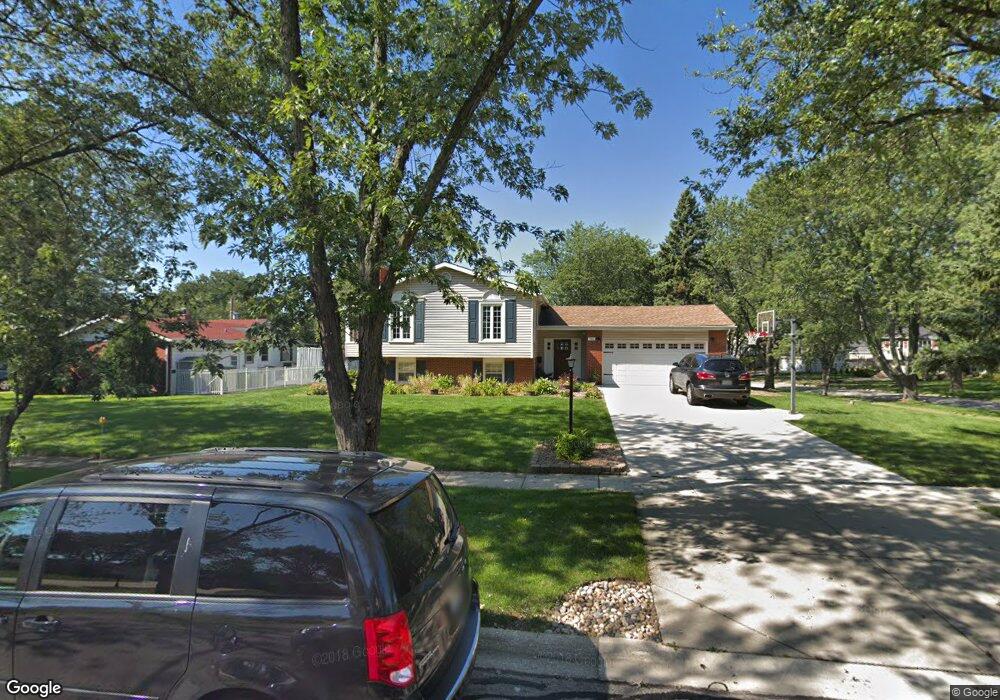
7302 Bunker Rd Unit 1 Darien, IL 60561
Estimated Value: $474,000 - $530,000
4
Beds
2
Baths
1,302
Sq Ft
$394/Sq Ft
Est. Value
About This Home
This home is located at 7302 Bunker Rd Unit 1, Darien, IL 60561 and is currently estimated at $512,653, approximately $393 per square foot. 7302 Bunker Rd Unit 1 is a home located in DuPage County with nearby schools including Mark Delay School, Lace Elementary School, and Eisenhower Jr High School.
Ownership History
Date
Name
Owned For
Owner Type
Purchase Details
Closed on
Feb 25, 2013
Sold by
Gerardi Richard J and Gerardi Heather M
Bought by
Gerardi Richard J and Gerardi Heather M
Current Estimated Value
Home Financials for this Owner
Home Financials are based on the most recent Mortgage that was taken out on this home.
Original Mortgage
$257,452
Outstanding Balance
$179,271
Interest Rate
3.25%
Mortgage Type
FHA
Estimated Equity
$333,382
Purchase Details
Closed on
Jul 19, 2011
Sold by
Zabelny Edward C and Zabelny Jeanne M
Bought by
Gerardi Richard J and Gerardi Heather M
Home Financials for this Owner
Home Financials are based on the most recent Mortgage that was taken out on this home.
Original Mortgage
$258,620
Interest Rate
4.25%
Mortgage Type
FHA
Purchase Details
Closed on
Jul 3, 1997
Sold by
Zabelny Barbara L
Bought by
Zabelny Edward C
Create a Home Valuation Report for This Property
The Home Valuation Report is an in-depth analysis detailing your home's value as well as a comparison with similar homes in the area
Home Values in the Area
Average Home Value in this Area
Purchase History
We collect this data history from publicly available records. To have your information removed, we recommend requesting removal directly through your county’s website.
| Date | Buyer | Sale Price | Title Company |
|---|---|---|---|
| Gerardi Richard J | -- | First American Title | |
| Gerardi Richard J | $268,000 | First American Title | |
| Zabelny Edward C | -- | -- |
Source: Public Records
Mortgage History
We collect this data history from publicly available records. To have your information removed, we recommend requesting removal directly through your county’s website.
| Date | Status | Borrower | Loan Amount |
|---|---|---|---|
| Open | Gerardi Richard J | $257,452 | |
| Closed | Gerardi Richard J | $258,620 |
Source: Public Records
Tax History
| Year | Tax Paid | Tax Assessment Tax Assessment Total Assessment is a certain percentage of the fair market value that is determined by local assessors to be the total taxable value of land and additions on the property. | Land | Improvement |
|---|---|---|---|---|
| 2024 | $9,154 | $150,073 | $65,518 | $84,555 |
| 2023 | $8,820 | $137,960 | $60,230 | $77,730 |
| 2022 | $8,645 | $135,140 | $59,000 | $76,140 |
| 2021 | $8,317 | $133,600 | $58,330 | $75,270 |
| 2020 | $8,206 | $130,950 | $57,170 | $73,780 |
| 2019 | $7,934 | $125,640 | $54,850 | $70,790 |
| 2018 | $7,449 | $119,230 | $54,520 | $64,710 |
| 2017 | $7,377 | $114,730 | $52,460 | $62,270 |
| 2016 | $7,188 | $109,500 | $50,070 | $59,430 |
| 2015 | $7,088 | $103,020 | $47,110 | $55,910 |
| 2014 | $6,750 | $97,080 | $45,800 | $51,280 |
| 2013 | $6,525 | $96,630 | $45,590 | $51,040 |
Source: Public Records
Map
Nearby Homes
- 7216 Leonard Dr
- 6922 Sierra Dr
- 1139 James Peter Ct
- 7413 Brookdale Dr Unit 208
- 7413 Brookdale Dr Unit 212
- 6914 Richmond Ave
- 526 72nd St
- 538 Maple Ln
- 825 Walnut Dr
- 430 71st St
- 344 Sheridan Dr Unit 1C
- 913 Andermann Ln
- 7700 Apple Tree Ln
- 7113 Clarendon Hills Rd
- 18W193 Holly Ave
- 7825 Stratford Place
- 1120 Ponderosa Ct
- 321 Janet Ave
- 1061 Sean Cir
- 18W276 Holly Ave
- 7306 Bunker Rd
- 905 Timber Ln
- 7310 Bunker Rd
- 822 Timber Ln
- 902 Timber Ln
- 818 Timber Ln
- 7301 Bunker Rd
- 909 Timber Ln
- 814 Timber Ln
- 7305 Bunker Rd
- 906 Timber Ln
- 7314 Bunker Rd
- 7309 Bunker Rd
- 810 Timber Ln
- 910 Timber Ln
- 913 Timber Ln
- 7313 Bunker Rd
- 7318 Bunker Rd
- 7307 Seminole Ct Unit 1
- 806 Timber Ln Unit 3
Your Personal Tour Guide
Ask me questions while you tour the home.