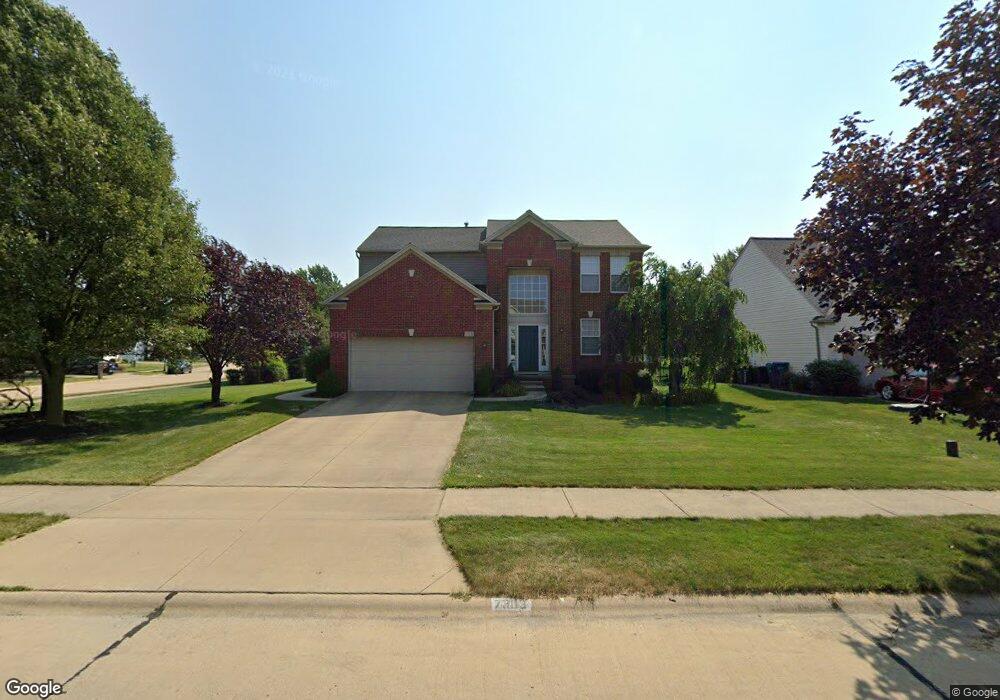
7303 Glenside Ln Olmsted Falls, OH 44138
Estimated Value: $376,000 - $456,000
4
Beds
3
Baths
2,216
Sq Ft
$184/Sq Ft
Est. Value
About This Home
This home is located at 7303 Glenside Ln, Olmsted Falls, OH 44138 and is currently estimated at $408,549, approximately $184 per square foot. 7303 Glenside Ln is a home located in Cuyahoga County with nearby schools including Olmsted Falls Intermediate Building, Falls-Lenox Primary Elementary School, and Olmsted Falls Middle School.
Ownership History
Date
Name
Owned For
Owner Type
Purchase Details
Closed on
Apr 1, 2006
Sold by
Schneider Keith H and Schneider Jacquelyne M
Bought by
Dobos Paul E and Dobos Tina L
Current Estimated Value
Home Financials for this Owner
Home Financials are based on the most recent Mortgage that was taken out on this home.
Original Mortgage
$182,400
Interest Rate
6.82%
Mortgage Type
Purchase Money Mortgage
Create a Home Valuation Report for This Property
The Home Valuation Report is an in-depth analysis detailing your home's value as well as a comparison with similar homes in the area
Home Values in the Area
Average Home Value in this Area
Purchase History
| Date | Buyer | Sale Price | Title Company |
|---|---|---|---|
| Dobos Paul E | $228,000 | Chicago Title Insurance C |
Source: Public Records
Mortgage History
| Date | Status | Borrower | Loan Amount |
|---|---|---|---|
| Previous Owner | Dobos Paul E | $182,400 |
Source: Public Records
Tax History Compared to Growth
Tax History
| Year | Tax Paid | Tax Assessment Tax Assessment Total Assessment is a certain percentage of the fair market value that is determined by local assessors to be the total taxable value of land and additions on the property. | Land | Improvement |
|---|---|---|---|---|
| 2024 | $9,428 | $127,470 | $25,550 | $101,920 |
| 2023 | $9,031 | $99,440 | $21,420 | $78,020 |
| 2022 | $8,971 | $99,440 | $21,420 | $78,020 |
| 2021 | $8,889 | $99,440 | $21,420 | $78,020 |
| 2020 | $8,784 | $87,220 | $18,800 | $68,430 |
| 2019 | $7,954 | $249,200 | $53,700 | $195,500 |
| 2018 | $7,513 | $87,220 | $18,800 | $68,430 |
| 2017 | $7,425 | $78,610 | $18,270 | $60,340 |
| 2016 | $7,391 | $78,610 | $18,270 | $60,340 |
| 2015 | $7,319 | $78,610 | $18,270 | $60,340 |
| 2014 | $7,319 | $76,340 | $17,750 | $58,590 |
Source: Public Records
Map
Nearby Homes
- 7296 Chestnut Ct
- 7097 Stearns Rd
- 7224 Pine Woods Way
- 7087 Mackenzie Rd
- 6926 Mackenzie Rd
- 27202 Cook Rd Unit 95
- 27202 Cook Rd Unit 127
- 27097 Oakwood Cir Unit 208Z
- 29651 Westminster Dr
- 6979 Warrington Dr
- 6752 Cypress Dr
- 29880 Westminster Dr
- 28130 Angela Dr
- 27259 Cook Rd
- 8706 Stearns Rd
- 27261 Cook Rd
- 6706 Crestwood Ln
- 29 Carl Ln
- 29695 Bretton Ridge Dr
- 6560 Mackenzie Rd
- 7307 Glenside Ln
- 7311 Glenside Ln
- 7302 Valeside Ln
- 7306 Valeside Ln
- 27080 Laurel Ln
- 27076 Laurel Ln
- 7315 Glenside Ln
- 7300 Glenside Ln
- 27072 Laurel Ln
- 7304 Glenside Ln
- 7310 Valeside Ln
- 27088 Laurel Ln
- 7308 Glenside Ln
- 7319 Glenside Ln
- 7314 Valeside Ln
- 27068 Laurel Ln
- 7312 Glenside Ln
- 27092 Laurel Ln
- 7316 Glenside Ln
- 27063 Laurel Ln